Guide to Stunning Doi Suthep & Doi Pui
Chiang Mai | 70 KM Ride | Free Guide
Doi Suthep and Doi Pui are twin peaks in the Thanon Thong Chai Range, part of the larger Shan Highlands. Rich in biodiversity, with waterfalls, jungle trails, hilltribes, and the iconic Wat Phra That Doi Suthep.
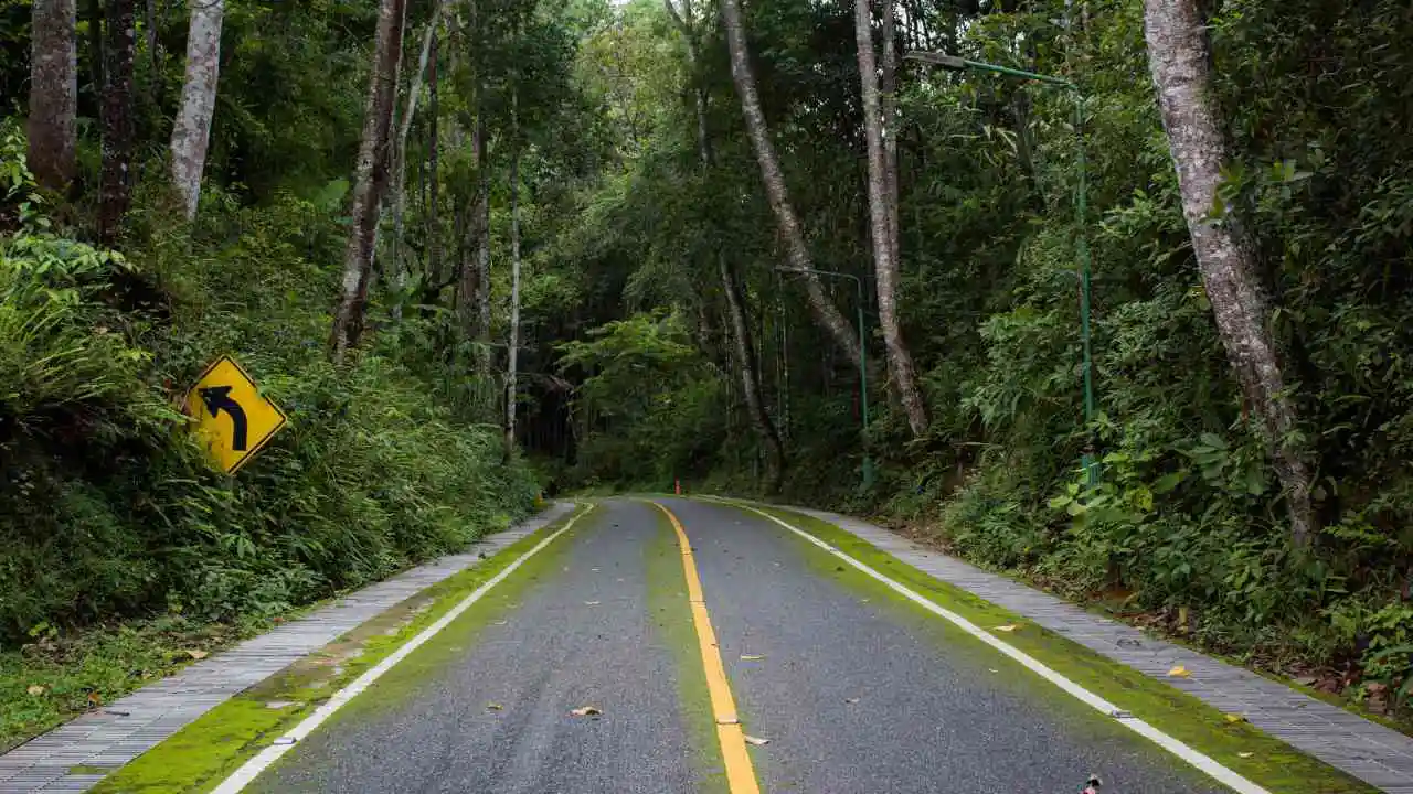
The route offers generally good paved roads, tight hairpins, with occasional potholes or debris. – suitable for most vehicles, with optional dirt route section.
Click to Close
Note: GPS waypoints and an interactive map is available once content access is unlocked.
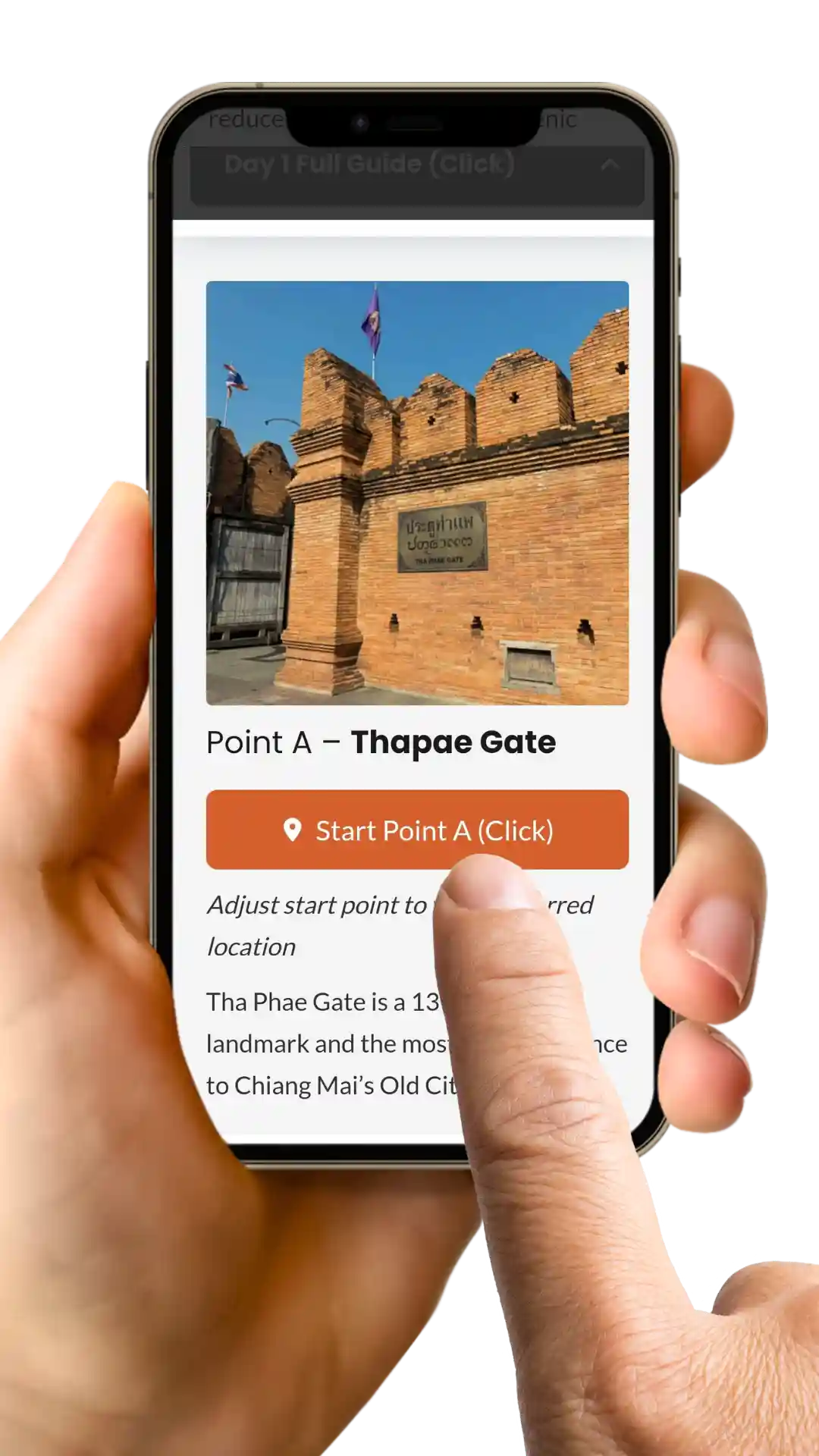
Follow the guide step-by-step. Each stop has a GPS location button – click it! The link will open up in Google Maps (or an alternative map-app on your phone).
Wifi
on
Scroll
Down
Click
Steps
Follow
Route
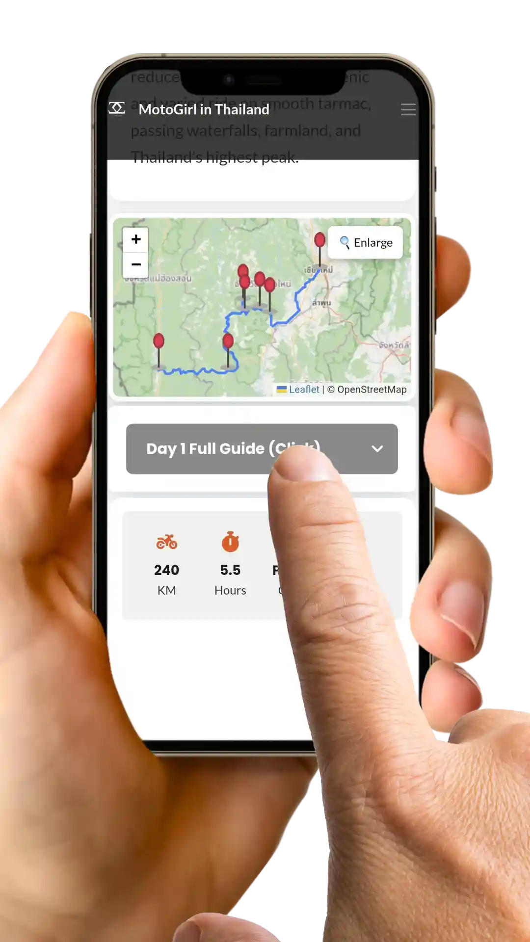
Note: An active internet connection is best to use the guide correctly.
This guide is for personal use only. Please do not share or distribute the route
58
KM
4 – 6
Hours
Paved
Mixed
9
Stops
Open from 6am – 8pm. Free entry. Fuel sold at limited locations
Click to Close
Contents
/membership]
Click to Close
In the late 14th century, a relic believed to be part of the Buddha’s shoulder bone was found in Sukhothai and sent to the Lanna Kingdom. A sacred white elephant carried it up Doi Suthep, pausing at Wat Pha Lat before climbing higher, trumpeting three times, and dying.
Taking this as a divine sign, King Nu Naone built Wat Doi Suthep in 1383, where the relic remains enshrined today – a timeless symbol of faith and devotion.
Click to Close
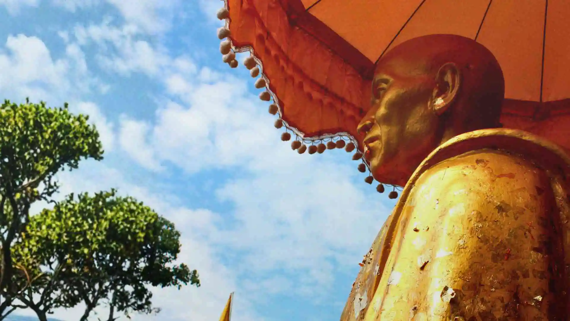
Point A – Kruba Srivicha Monument
A monument honouring one of Northern Thailand’s most revered monks, known as the “Engineer Monk” for mobilising thousands of volunteers to build the road up to Wat Phra That Doi Suthep in 1935.
Click to Close
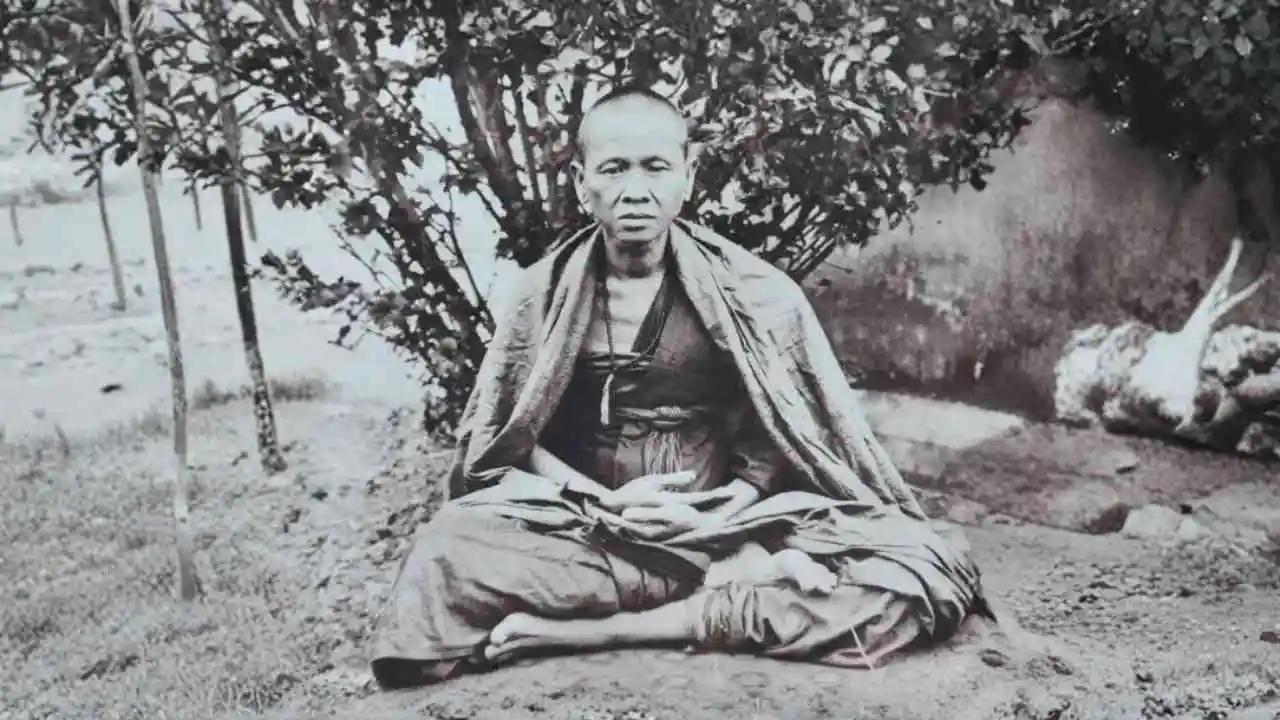
Phra Kruba Sriwichai
Born: 11th June 1878 – Died: 21 February 1938
Known as the “Engineer Monk,” he inspired thousands of volunteers to build the mountain road to the temple in 1935 – entirely by hand. He is deeply loved not only for this achievement, but for his humility, strong spiritual leadership, and role as a symbol of Lanna pride and unity.
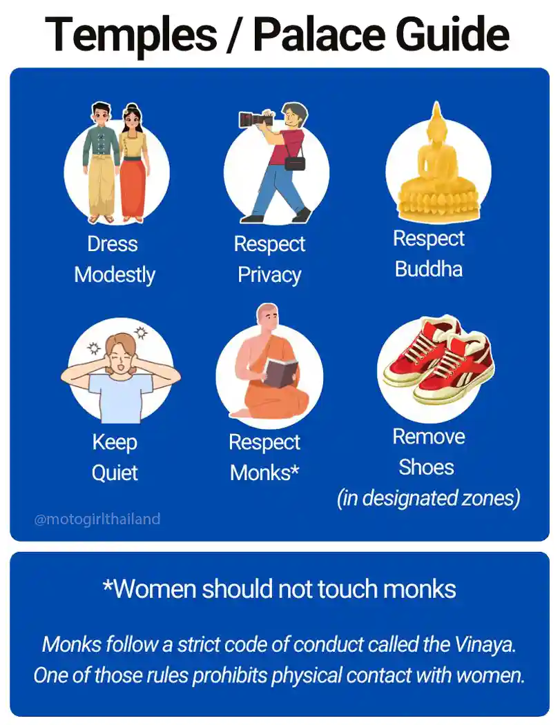
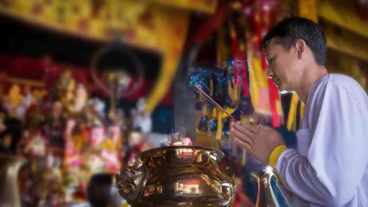
Paying Respects
It is customary for both locals and travellers alike to stop at the base of the temple to pay their respects to Kruba Sriwichai and wish for a safe journey. This involves offering flowers and/or incense.
If you wish to make a simple offering, you can normally purchase flowers, incense sticks and candles at one of the local stalls opposite the temple.
How to do it:
- Light incense and candle
- Place flowers respectfully at the statue
- Keep it simple – intention matters more than perfection
- Stand or kneel facing the statue
- Hold the incense and/or candle.
- Bring your hands together in a Wai (prayer gesture)
- Take a quiet moment
- Place incense and candle in the urn with ashes
- Make merit by leaving a donation (optional)
Repeat this same process when visiting other temples, in front of the Lord Buddha statues (optional)
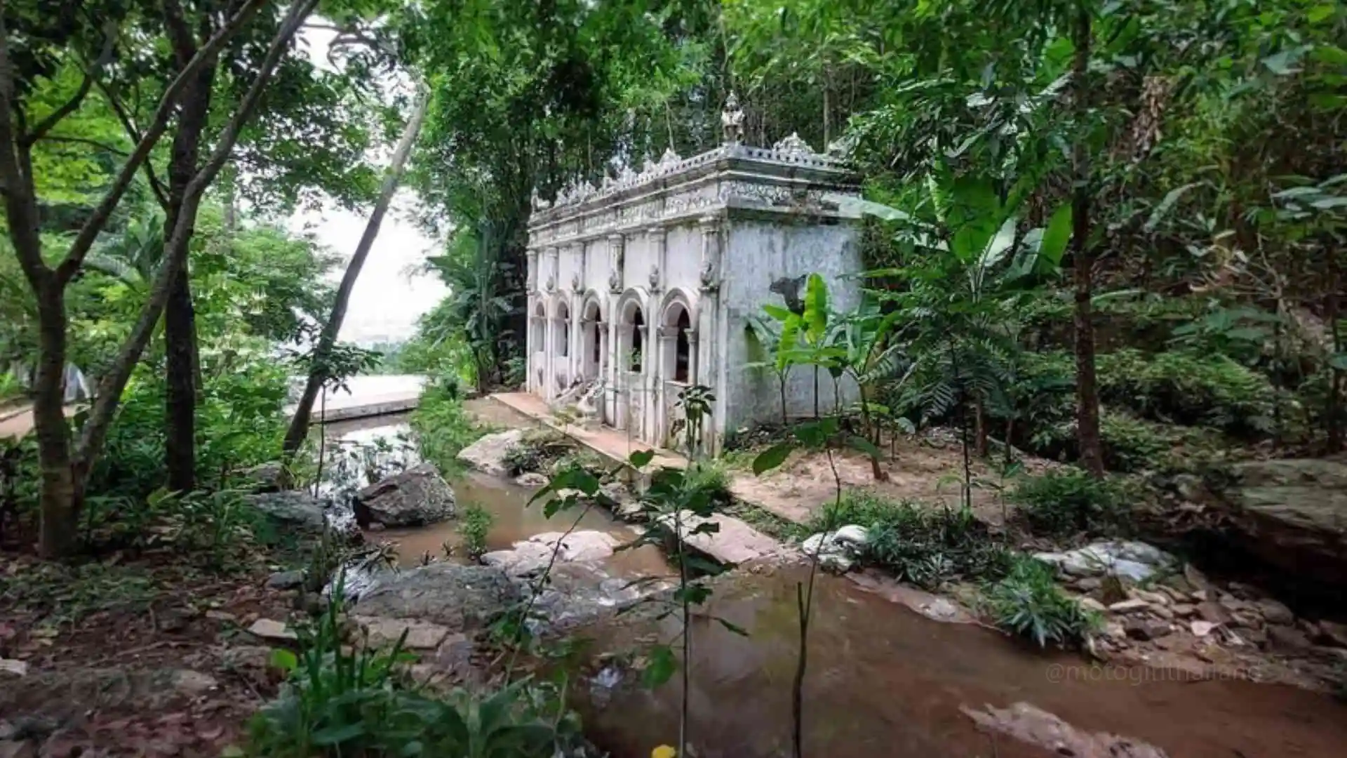
Point B – Wat Pha Lat
Wat Pha Lat, meaning “Monastery on the Sloping Cliff”, was originally a resting point for monks on the pilgrimage to Doi Suthep.
4.4
KM
7
Minutes
Paved
Curvy
Click to Close
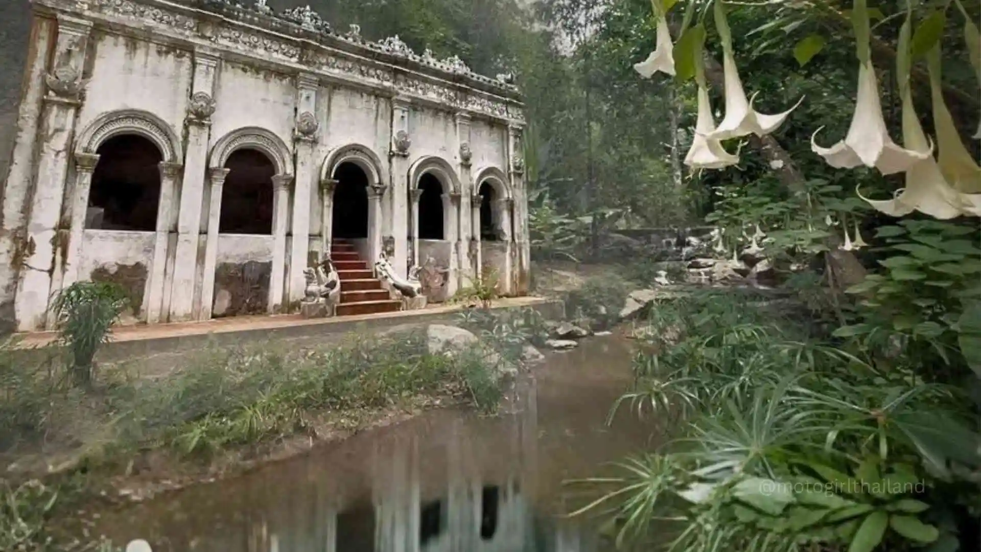
Wat Pha Lad
Founded: 14th century
Wat Pha Lat was founded during the reign of King Kuena (circa 1355–1385), ruler of the Lanna Kingdom in northern Thailand. According to legend, the white elephant carrying a sacred relic paused here to rest, and a temple was built to mark the spot before it continued up to Doi Suthep.
Originally a rest stop for monks on pilgrimage to Doi Suthep, it later became a tranquil forest temple and meditation retreat.
The original Monk’s Trail is now a peaceful 2–3 hour hike to Doi Suthep, marked by orange robes tied to trees along the path.
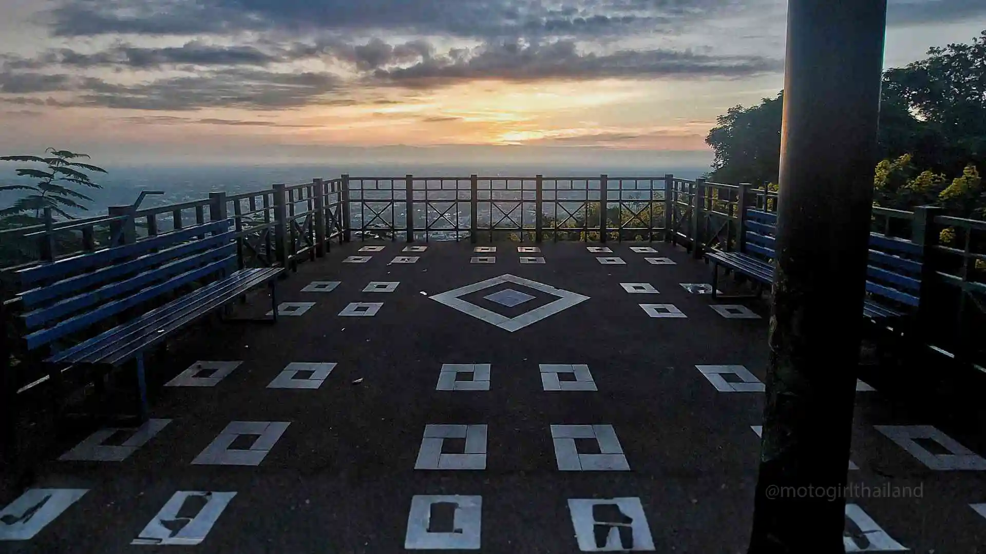
Point C – Pavilion Viewpoint
Built in traditional Lanna style, Chaleom Pra Kiat Viewpoint provides stunning panoramic views of Chiang Mai City. It’s a peaceful spot perfect for early-morning reflections or sunset photography.
1.6
KM
3
Minutes
Paved
Curvy
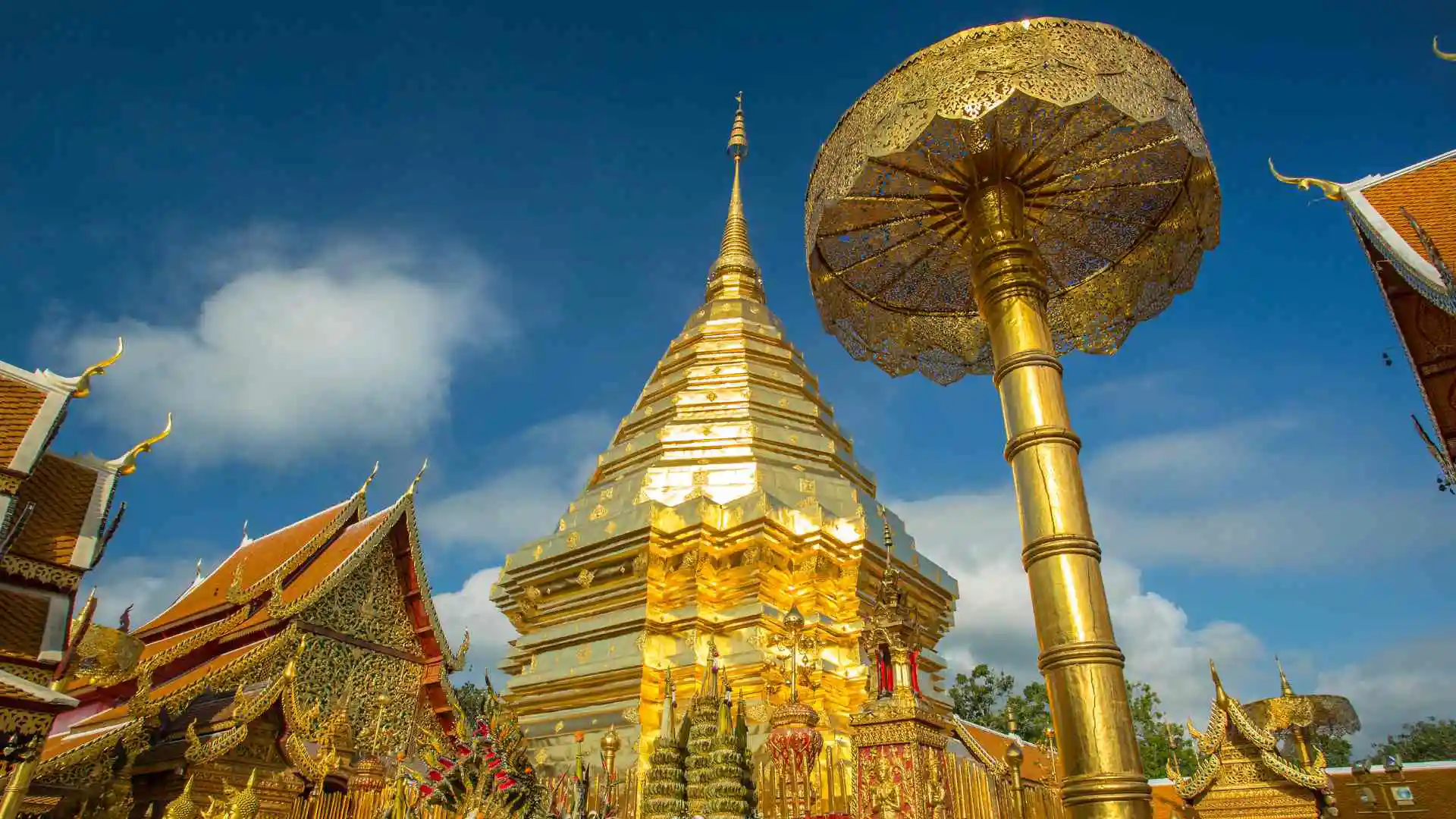
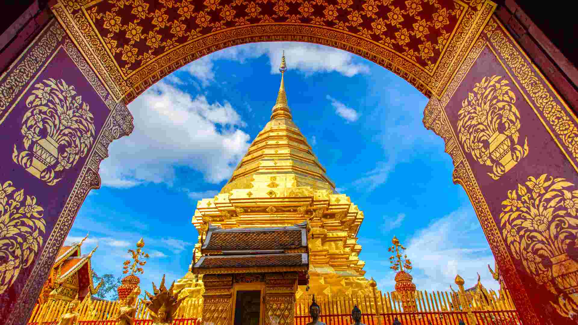
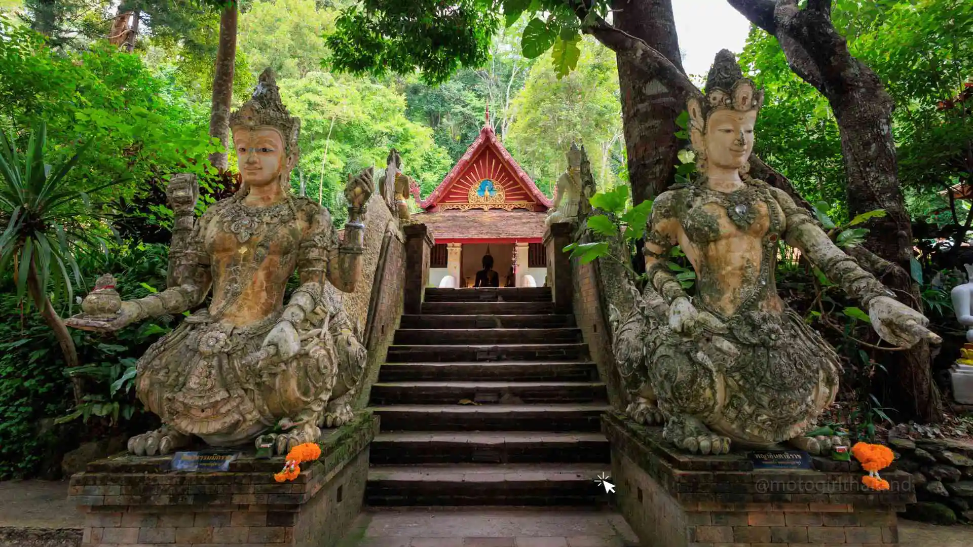
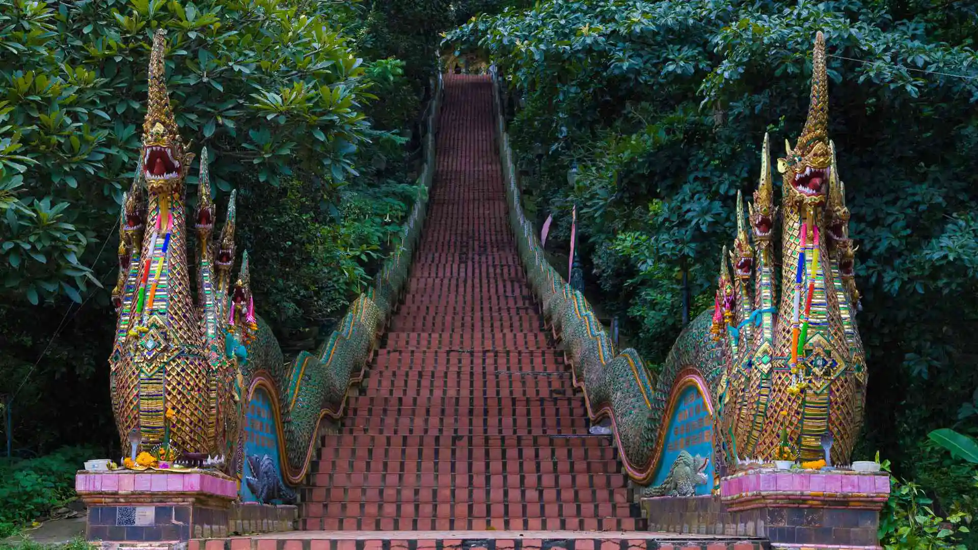
Point D – Wat Phra That Doi Suthep
Chiang Mai’s most iconic temple, known for its golden chedi, sweeping city views, and spiritual significance. To reach the top of the temple, you can either traditionally walk 306 steps to the stop via the Naga stairway or take the 50 Baht tram ride. (If required, fuel can be purchased from one of the small vending shops which line the road outside of the temple).
5
KM
8
Minutes
Paved
Curvy
Click to Close
Wat Phra That Doi Suthep
Founded: 14th century
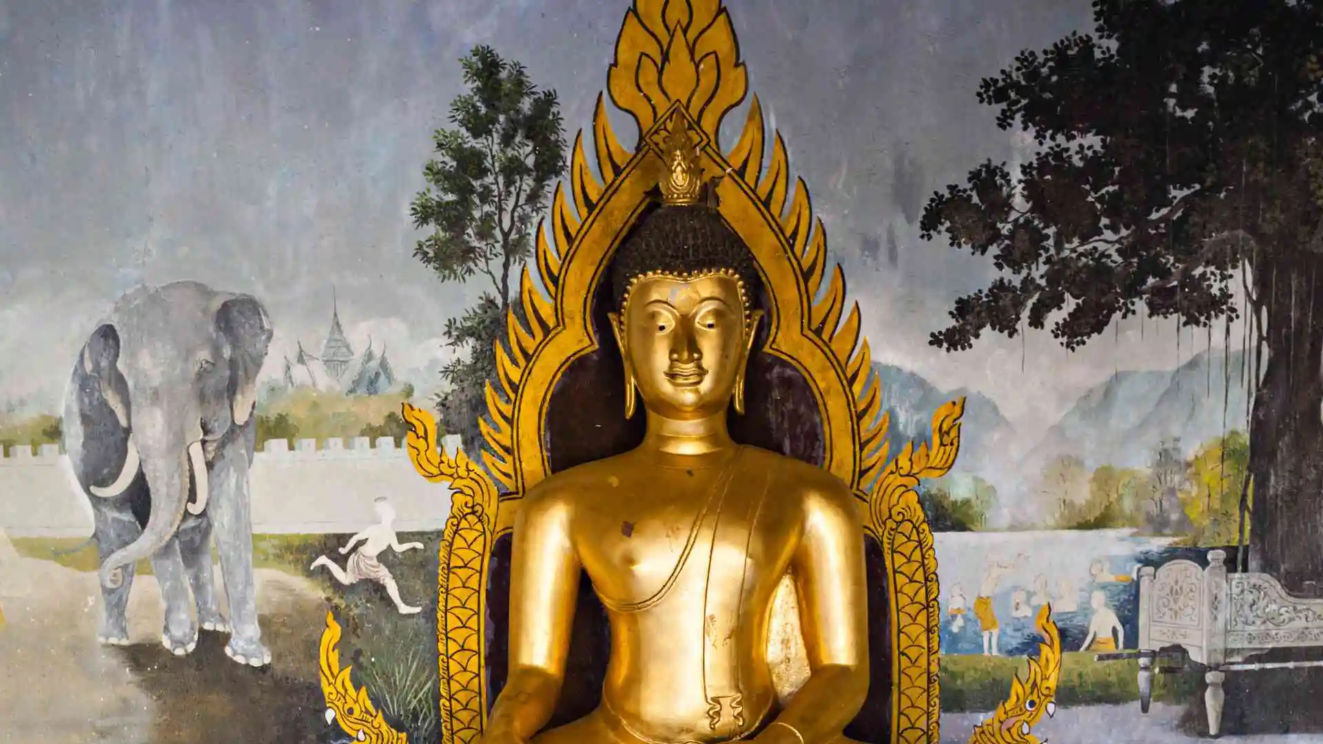
Wat Doi Suthep is one of Chiang Mai’s most important and sacred temples. Located at an elevation of around 1,060 metres (3,480 feet), it was founded to enshrine a relic believed to be a piece of the Buddha’s shoulder bone.
Visitors can reach the site by climbing a 306-step staircase flanked by Naga (mythical serpents), or by taking a tram.
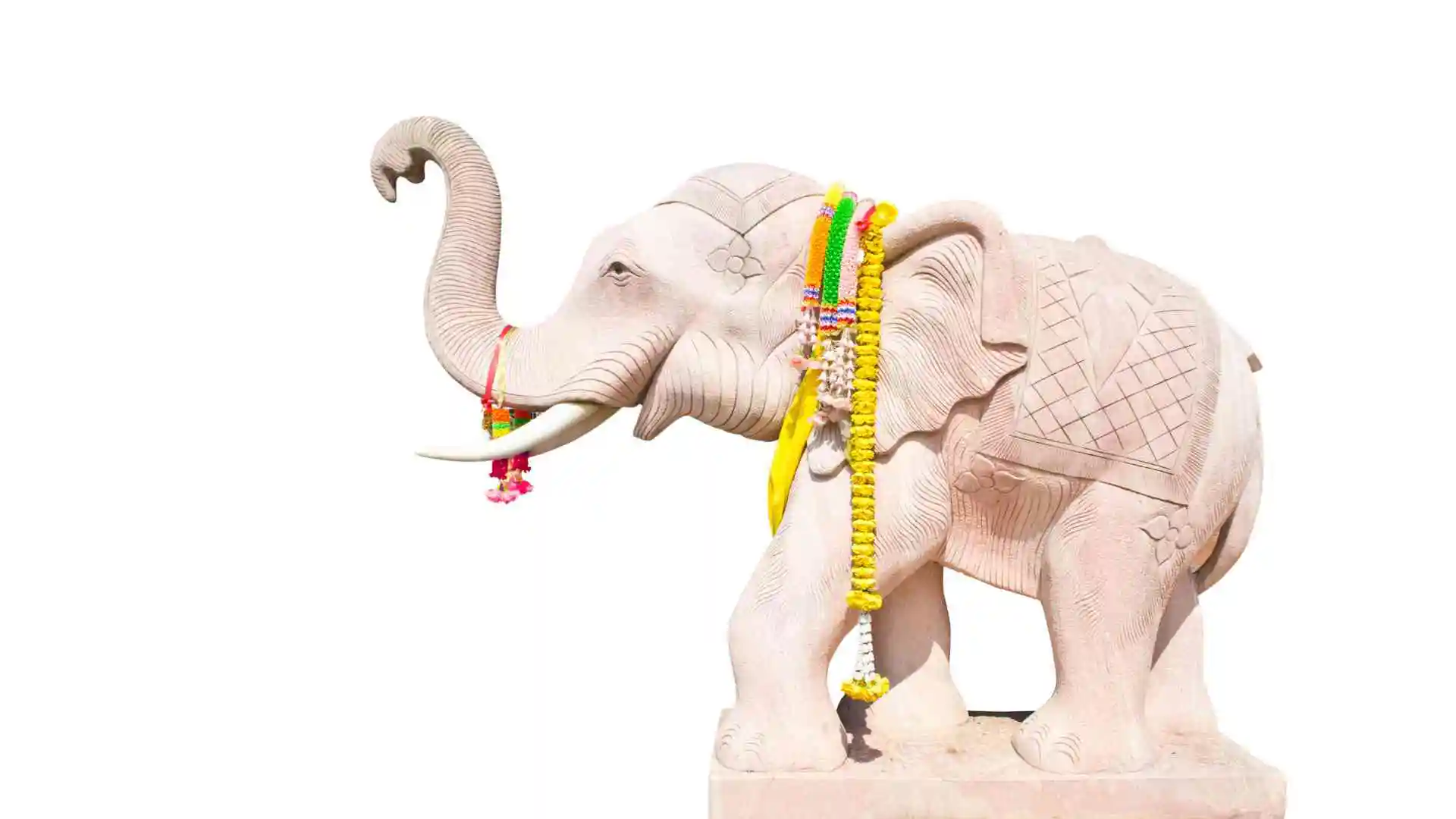
At the top, the temple complex features a golden stupa, a viewpoint area, meditation areas, gardens, shrines, and a statue of the white elephant that, according to legend, carried the relic to its final resting place.
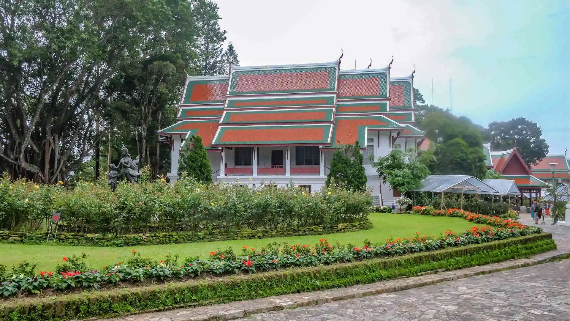
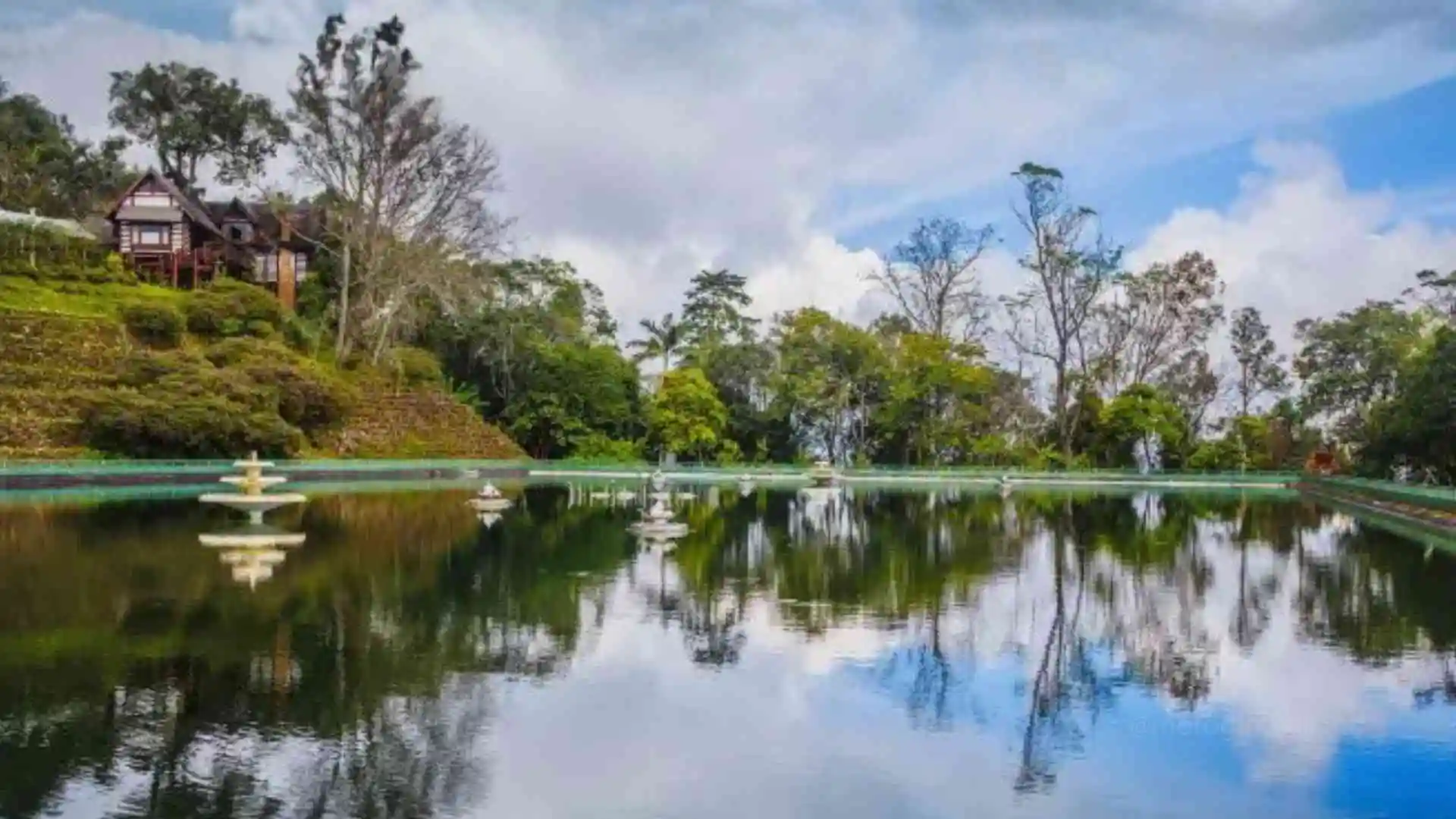
Point E – Bhubing Palace
The royal winter residence is open to visitors when the royal family is not in residence (March–November). Food/Drinks can be purchased from the stalls opposite the entrance of the Palace.
5.8
KM
11
Minutes
Paved
Twisty / Steep
Bhubing Palace
Built in 1961
Built in 1961 in just five months, Bhuping Palace serves as the Thai royal family’s winter residence when visiting the north. The palace is best known for its beautifully maintained gardens, landscaped grounds, and cool mountain air, which are open to visitors when the royal family is not in residence.
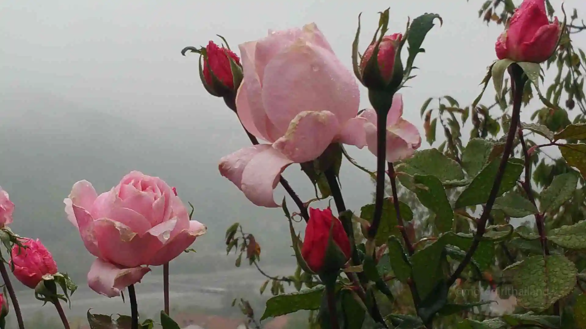
Set at high altitude, the palace grounds are famous for their cool climate and landscaped gardens featuring temperate plants rarely seen elsewhere in Thailand.
The rose garden alone boasts over 274 species from around the world, including hybrid tea, floribunda, climbing, miniature, and heritage roses.
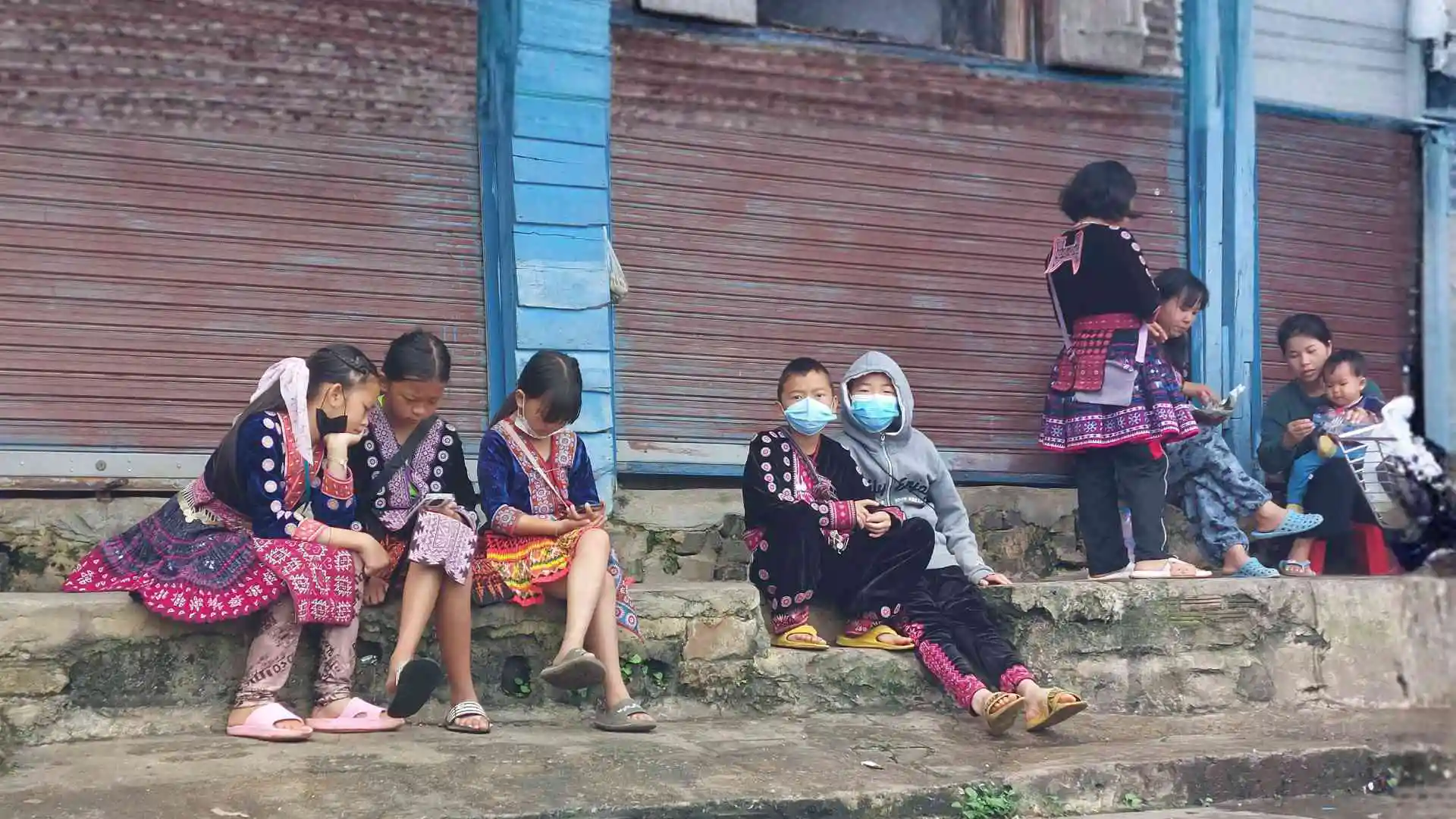
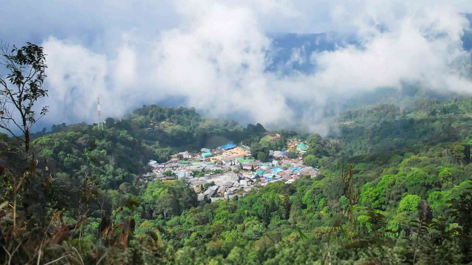
Point F – Hmong Doi Pui Village
A traditional Hmong village offering an authentic cultural experience, stunning mountain views, and local handicrafts.
3.8
KM
10
Minutes
Paved
Curvy
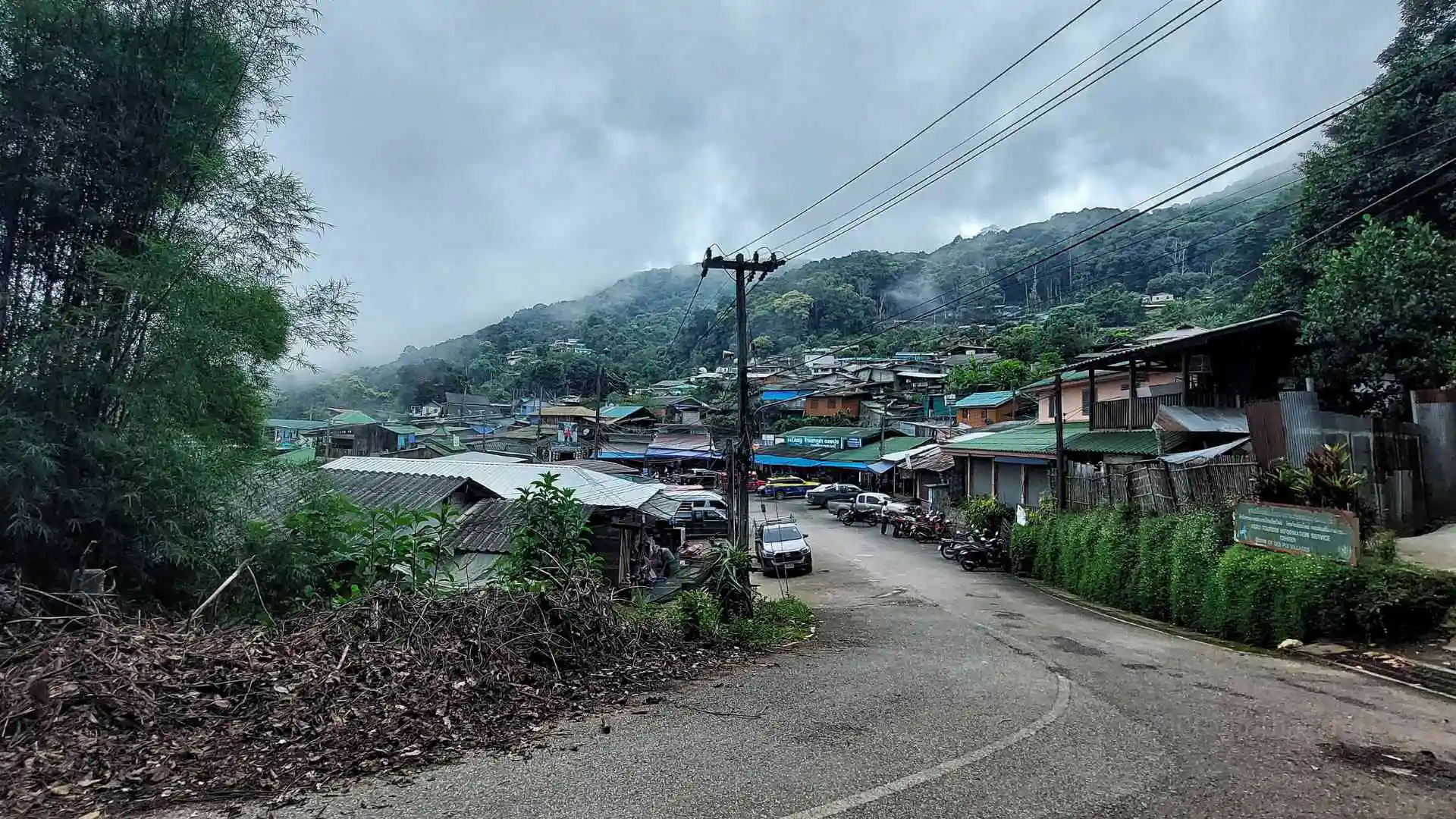
Doi Pui Village
Founded in 1951 / Population: 1300 (approx)
Background: In the 1950s, the Hmong community relied heavily on opium cultivation, which remained widespread despite being outlawed in 1959.
King Bhumibol Adulyadej’s visit to the village in 1969 led to a new initiative: a research and agricultural development project which replaced opium cultivation with sustainable crops.
This marked the beginning of the Royal Project, which continues to benefit communities throughout Northern Thailand.
The Waterfall Park
Entry: 20 Baht
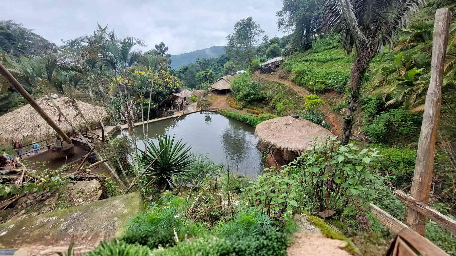
Doi Pui Waterfall Park features traditional buildings, a waterfall, and vibrant flora. Visitors can rent traditional clothing and explore displays of traditional tools.
For more cultural insights, a small museum in the main village showcases additional ways of life.
*Tip* – At the park’s end, a cozy Hmong Cafe offers excellent coffee and seasonal snacks.
Point G – Doi Pui Viewpoint
A popular viewpoint offering expansive views of the nearby Hmong village and surrounding forested hills. Ample parking is available, though the area is dirt and gravel.
3.3
KM
9
Minutes
Paved
Twisty / Steep
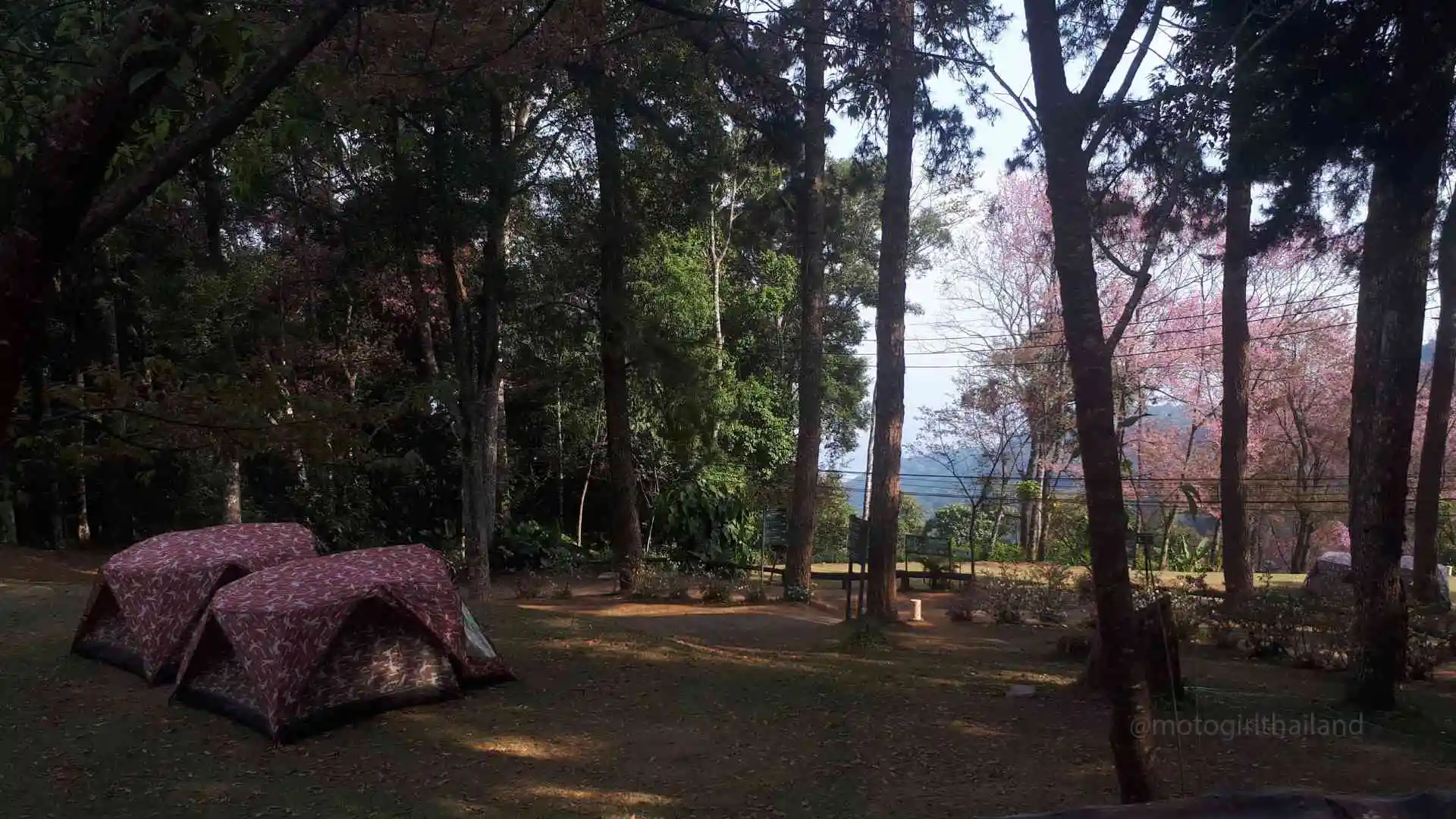
Point H – Doi Pui Camping
A campground offering basic facilities including restrooms. Tents & sleeping bags are available for rent. (Expect seasonal closures).
2.6
KM
7
Minutes
Paved
Twisty / Steep
Prices may be subject to change.
30 Baht – when using own camping equipment
Tent Rental Fee – 220 Baht
Sleeping Bag Fee – 30 Baht
Mats – 20 Baht / Pillows -10 Baht
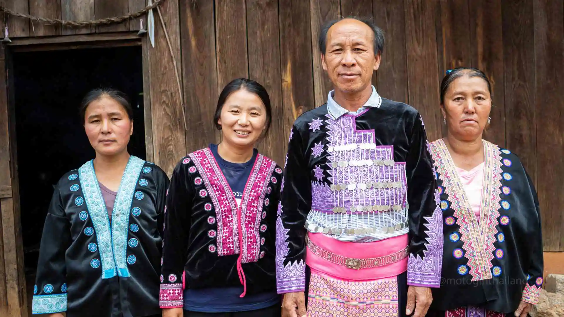
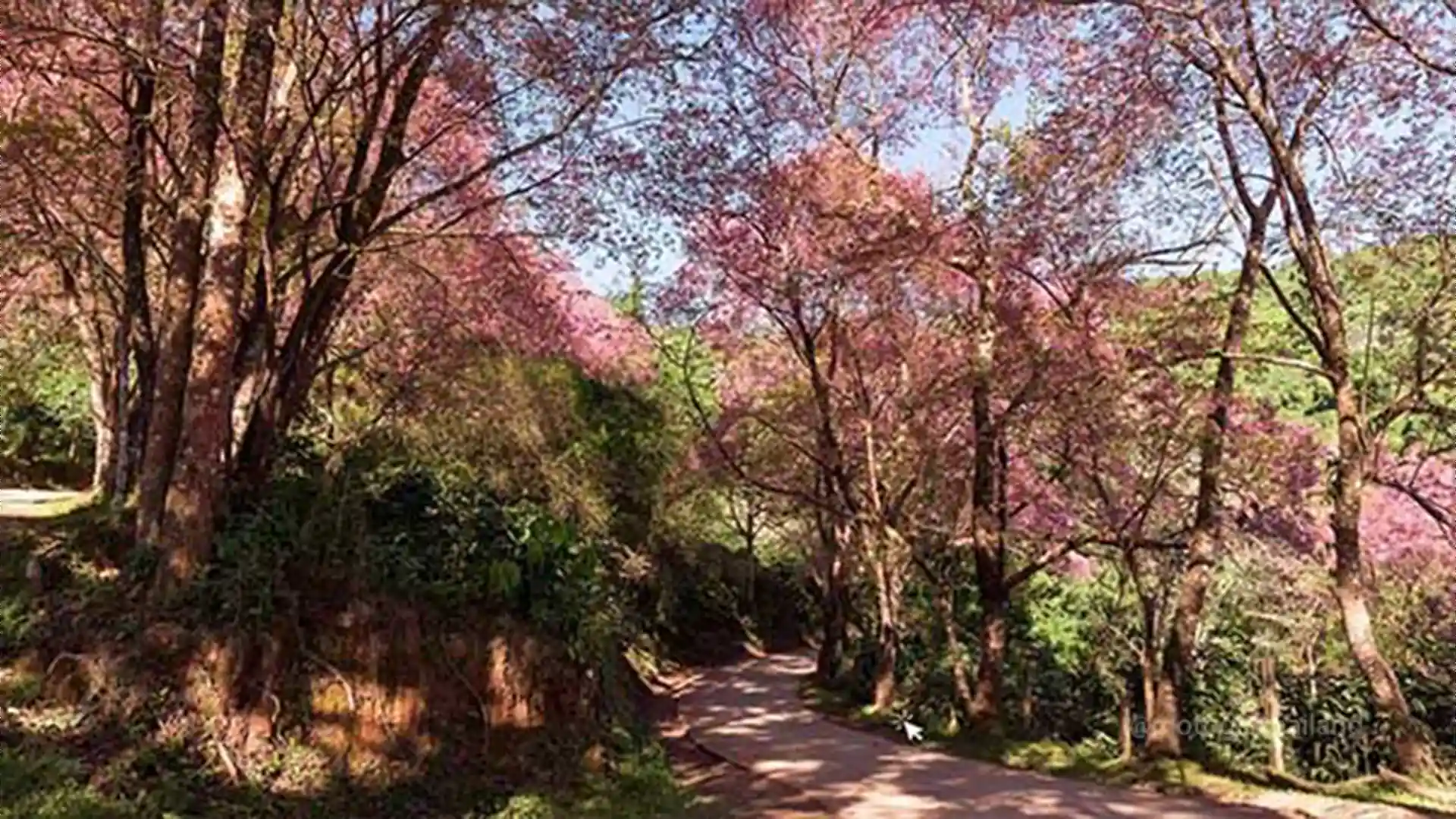
Point I – Khun Chang Khian Village
A small Hmong village best known for the stunning Sakura cherry blossoms in late winter (late January – February). Click “Read More” for optional dirt route in this area.
4
KM
12
Minutes
Paved
Twisty / Steep
Khun Chang Khian Village
Founded in 1955 – Population: 700 (approximately)
This Hmong hilltribe village offers a look into traditional rural life, with a few small cafés and eateries serving simple dishes.
This Hmong hilltribe village offers a look into traditional rural life, with a few small cafés and eateries serving simple dishes.
Point J – Return to Base
Unless taking the back route dirt trail, head back down the mountain the same way you rode up. If you have time, there are a few additional attractions worth exploring along the way.
25
KM
50
Minutes
Paved
Twisty / Steep
Did you enjoy the Guide?
Please take a moment to leave feedback on the product page or below. Additionally, if you notice any issues with the guide or have a general question, scroll down and comment to let me know!
We did this as a couple on one bike and had a great time.
Loved the guide. Thank you.
Thank you so much for this guide. Helped us a lot!
I just recently learned how to ride and was nervous.
At 67, I’m not out here looking for speed.