Temple Lions. Mae Hong Son

The Mae Hong Son Loop

The Mae Hong Son Loop. 600+ km, 4000+ curves, 4-Day Loop ride through incredible landscapes on Thailand's most famous loop!

Mae Hong Son

4- Days

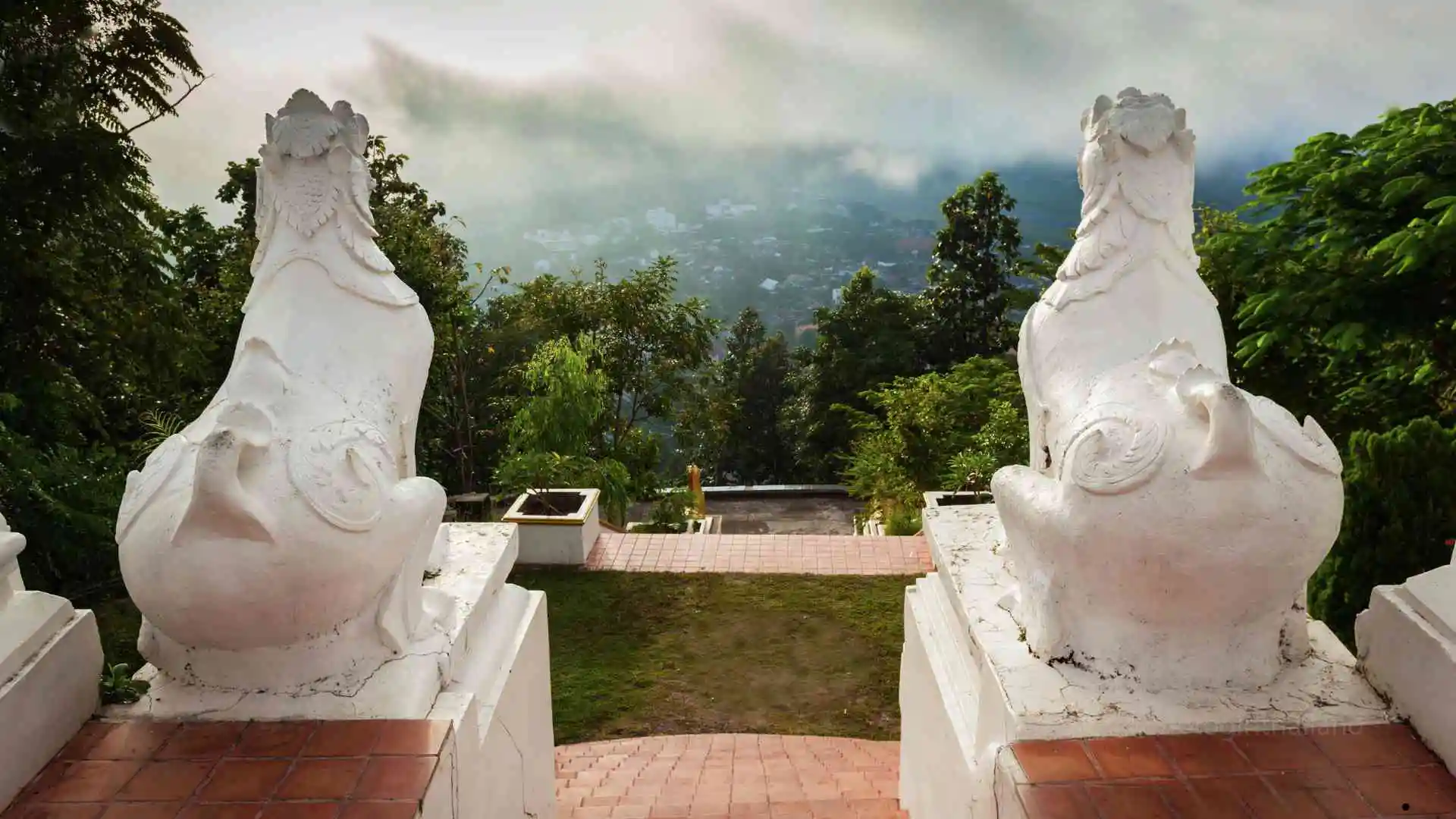
The Incredible Mae Hong Son Loop

Mae Hong Son | 720 KM Loop | Classic Guide

Spanning over 600 km and 4,088 curves, the Mae Hong Son Loop is Northern Thailand’s most iconic ride, famed for its winding mountain roads, epic views, and rich cultural encounters. Note: this guide is more km than the average classic loop, due to including the spectacular route through Mae Chaem, and the option of riding to Thailand’s highest mountain.

The Loop offers generally good paved roads, tight hairpins, with occasional potholes or debris.

How to Use the Guide (Click)

Click to Close

Note: GPS waypoints and an interactive map is available once content access is unlocked.

Follow the guide step-by-step. Each stop has a GPS location button – click it! The link will open up in Google Maps (or an alternative map-app on your phone).

Wifi

Scroll

Click

Follow

A graphic with a mobile phone with a finger - motosplore guides. motogirlthailand

Toilet

Tickets

Food

Coffee

ATM

Hotel

Camping

Bars

Note: An active internet connection is best to use the guide correctly.

This guide is for personal use only. Please do not share or distribute the route

Hmong Hilltribe Chiang Mai

Unlock this Guide🔒 Purchase the individual guide, or unlock multiple guides with a Classic or Premium subscription.

720

4

Paved

21

Daily Overview (Click)

Click to Close

Routes for each are mixed (straight, curvy, twisty & steep). Add additional time for visiting attractions.

Day 1: Chiang Mai to Mae Sariang

240

5.5

Paved

6

+additional KM/time if visiting attractions


Day 2: Chiang Mai to Mae Hong Son

162

3

Paved

5

+additional KM/time if visiting attractions


Day 3: Mae Hong Son to Pai

108

2.15

Paved

5

+additional KM/time if visiting attractions


Day 4: Pai to Chiang Mai

127

3

Paved

5

+additional KM/time if visiting attractions

Table of Contents (Click)

Unlock this Guide🔒 Purchase the individual guide, or unlock multiple guides with a Classic or Premium subscription.

Fuel stops are based on a 7.7 Liter tank. Smaller tanks will need to add additional stops.

Hmong Hilltribe Chiang Mai


Hmong Hilltribe Chiang Mai

Day 1 – Chiang Mai to Mae Sariang

Day 1 is the longest day in the saddle, so an additional day may be added if needed (or, alternatively, bypass the Doi Inthanon-Mae Chaem section, to reduce the saddle hours). A scenic and varied ride on smooth tarmac, passing waterfalls, farmland, and Thailand’s highest peak.

240

5.5

Paved

6

+ 18 km / 26 mins ride time, if visiting Doi Inthanon Summit


Hmong Hilltribe Chiang Mai

Day 2 – Mae Sariang to Mae Hong Son

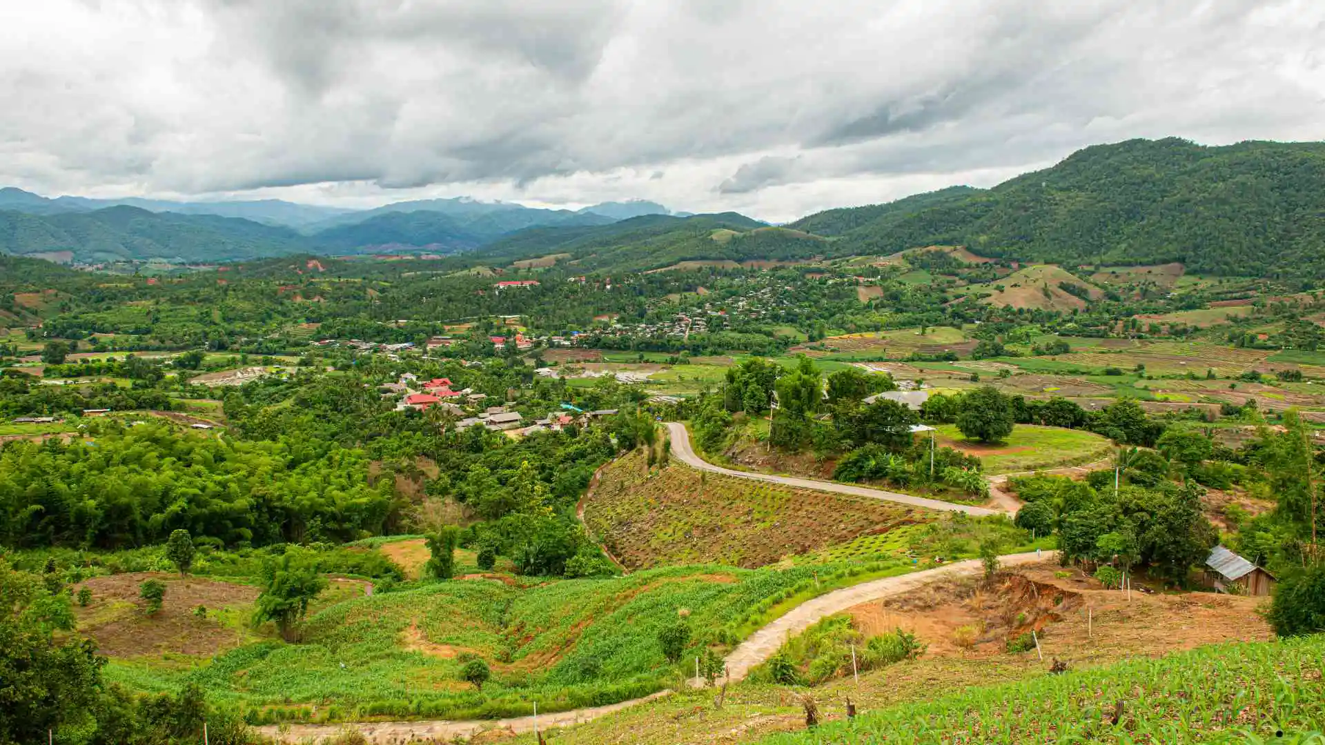
Day 2 is a scenic blend of rolling hills, forested curves, and peaceful mountain views. With its long stretches of road leading to Mae Hong Son, it is less intense than Day 1 route.

162*

3

Paved

5

+20 km / 34 mins – if visiting Kayan Long Neck Village.


Hmong Hilltribe Chiang Mai

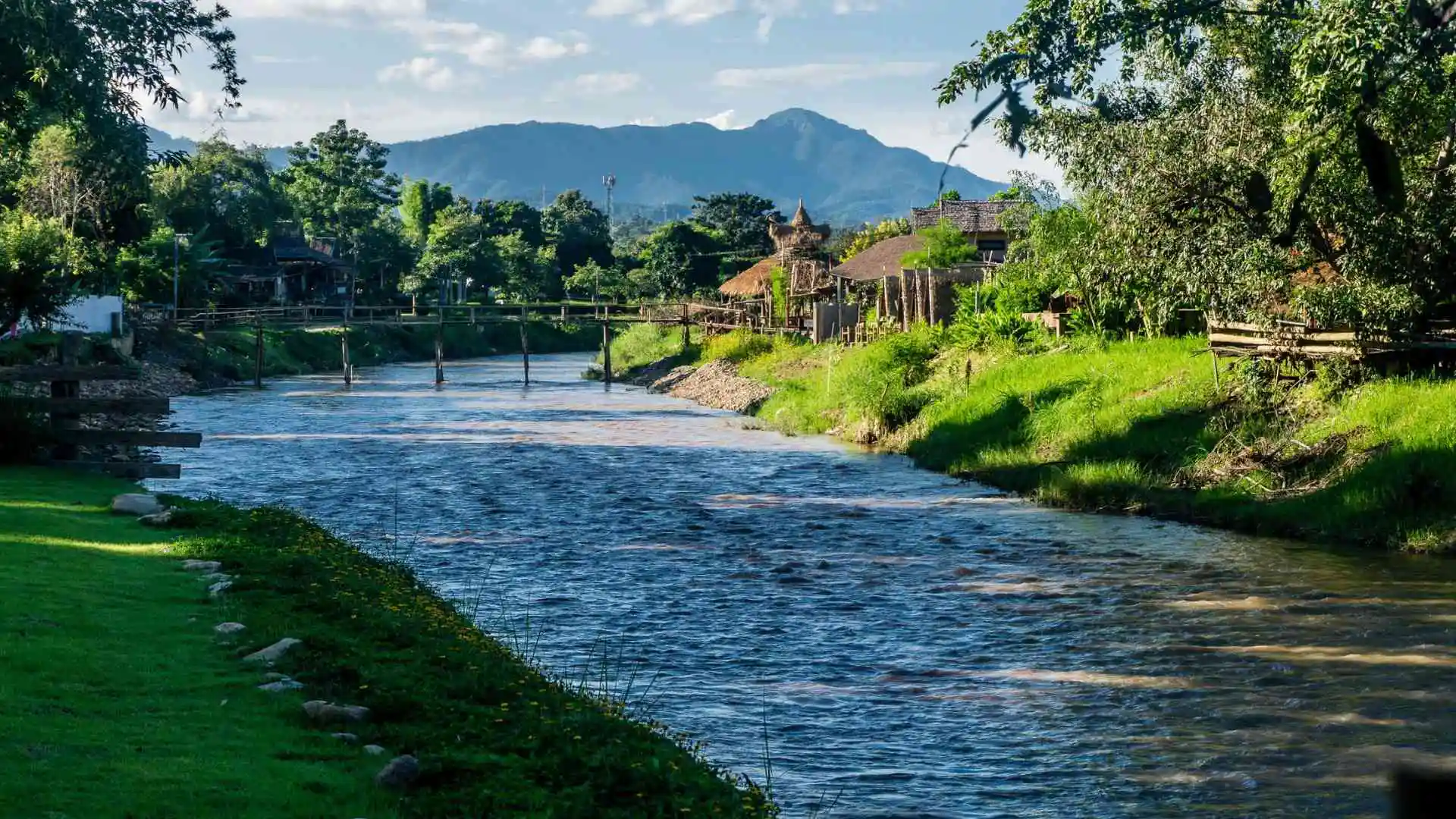
Day 3 – Mae Hong Son to Pai

Day 3 is a scenic ride through lush mountain curves, viewpoints, and hilltribe village zones. Its long, sweeping bends make it a memorable part of the Mae Hong Son loop.

108

2

Paved

5

+additional KM / Time if visiting attractions

Day 3 Guide (Click)
Hmong Hilltribe Chiang Mai

Point A – Depart Mae Hong Son

Adjust start point to your preferred location


Hmong Hilltribe Chiang Mai

Point B – JUNCTION for Su Tong Pae

Decide if you wish to visit Su Tong Pae Bridge or continue along the route. The route is 2 KM each way.

Su Tong Pae is a 500-meter bamboo bridge built by local volunteers in 2012 to aid the local monks. It has since become a popular local tourist attraction.

10

13

Paved

Visit Su Tong Pae (Click)
Hmong Hilltribe Chiang Mai

Su Tong Pae – Bamboo Bridge

24 Hours

Free

4

6

Paved

End – Return to junction and continue along the loop


Hmong Hilltribe Chiang Mai

Point C – JUNCTION for Ban Rak Thai

Decide if you wish to visit Ban Rak Thai Village or continue along the route. The route is 27 KM each way.

Ban Rak Thai (meaning “Thai-loving village”), is a picturesque village, known for tea cultivation.

6.5

8

Paved

Visit Ban Rak Thai (Click)
Hmong Hilltribe Chiang Mai

Ban Rak Thai – Yunnanese Village

Founded: 1980’s

Population: 800 approx

Background: Originally a settlement for former Kuo Min Tang nationalist fighters from Yunnan Province in China, who fled after the Communist takeover in 1949.

24 Hours

Free

3.6

6

Paved


Hmong Hilltribe Chiang Mai

Ban Rak Thai State Outpost

Step over the border into Mae Aw remote border village, to visit the village, shop and museum. Note: This is a restricted access zone, controlled by the Thai Army. It may be closed at times – especially during political turmoil periods.

Background: This zone was set up for controlling the Jade trade arriving in from the Shan State. It was also a hotspot for drug smuggling, which used to dominated the economy.

Times vary

Free

3.6

6

Paved

End – Return to junction and continue along the loop


Hmong Hilltribe Chiang Mai

Point D – JUNCTION for Nam Lod Cave

Decide if you wish to visit Ban Rak Thai (village) or continue along the route. The route is cuts through a local village area, and adds an additional?? KM each way.

Nam Lod is famous for towering chambers, prehistoric history, and guided bamboo river rafts.

55

50

Paved

Visit Nam Lod Cave (Click)

Note: There are many steep steps to climb.

Hmong Hilltribe Chiang Mai

Entrance Fee
(Group of 1-3 people)
Column Cave (1 Cave) : 300 Baht*
All 3 Caves + Raft: 600 Baht*
Additional
Fish Food: 50 Baht
Tip for Guide: (Optional)
*Prices may vary

This impressive 1,666-meter limestone cave system contains towering stalactites, a river system, ancient teakwood coffins believed to be carved by the Lawa tribe, and thousands of swifts and bats.

A lamplit bamboo raft takes visitors along the Nam Lang River system, which winds through the cave’s towering dark chambers.

8am – 3pm

8.5

15

Paved

Hmong Hilltribe Chiang Mai

End – Return to junction and continue along the loop


Hmong Hilltribe Chiang Mai

Point E – Doi Kiew Lom Viewpoint

Doi Kiew Lom Viewpoint offers stunning mountain views, local snacks, Hilltribe souvenirs, and occasional photo ops with children in traditional dress for a small tip. Drinks, snacks and souvenir shops on-site are normally open from 6am to 6pm.

24 Hours

Free

17

24

Paved


Hmong Hilltribe Chiang Mai

Point F – Arrive Pai

Once a quiet Shan market village, Pai has evolved to be a popular tourist hub, known for its laid-back vibe.

24 Hours

25

30

Paved

Pai Quick Recommendations (Click)

Quick recommendations – Read the detailed guide to Pai below for more information on Pai.

Where to Stay

Heart of Pai

Villa de Pai


Where to Eat

Baan Pai

Cake ‘o’ Go


Market

Walking Street

6pm – 10pm

Saturday Market

9am – 3pm


Temple

Big Buddha Pai


Waterfall

Morpaeng Falls


Nightlife


Attractions

Pai Canyon

Best for sunset

Yun Lai Viewpoint

Best for sunrise


Hot Spring

Sai Ngam

End – Enjoy your time in Pai


Hmong Hilltribe Chiang Mai

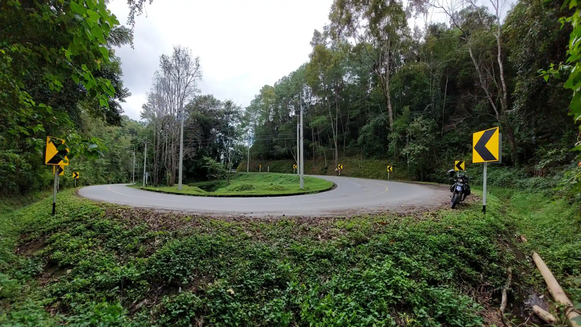
Day 4 – Pai to Chiang Mai

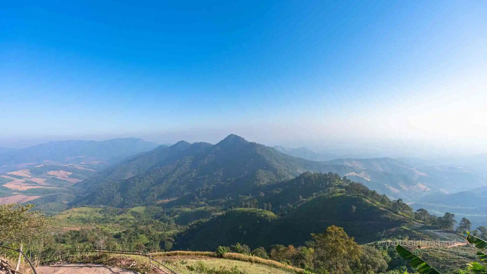
Day 4 is a steep and twisty ride of 762 curves through the lush mountains between Mae Hong Son and Chiang Mai Province. This is one of Thailand’s most thrilling riding routes.

127

3

Paved

5

Day 4 Guide (Click)
Hmong Hilltribe Chiang Mai

Point A – Depart Pai

Adjust start point to your preferred location


Hmong Hilltribe Chiang Mai

Point B – Pai Memorial Bridge

Pai Memorial Bridge was built during WWII by villagers under Japanese orders, using elephants to haul jungle timber, to extend the army’s route into Myanmar / Burma. Drinks, snacks and souvenir shops on-site are normally open from 6am to 6pm.

6am – 5pm

Free

9

12

Paved


Hmong Hilltribe Chiang Mai

Point C – Army Checkpoint

The army checkpoint at Doi Mae Ya is typically hassle-free. Foreign visitors are rarely stopped. Just slow down and continue on your way.

19

26

Paved


Hmong Hilltribe Chiang Mai

Point D – Rak Chang Viewpoint

A small café and convenient bathroom stop with pretty views, where low clouds and grazing cattle often create perfect photo moments. The on-site cafe is open from 6am to 6pm.

24 Hours

Free

9

17

Paved

Hmong Hilltribe Chiang Mai

Point E – Coffee We / Witches Hut

A fun, quirky witch-themed café-restaurant serving a variety of drinks, food, and homemade snacks in a cozy setting filled with witch statues and broomsticks.

6am – 6pm

13

19

Paved

Hmong Hilltribe Chiang Mai

Point F – Mok Fa Waterfall

Mok Fa is a 60-meter waterfall with a shallow 1-meter pool, perfect for a cool dip. Note: it may close during the rainy season and be shallow in the hot season. Note: Ticket prices may vary and expect to pay an additional 20 Baht for motorbike parking fee.

Food & Drink available in the nearby Pankled Coffee.

8:30am – 4:30pm

100 Baht

28

31

Paved

Hmong Hilltribe Chiang Mai

Point G – Arrive Chiang Mai

The final leg into Chiang Mai city brings you onto the main highway route. If you have time, consider stopping at Air Diamond Café, an intriguing coffee shop built inside a jet plane.

55

1

Paved

Unlock this Guide🔒 Purchase the individual guide, or unlock multiple guides with a Classic or Premium subscription.

Did you enjoy the Mae Hong Son Loop Guide?

Please take a moment to leave feedback,
Additionally, if you notice any issues with the guide, please do let me know!

Leave a Reply

Your email address will not be published. Required fields are marked *