![]()
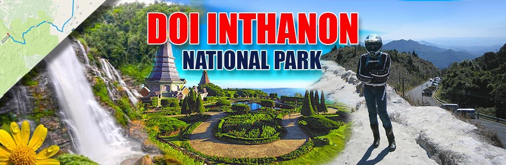
Nicknamed “The Roof of Thailand“, Doi Inthanon National Park is part the Chiang Mai province of northern Thailand and part of the Himalayan mountain range. The park covers an area of 482 km² with elevation ranges between 800 and 2565 meters, with the highest peak at Doi Inthanon, making it the highest mountain in Thailand. Due to the high altitude, the park has cold weather and high humidity all year round, with the average daily temperatures around 10-12°C. The park is host to a variety of flora and fauna and is a top spot for bird-watching (with over 300 varieties of birdlife). With its spectacular waterfalls, nature-rich walking trails, and ancient hill tribe villages, Doi Inthanon is a must-see national park in Northern Thailand.
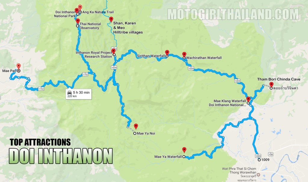
click to enlargeGetting there
From Chiang Mai city head south on the 108 towards Mae Sariang. Approximately 60km along the 108 you will see a turn off for Doi Inthanon (route 1009) on the right-hand side.
This route will take you through mountain ranges and checkpoints with the main entry point to the national park at around 8km in.
The entrance fees (2017) is as follows:
Foreigners – 300 baht (150 baht for children)
Thai Nationals (or those with correct documents): 50 baht (20 baht for children)
Yes, two tiered pricing rates…
“Correct documents” are really hit and miss and often depends upon the mood of the person manning the ticket booth. If you are a foreign national holding a work permit, pink ID, tabian baan (house book), or a combination of any or all of them, you may get the local rate. Try your luck for the local rate, but go expecting to pay full foreigner rate.
Approximately 1km from the main entrance you will reach the visitor centre and around 20km after the visitor center is the park headquarters, where you can camp overnight for a registration fee of 30 baht. The HQ opening times are 5:30am to 6:00pm and camping tents and accessories can be rented (two-person: 250 baht, three-person: 300-400 baht, four-person: 500 baht, six-person: 600 baht) if required.
Contact number: +66 5335 5728, +66 5326 8550
TOP ATTRACTIONS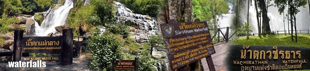 Waterfalls
There are several waterfalls within the national park but I am focusing on four of the most popular ones, consisting of Mae Klang Waterfall (100 meters), Mae Ya Waterfall (250m high – the highest waterfall in the park), Wachirathan Falls (100m high) and Sirithan Waterfall (50m high).
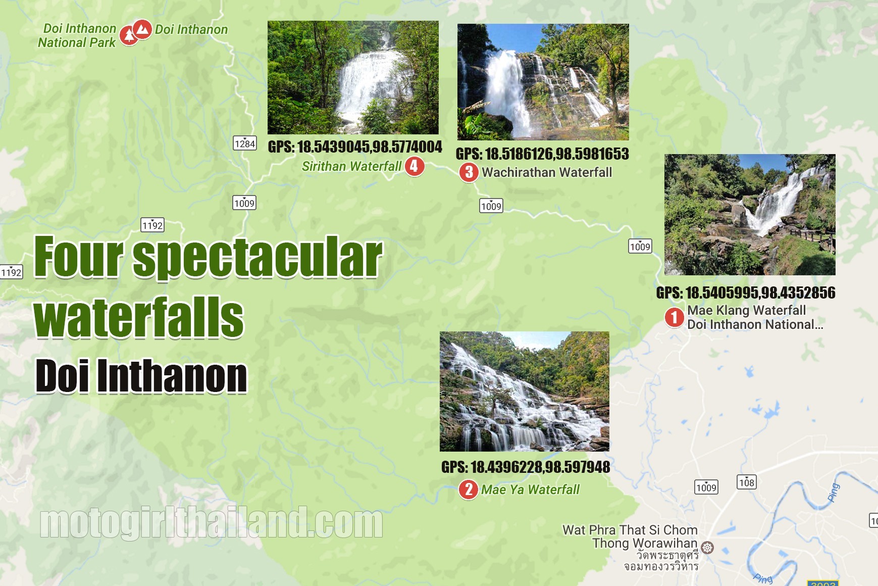 1: Mae Klang Waterfall (google map link)
Mae Klang Waterfall stands at 100 meters high and is the first waterfall on the main road into the national park, located 600 meters south of the south east checkpoint. The waterfall cascades over several tiers, with the highest tier at 25-30 meters high. Being the closest waterfall as well as an easily accessible one, makes Mae Klang Waterfall a very popular spot. Keep in mind that it can become quite busy during the weekends and on public holidays.
2: Mae Ya Waterfall (google map link)
Mae Ya Waterfall stands at 250 meters high and close to 100 meters wide, making it an impressive sight (particularly during rainy season). There are several tiers in which visitors can view the waterfall with the tallest viewing tier standing at 50 meters high. Mae Ya Waterfall is considered to be the second largest waterfall in Thailand, with Thi Lo Su Waterfall in Tak Province beating it by several meters wide (same height but 450 meters wide). The waterfall is located 12 km from Chom Thong Village in the Doi Inthanon area. Take a left turn when you see the sign, just after highway 1009.
3: Wachiratan Waterfall (google map link)
Wachiratan Waterfall is the second major waterfall on the way to the summit, standing at 100 meters high. This waterfall has the most spray out of all the waterfalls, so you can easily get quite soaked. It is easy to access via a short trail from the car park next to the main road (approx 20km trail).
4: Sirithan Waterfall (google map link)
Sirithan Waterfall, named after the Queen who came to visit it, stands at 50 meters high and origins from the Mae Klang River. A very popular waterfall, so expect a lot of visitors. The fall can be reached by walking a 200 meter trail from the parking area on the main road.
Tham Bori Chinda Cave (google map link)
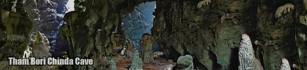
Tham Bori Chinda Cave is a large two chambered limestone cave located near the visitor center and Mae Klang waterfall. You will need to trek to reach the cave, which should take around an hour to reach. Buddha images line the cave and a rocky stream flows through it.
 Tham Bori Chinda Cave is an open cave and so sunlight is able to enter which allows visitors to see the entire cave in all it’s stunning glory.
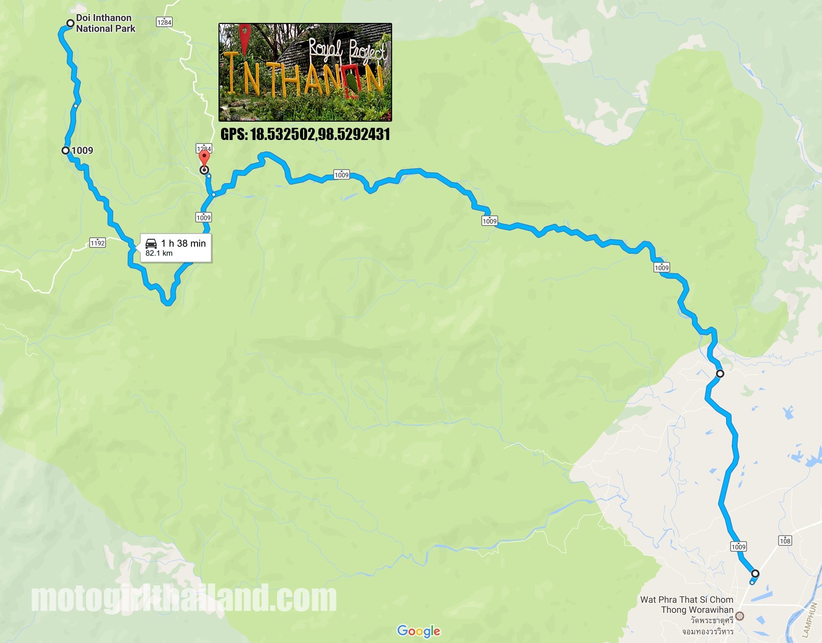
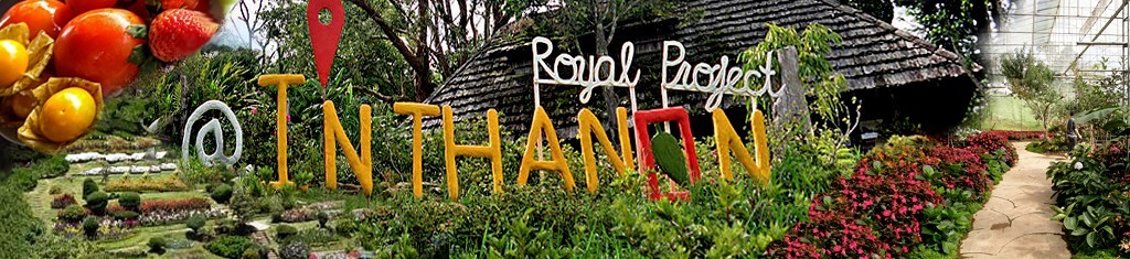 Doi Inthanon Royal Project (google map link)
Close to the park headquarters, within Khun Klang village. The project was developed in 1979 to help train hill tribe communities in modern agricultural practices (and steer them away from cultivating opium). The resulting harvest of crops, plants and flowers could then be sold through the project. The onsite flower breeding research lab and plantations are open to visitors.
 Note: There are multiple Royal Projects around the whole of the country, which was set up by His Majesty King Bhumibol, who recently passed away, much to the sorrow of his countrymen. You can read more about his projects HERE
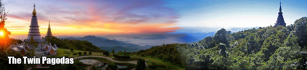
The Twin Pagodas (google map link)
The twin pagodas (Phra Mahathat Napha Methanidon and Phra Mahathat Naphaphon Bhumisiri), are situated 100 meters from one another, and were built to commemorate the fifth cycle birthdays of the late King Bhumibol Adulyadej and Queen Sirikit.
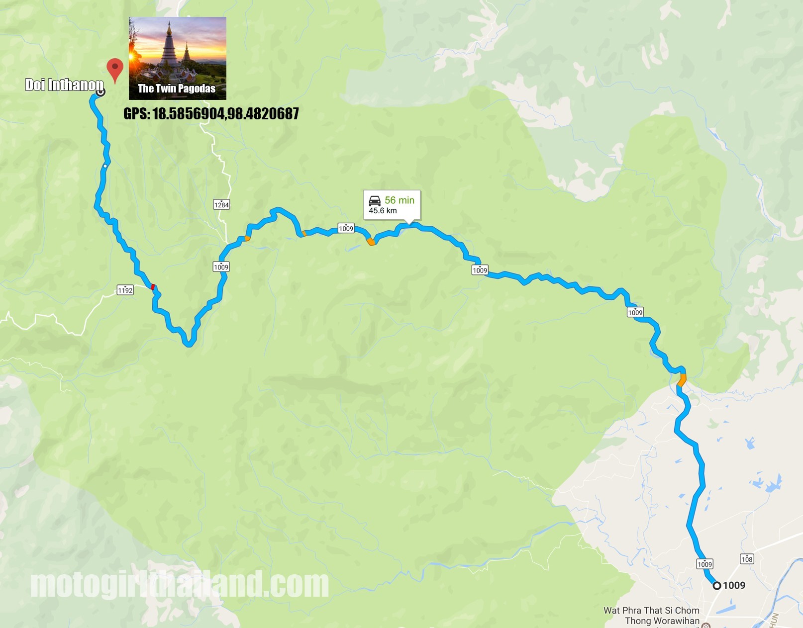 The pagodas enshrine the Lord Buddha’s relics and include fine tiled murals and imagery of the Buddha. The views on a clear day are magnificent, but often obscured by cloud cover.
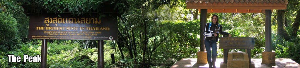 Doi Inthanon Peak (google map link)
The peak of the park is very straight forward to reach and has plenty of signage and photo ops on the way and at the destination. The area is cool all year round so take something warm. You can also purchase warm drinks and food at the peak.
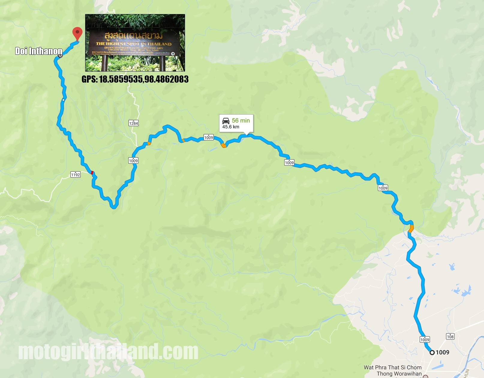 The peak is the site of King Inthawichayanon’s (the seventh and last king of Chiang Mai) stupa. King Inthawichayanon is said to have had a deep concern about preserving the forestry for future generations. He had a deep affinity with Doi Inthanon so requested that part of his ashes be placed there.
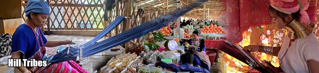
Hill Tribes of Doi Inthanon (various locations. See map)
For centuries Doi Inthanon has been home to various hill tribes who continue to maintain their ancient way of life in the area. Much of what they cultivate can be purchased in the Royal Project shop in Khun Klang village.
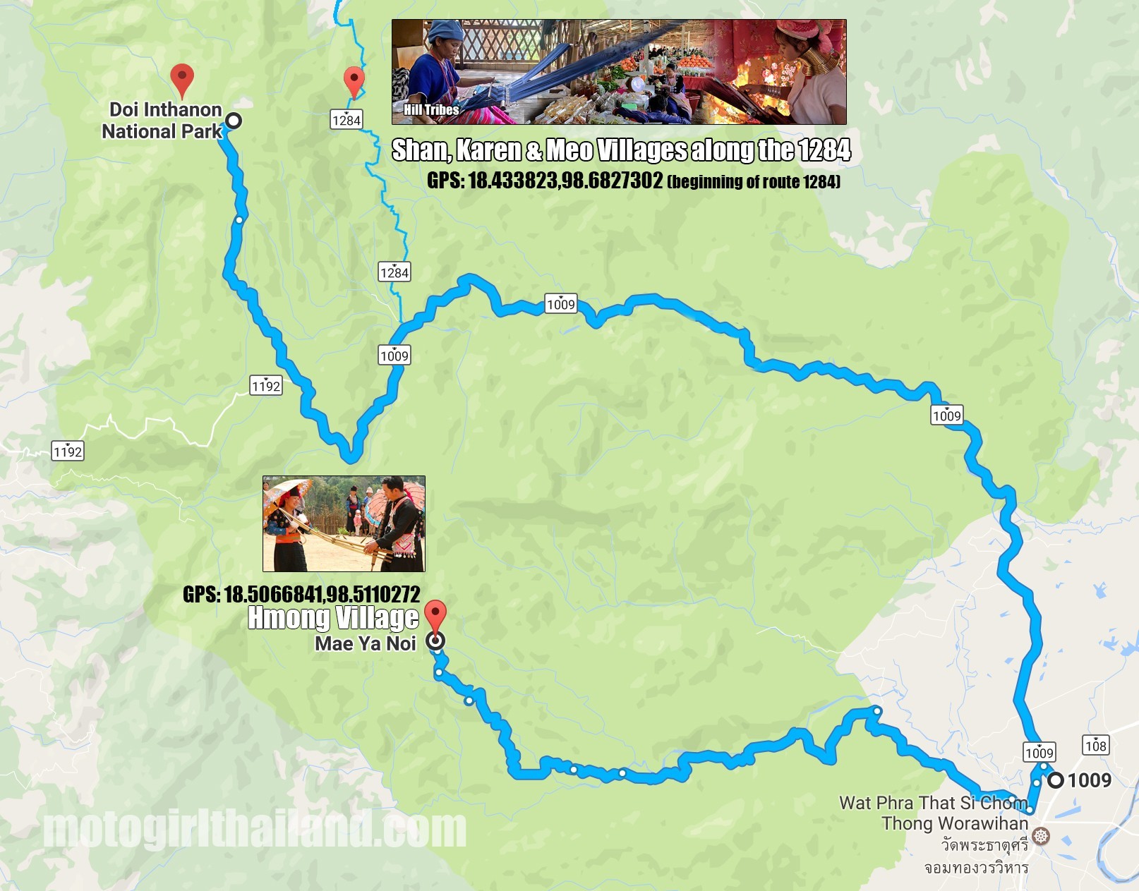 At the base of the peak resides Hmong tribes, where the community continues to tend their fields in the same way they have done for hundreds of years. Their methods remain the same, however they now cultivate commercial crops such as vegetables and flowers, rather than the opium poppies they once tended. In the Hmong Village of Khun Ya Noi, you can visit the local market and admire the colourfully embroidered clothing of the tribes-people.
There are also several Karen (long neck) Shan and Meo villages within the park where you can purchase traditional textiles and observe their traditional ways of life. Some villages also offer bamboo rafting and elephant riding (although personally I am not a supporter of elephant riding).
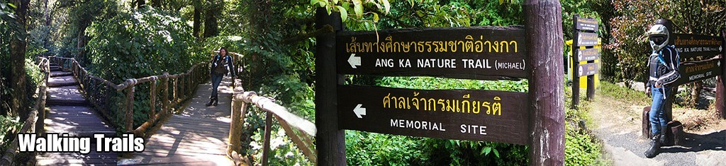
Walking Trails
There are many walking trails in the park (ranging from 1 to 8 km) and its a true paradise for those who love to explore on foot. Many of the trails do require prior permission from the park headquarters though, and some may require a guide to be present. Check in at the ranger station first where you can also obtain maps and guides on available trails.
Main trails include Kiu Mae Pan Nature Trail and Ang Ka Luang Nature Trail:
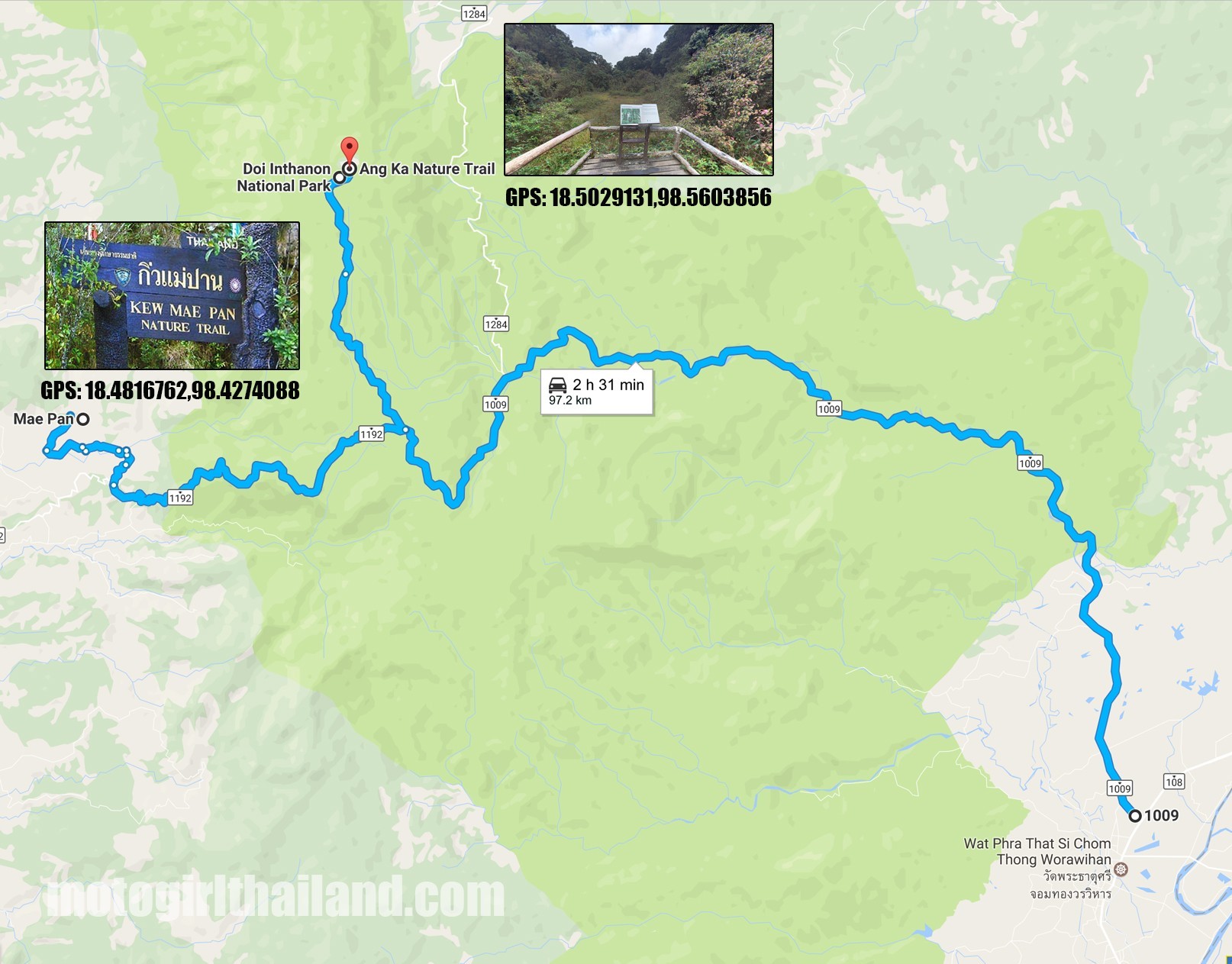 Kiu Mae Pan Nature Trail (google map link)
This trail begins at thet 45km mark and covers close to 2.5km (taking approximately 3 hours). The trail takes you past a string of viewpoints including one where you can gain an excellent view of the Twin Pagodas. This trail also takes you past the trail to Mae Pan Waterfall. Rhododendrons are a common sight (and commonly found in the Himalayas), and are best viewed between December and February when they are in full bloom. Prior permission needs to be sought at the park headquarters and a group of not more than 15 people is recommended. Food consumption is not allowed while trekking also. This nature trail has 21 stations which offer detailed explainations about the plants and ecosystems. This trail is closed for reforestation from June 1 to October 30 annually.
Ang Ka Luang Nature Trail (google map link)
This trail is a 360 meter long trail which was surveyed and designed by a Canadian volunteer biologist. This trail is covered with indigenous plants that need a high level of nutrition, such as lichens and wild orchids. Rare species of birds can also be seen along the trail. The biologist, Mr. Michael MacMillan Walls, a devoted biologist unfortunately died from a heart attack whilst on the mountain.
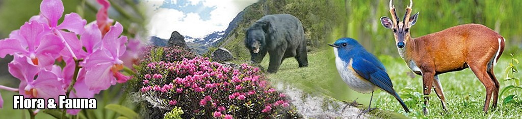
Flora and Fauna
Due to the high elevation and abundance of water in the park the area is with lush forestry and a rich biodiversity that is unique in Thailand. The base of the mountain which is dedicated to agriculture is interspersed with deciduous trees, which lose their leaves at the onset of dry season. The landscape then changes at higher elevations, where the deciduous forests give way to large tropical evergreen trees.
Flora such as Vanda Orchids, Rhododendron and Phycastylis can be found growing wild throughout the park and fauna such as Chinese Flying Squirrels, Barking Deer and (even) Asiatic Black Bears live alongside a large variety of primates including Leaf Monkeys Gibbons, Macaques, and well over 30 species of bats. Doi Inthanon is also the best location in Thailand for bird watching, with over 300 different species residing or migrating to the area (see post below).
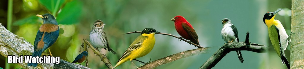
Birdwatching
Over 300 species of birdlife reside in the park, which includes indigenous and migrant birds. This includes Black-headed Woodpecker, Chestnut-bellied Nuthatch, White-rumped Falcon, White, Grey and Yellow Wagtails, Eurasian Woodcocks, Chestnut Thrushes, Little Buntings, Crested Buntings, Scarlet Finches and many more! There is a dedicated Information Centre located at 31km (known as Uncle Daeng’s Shop). Here you can gain information about the habitat and food of the birds and animals living within the park. There is also a Bird Watching Diary and sketches, trail guides, pictures and slides by various bird watching experts. The park’s protected status makes it a sanctuary for a wide range of animal species, making it an idea spot for bird watching, many of which cannot be found elsewhere in Thailand. The best time for bird watching is during the winter season (November through to February).
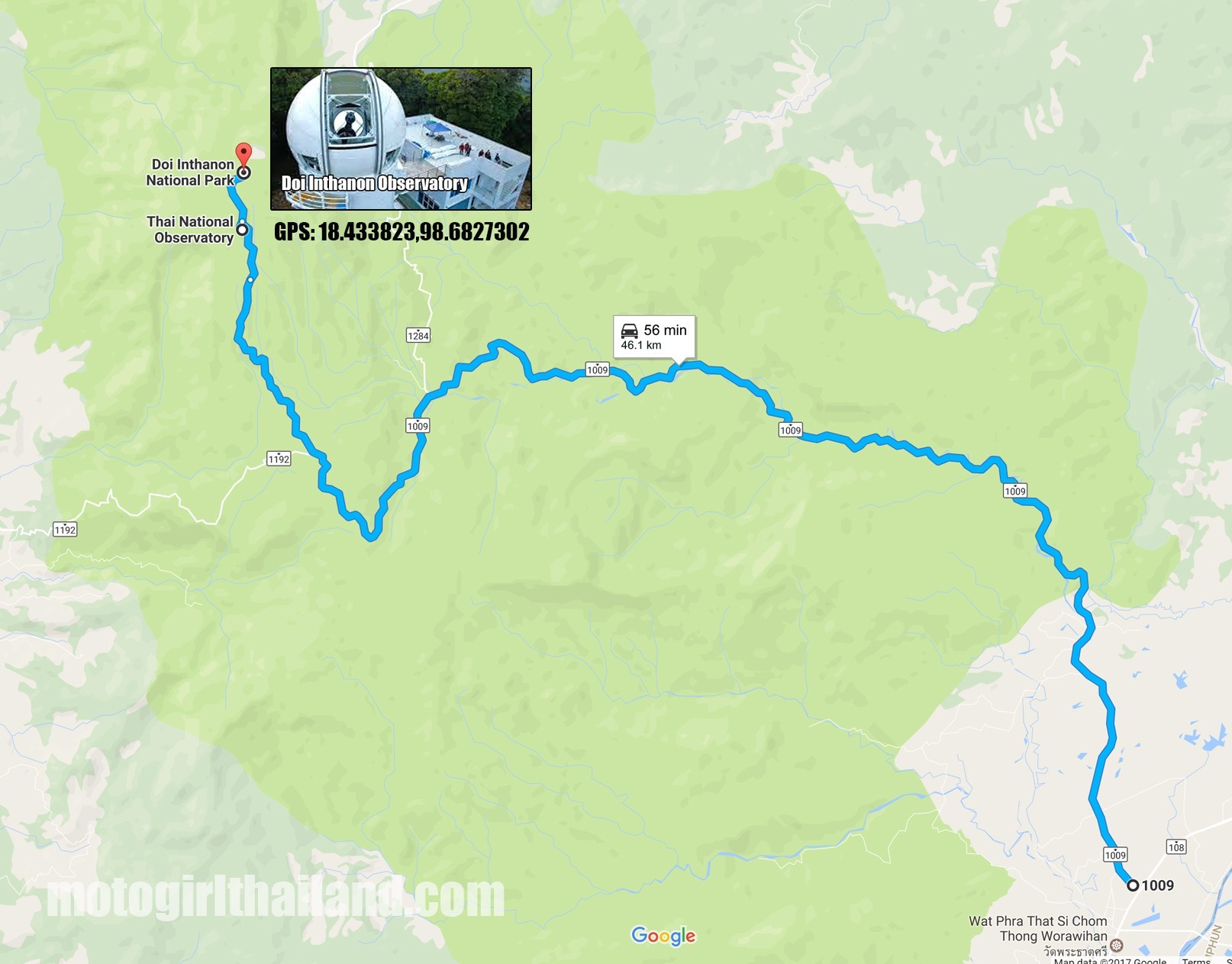
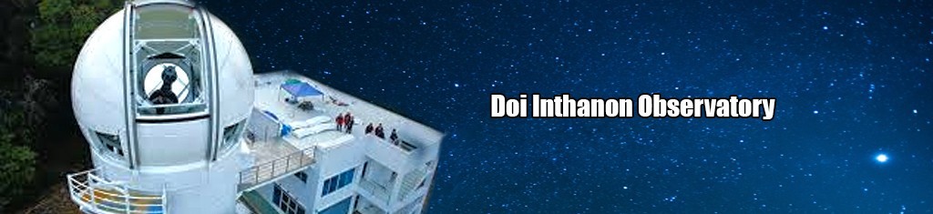 Doi Inthanon Observatory (google map link)
Located at the 44km mark, the observatory is the main facility of the National Astronomical Research Institute of Thailand.
 You can find more info on the National Astronomical Research Institution of Thailand’s website
ENJOY DOI INTHANON! 🙂
Did you find this post useful?
Any questions or if you have anything else to add, please comment below! 😀
Related Posts


2 Comments
Leave a Reply
You must be logged in to post a comment.
Great info!!
I wish I had seen this before I took my trip to the peak. I went there in July ’19 and it was a great drive. We got a bit lost on one of the tracks but it ended up ok.
I was a bit taken back by the difference in pricing for locals and foreigners ( 6X the price!!).
Anyhow, it’s a great area and we had a blast.
I am loving the blog. Keep it up.
Rent
Hi. Yes, the pricing difference is a bit hard to swallow to be honest…and a sore point in particular with expats.
Some national parks will give a reduced ticket price if you can speak Thai or have some documents (Thai License etc), but only at their discretion. It is hit and miss if will that will happen.
I can understand some hiking of prices for tourists (even if I don’t like it), but the gap in pricing is really extreme in some parks.
If I really want to visit a park that has expensive pricing then I will try to make it a full day or some overnight camping, to make it good value.
I have some friends that totally refuse to go to some parks due to the dual pricing, but many of them are so beautiful I just swallow my pride and pay.
Thanks for the comment (I think I ranted a bit there, oops..haha!). My best! 🙂