![]()
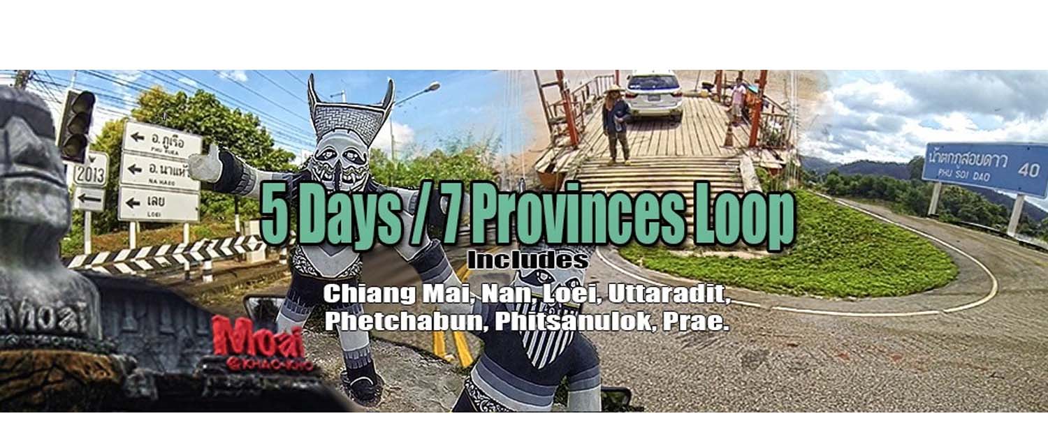
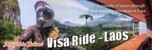
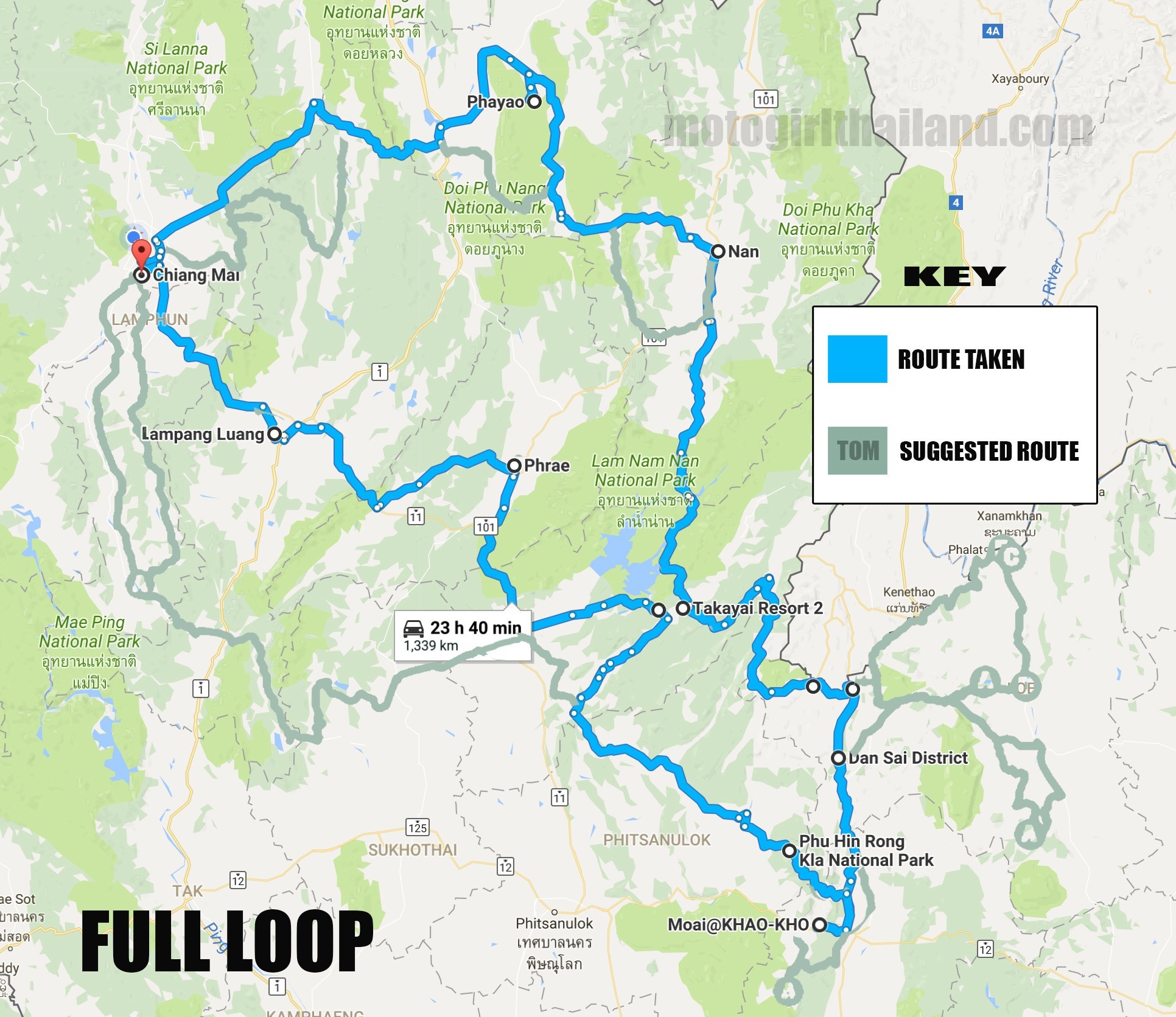
A motorcycle trip spanning over 5 days, taking in sections of 7 different provinces (although some outskirt provinces). These include: Chiang Mai, Nan, Loei, Uttaradit, Phetchabun, Phitsanulok, Prae.
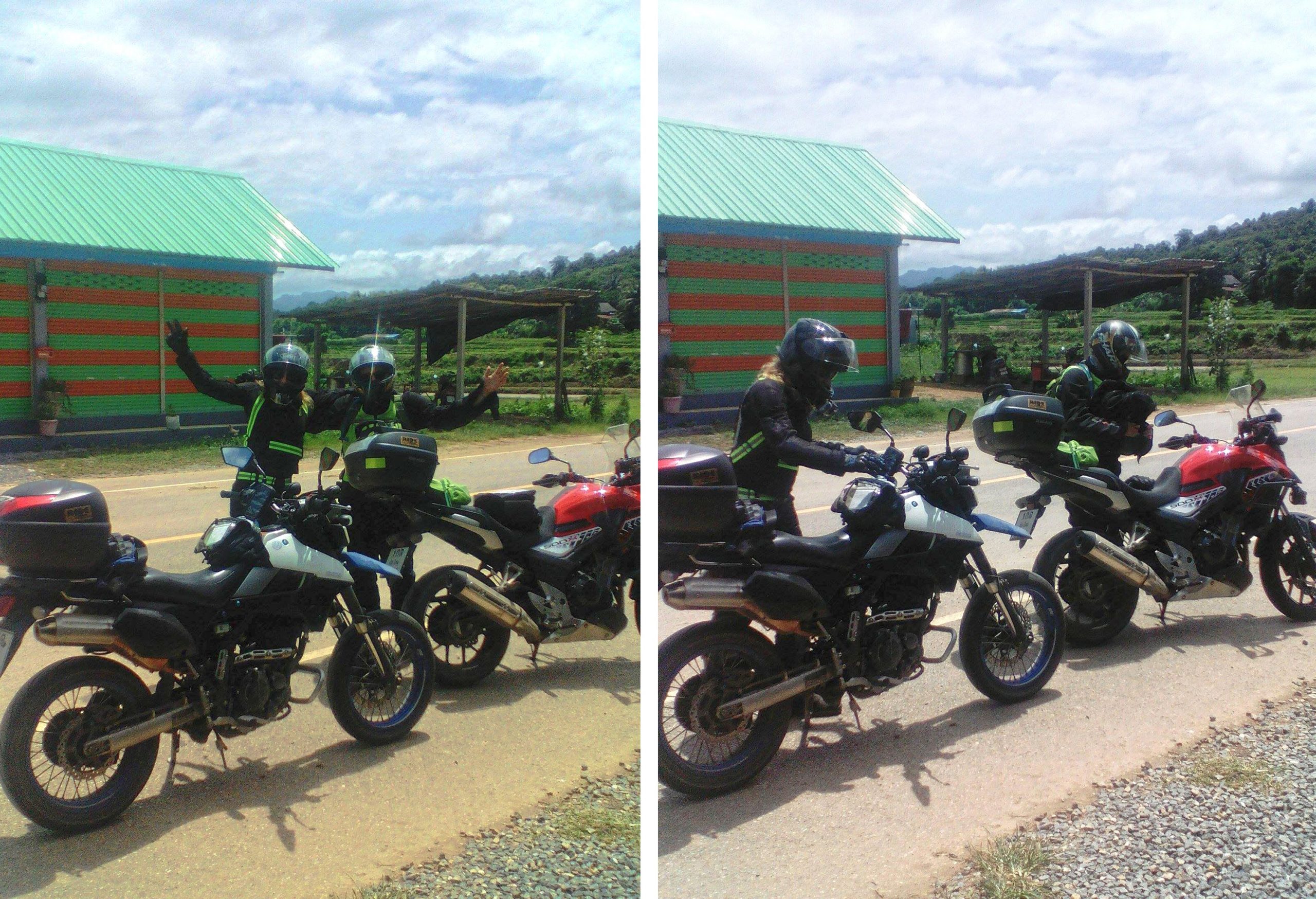
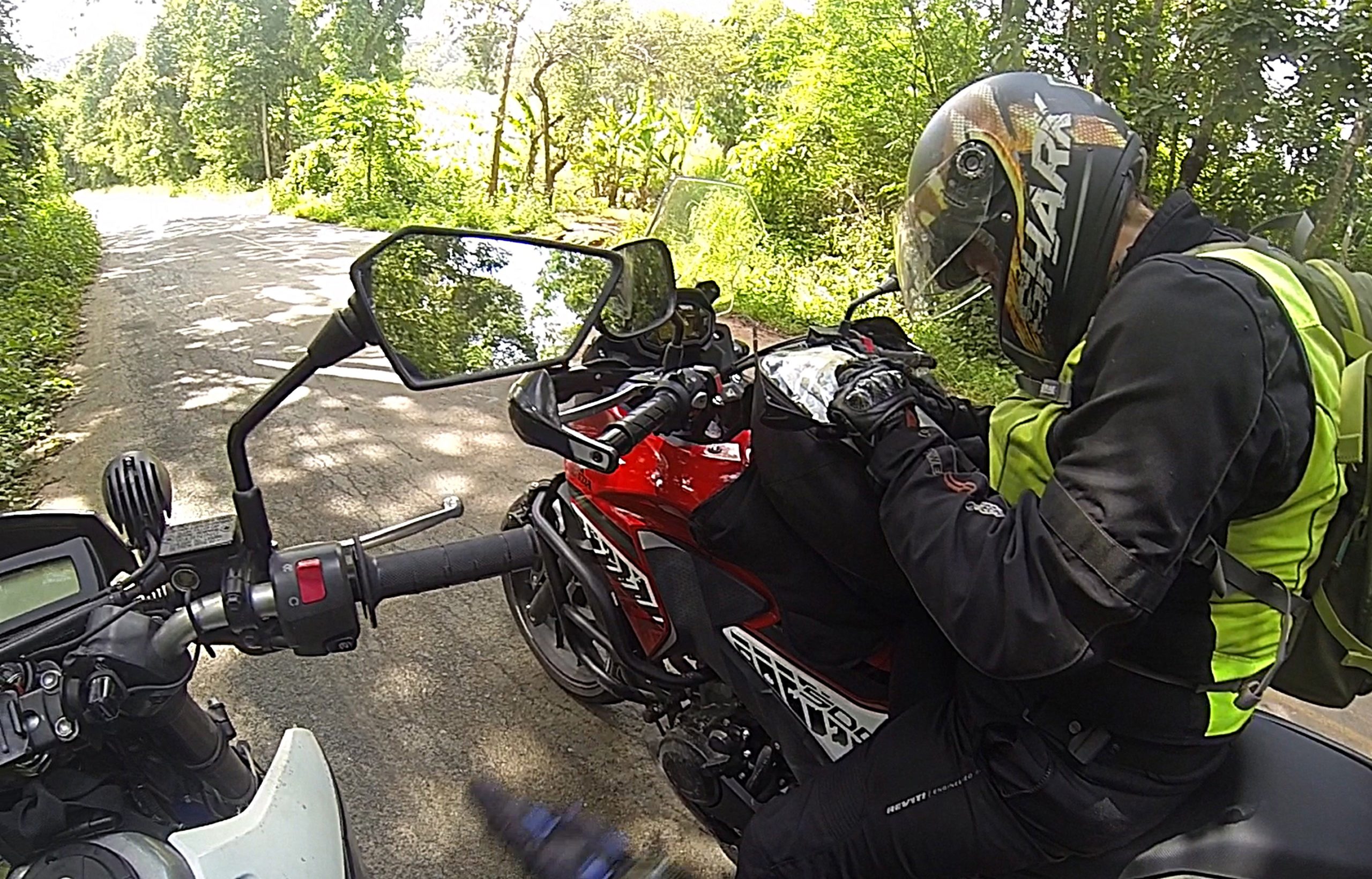
(July 2017) A friend suggested a long motorcycle trip (initially for around 8 days approx), visiting areas that neither of us had ever been to before. With a fab route map devised by an other friend (thanks Tom!) we set off on Sunday 30th of July (Rainy Season) for a new adventure. My friend was on her Honda CB500x and I on my Kawasaki Dtracker 250.
(video highlights at the end of the write-up)
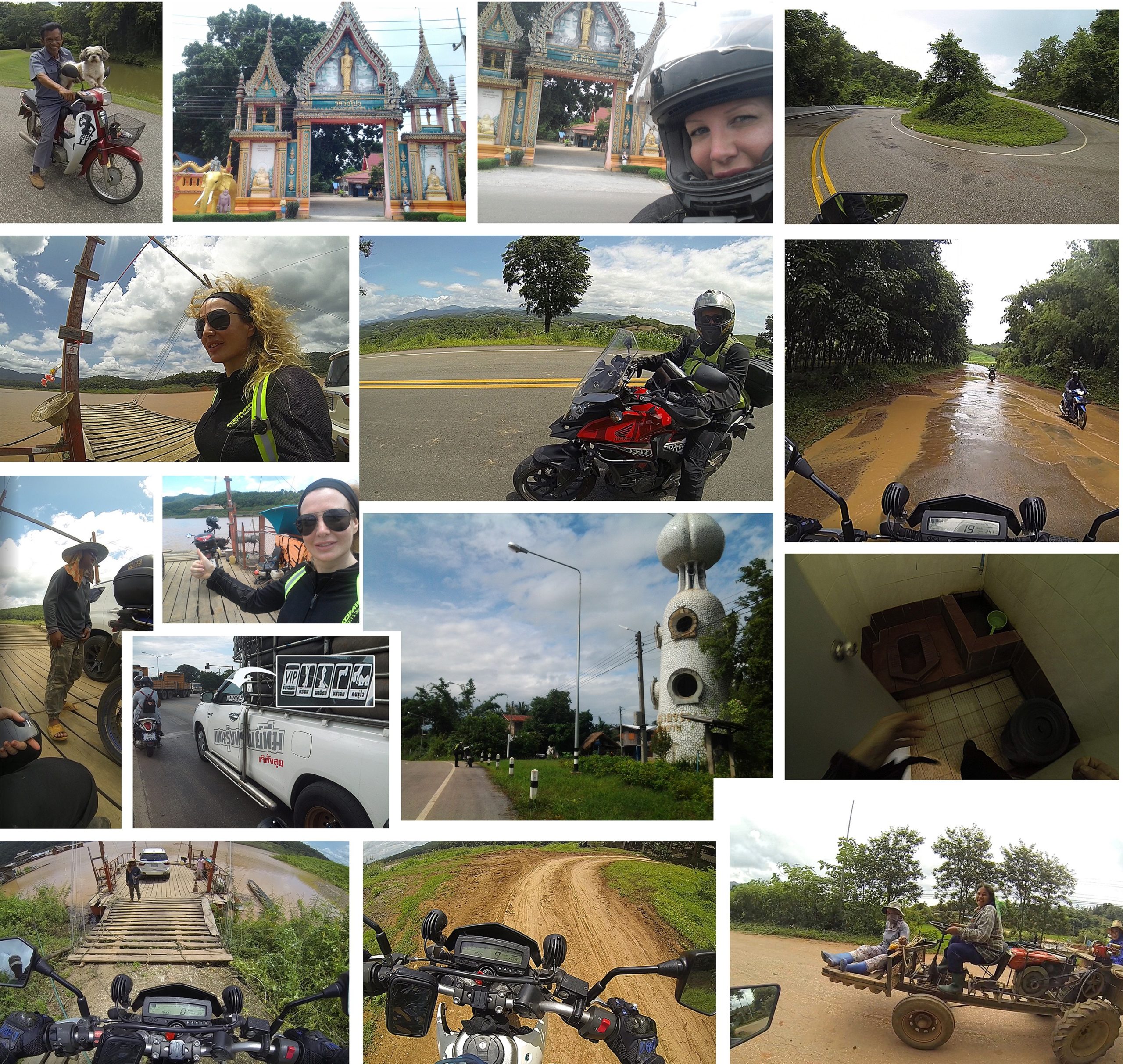
Day 1: Chiang Mai to Nan (Route taken) (Tom’s Suggested Route)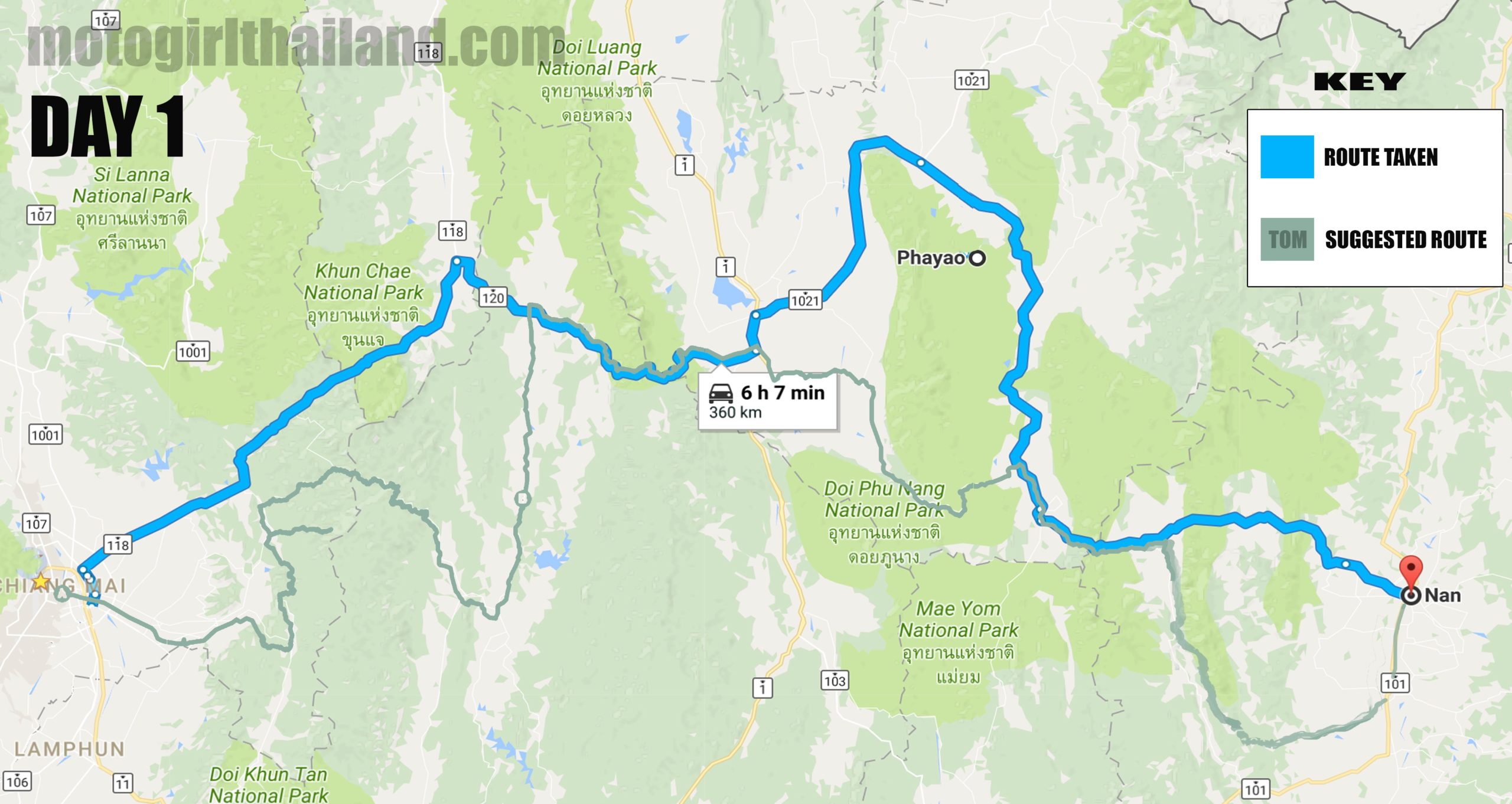 After an initial false start (the result of two paper map users trying to go digital) we headed up the 118 to Chiang Rai. (Tom’s route offered a more scenic alternative to the main route to Nan, but with neither of us used to following a digital route we abandoned that plan for a more familiar route. Additionally, we only had our phones rather than a dedicated Garmin or similar..which proved “interesting” later on..aka dot position moving about!). We both knew this main route to Nan, so no thinking was required and we could just enjoy the ride.
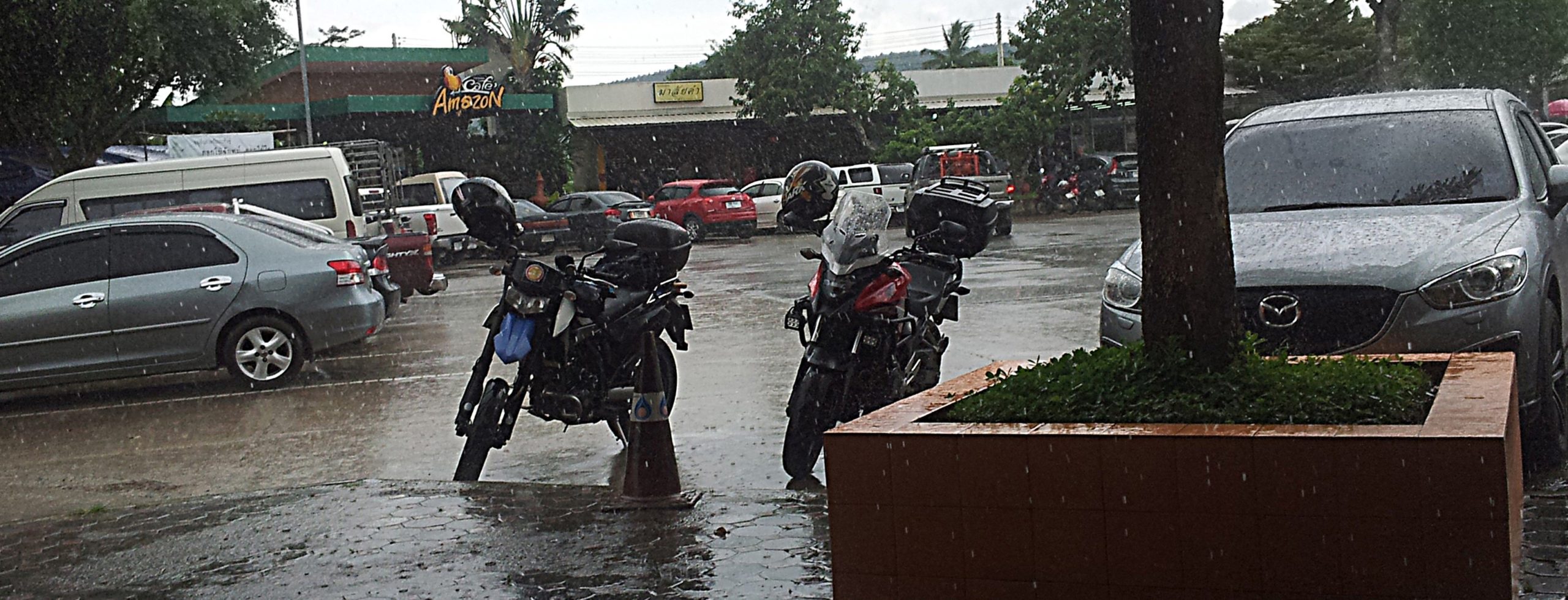
The main 118 route had a number of vehicles which was expected, but wasn’t too bad. Once we took the right turn onto the 120 to Phayao, the route became more scenic and twisty. About the half way mark between Chiang Mai and Nan we stopped in at a local garage area for lunch. Good thing too, because the HEAVENS opened up, so at least we had shelter.
A German man approached us whilst we were eating lunch. Turned out that he was a fellow rider, so we chatted a while. He also had the name of a great mechanic to give us for future reference. Given that Sam has been working on building an off-road bike lately, this was invaluable info for her. Conclusion: we were meant to have that false start!
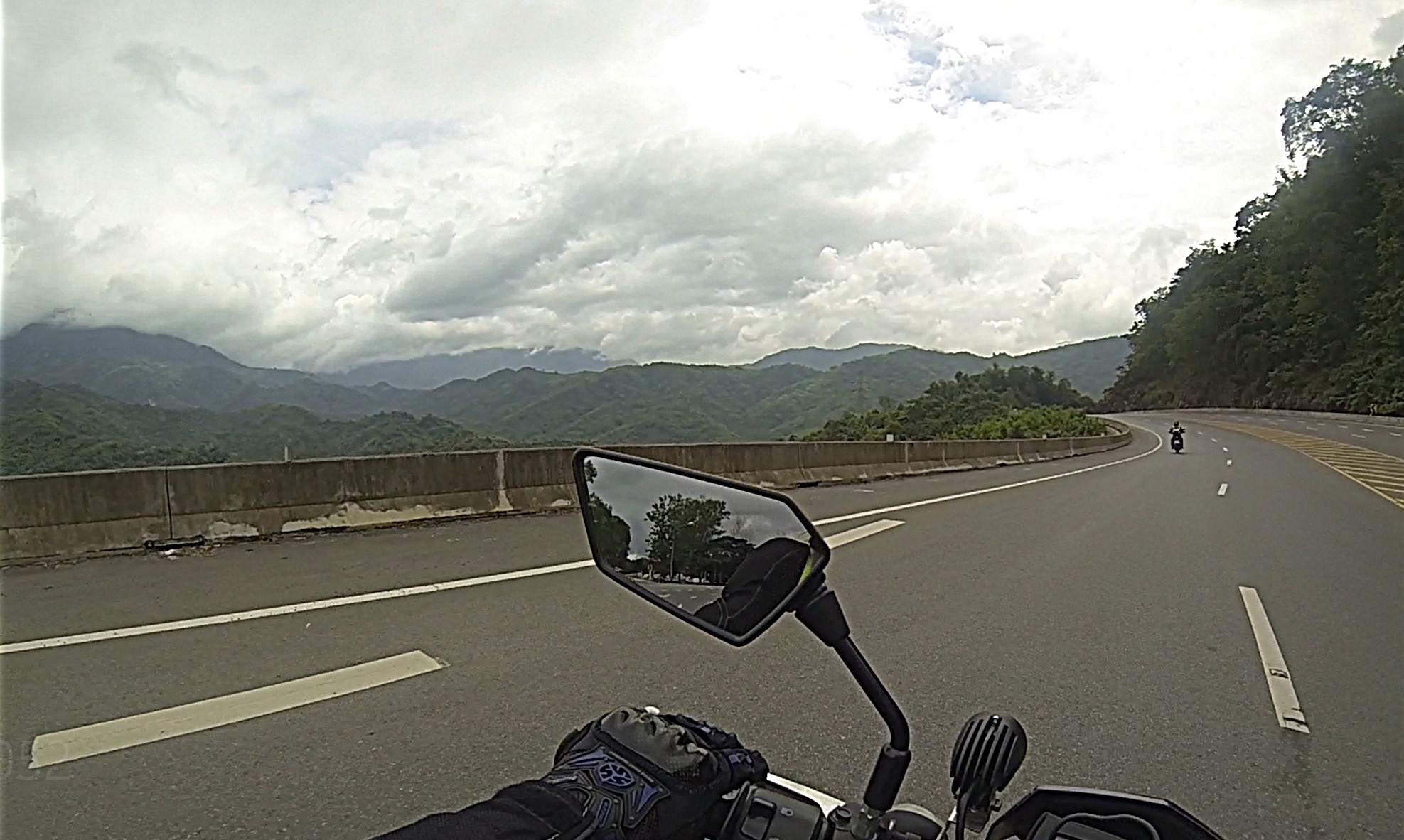
We hit a sprinkling of rain on the way to Nan, but was refreshing. The road was a little wet, but not too slippery. The scenery was lush and filled with glorious Rainy Season clouds. Picture perfect.
 Not much to write about on Day 1, so keeping this part short and focusing instead on the rest of the trip.
At Nan we checked into Sukkasem Hotel. A rather basic hotel, but clean, with easy walking access to eateries around the area. Took us a while to find it though (blasted GPS malarkey again…)
After cleaning up we went for a short walkabout and ordered food at a hotpot buffet place. Following that we spent time working out the next leg of the route on a paper map (which Sam had purchased whilst at the garage, as I only have northern Thailand regions). This is also when we discovered that route names and road numbers were often called different things on different apps and maps! Arggh! Sherlock Holmes times are ahead me thinks…
Day 2: Nan to Nam Pat (via Queen Sirikit Dam crossing)
(Route taken – Same Route as suggested by Tom)
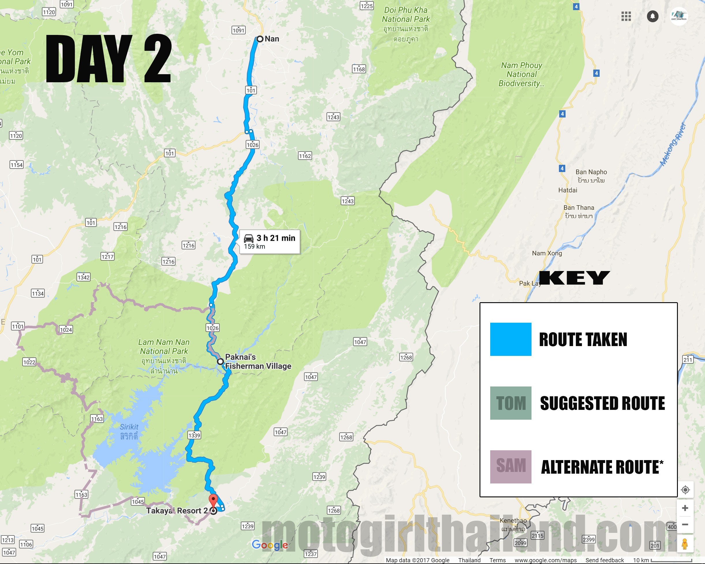 Setting off early we hit a small blip trying to find our way out of Nan and onto the 101. Honestly started to feel like a weird GPS curse! The main problem is that the phone GPS kept jumping from area to area, not always giving as an accurate location marker. However, the blip was minor and we got out onto the right road.
The problem we now faced was how to enjoy this ride without our noses in the map or the phone. It was new territory for both of us and neither of us wanted a frustrating amount of checking on the map and GPS for fear it would kill the adventure. However, we did do a LOT of double checking initially! Later on in the trip this mellowed out more as we got into a pattern. A relief for both of us!
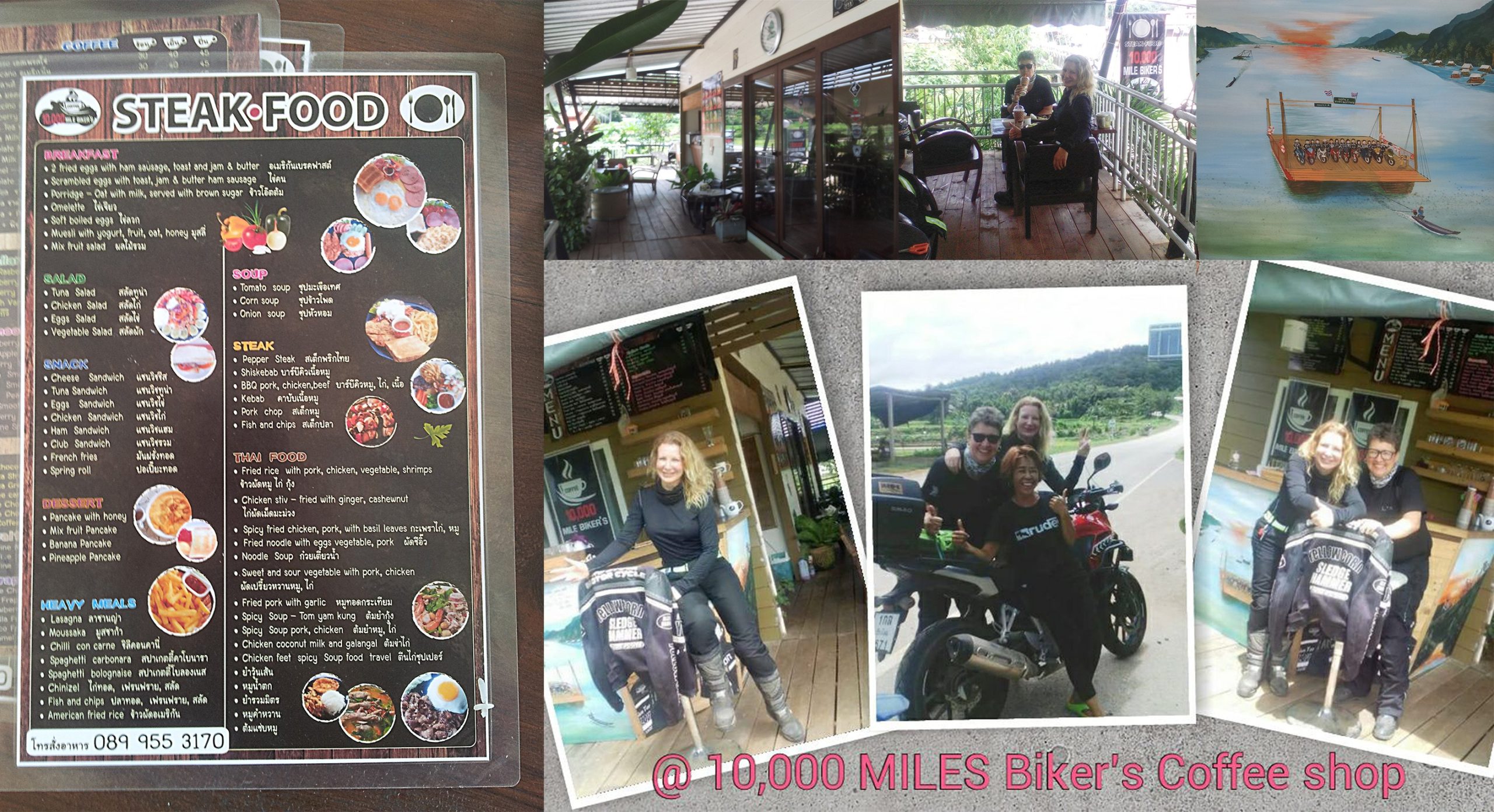
Having skipped breakfast that morning we were on the hunt for a place to stop and fill our bellies. We got what we asked for when “BAM!”, a fantastic biker restaurant and coffee shop appeared from out of nowhere! 10,000 Miles Biker’s Coffee Shop. Couldn’t believe our luck! We pulled in and had a chat with the owner, who was really lovely. Fantastic food at great prices and the perfect stop off before heading to the dam. Highly recommend!
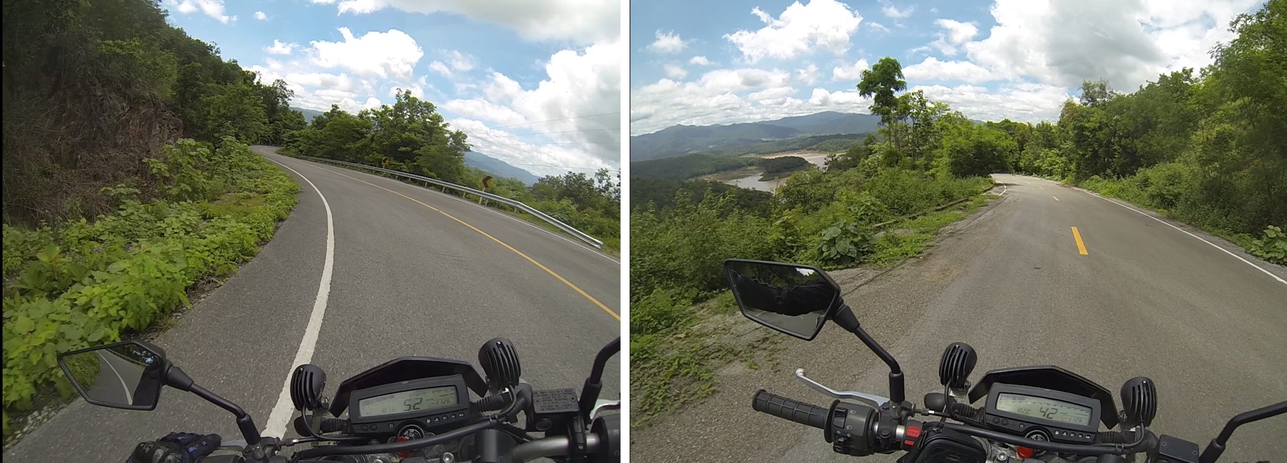
 We said our goodbyes and headed off into the mountain towards Pak Nai Fisherman Village, to get the ferry across the dam. The mountain route to the dam was breathtaking with some fab twisty sections.
Arriving at Pak Na Fisherman Village we were confused about which way to go down to get the ferry. One slope look like it led down to a restaurant only, so we went on further. We came up to sloping area which led down led to a ferry which was already carrying a car. The boat man began shouting up to us to come down that way, so naturally we assumed that was the correct entry point for bikes. It wasn’t…
This entry point was very steep and full of loose gravel. I headed down the slope and Sam, quite rightly, refused to follow. Given that I was already on it, I had no option but to carry on.
THIS is how the entry SHOULD have looked (correct entry point):

THIS is how it looked for us (incorrect..!) …

My video of the entry point (and exit point):
Once my bike was finally on the ferry I walked back up the slope to speak with Sam. She had decided to take the long way round, and I would take the ferry, meeting each other at the destination point of Nam Pat. Turned out to be a good thing really, because she got her favorite kind of road (sweeping) and I got myself a bit of technical stuff.
The exit point was dirt, but dry dirt, so not hard to navigate up through.
The 1139 to Nam Pat was a little pot-holey in sections, but beautifully scenic and quiet.
 Spotted a petrol stop on the way too, in a small remote village. Handy in case needed.
As I have a small tank I topped up a bit anyway “just in case”.
I arrived at the accommodation (Takayai Resort 2) earlier than Sam did and chilled out for a while. (Very nice accommodation at a great price).
When she arrived she was upset that she had regrettably lost a pair of beloved Crocs that had been tied to her bike. Might not seem like a big deal, but the sentimental value was high, as she had been to many countries with them. Given that I had lost a pair of cheap flip flops with the same high sentimental value, I completely understood. I felt bad because I had lent her the strap she had used, even though there had been no problems with the actual strap.
Once we had tidied up we both hit a local food place that was within walking distance. Turned out that it served some really excellent food!
Later, as I lay in bed researching about the ferry ride i had just taken, i found out the entry point i had taken was the wrong point. I became suddenly aware that the boatmen who directed us to come down that slope just wanted the money from us, and were willing to put us on a risky slope rather than direct us to the “proper” entry point. I had a sudden rush of anger and frustration, but had to let it go as an experience in order to get a good nights sleep. It is what it is…
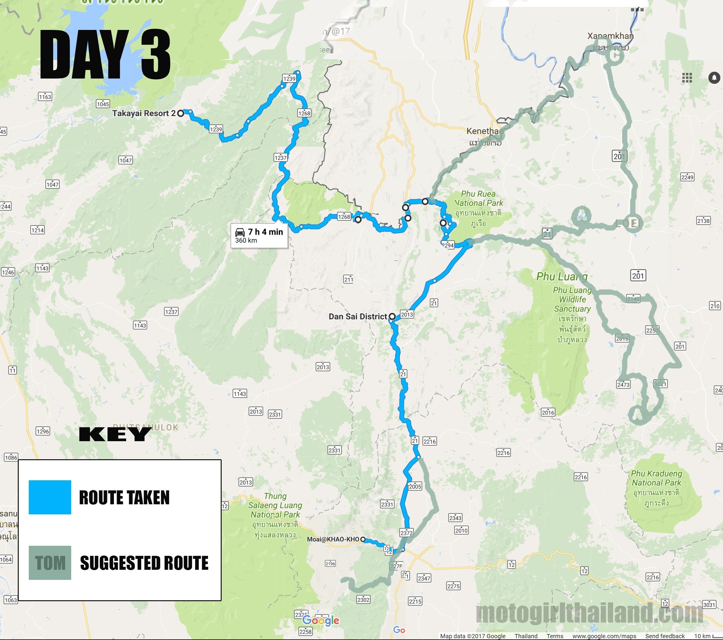
Day 3: Nam Pat to Khao Koh (Route taken)
(Tom’s suggested route options – over one or two days)
 Breakfast at the hotel was rather uninspiring (marmalade toast and a coffee), but was included in the price, so not complaining. We reviewed our route for the day. It was early, but stinking hot and humid. We reminded each other to keep hydrated because for sure if the heat continued like this it would sap our energy levels fast.
Thank goodness for Camelbaks!
This day turned out to be a really fantastic day.
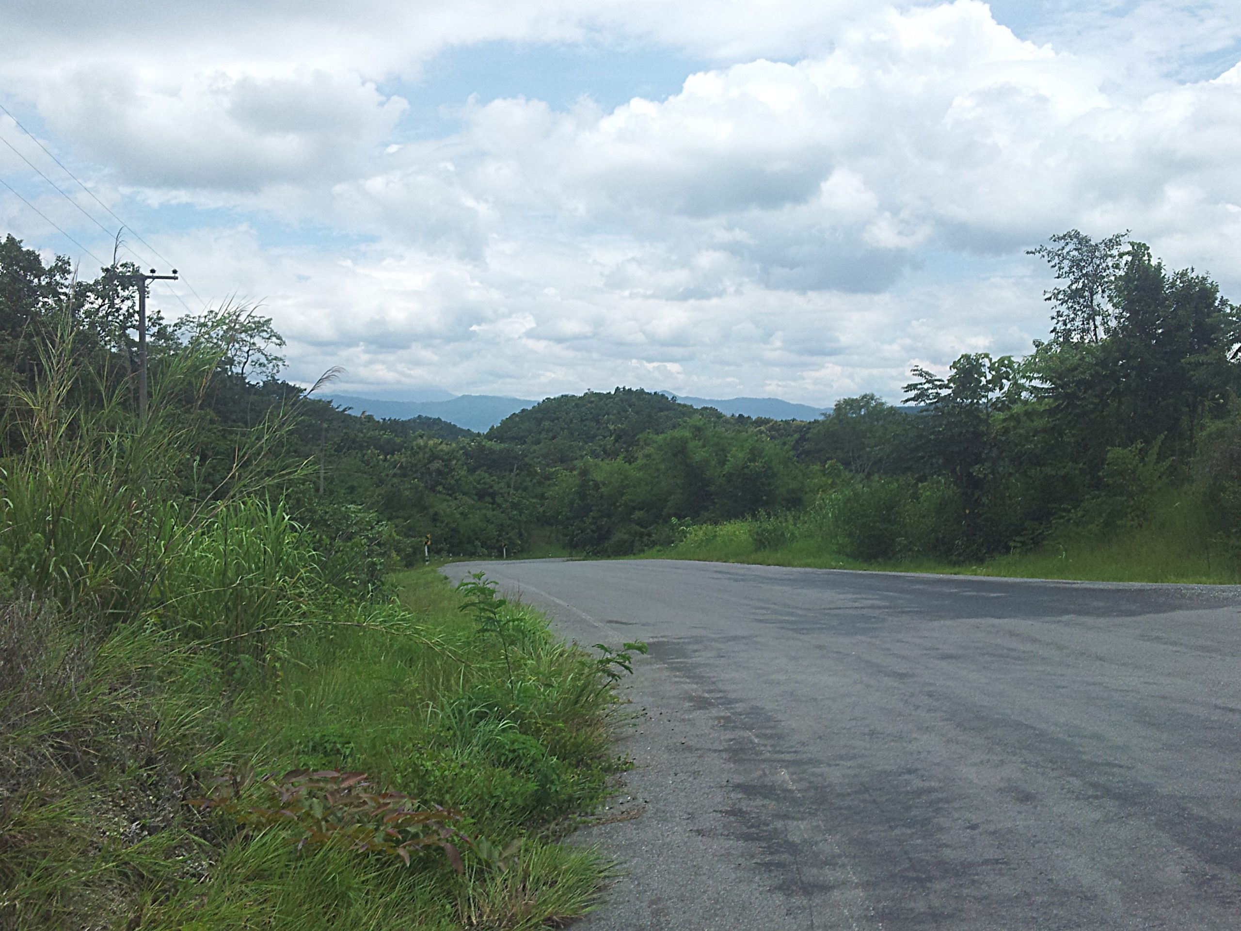
We hit some incredibly scenic roads and we had mellowed into the whole map reading/GPS thing more. We made a few errors en-route here and there, but nothing that was problematic.
On the 1239 we hit a reservoir area, which was too good an opportunity not to dip into and cool down in. Jumped off the bike and got into the water boots and all. Was going to find out just how waterproof these new boots of mine actually are… (turned out I should not expect “waterproof” to equal “submerge-proof”..haha..oops!)
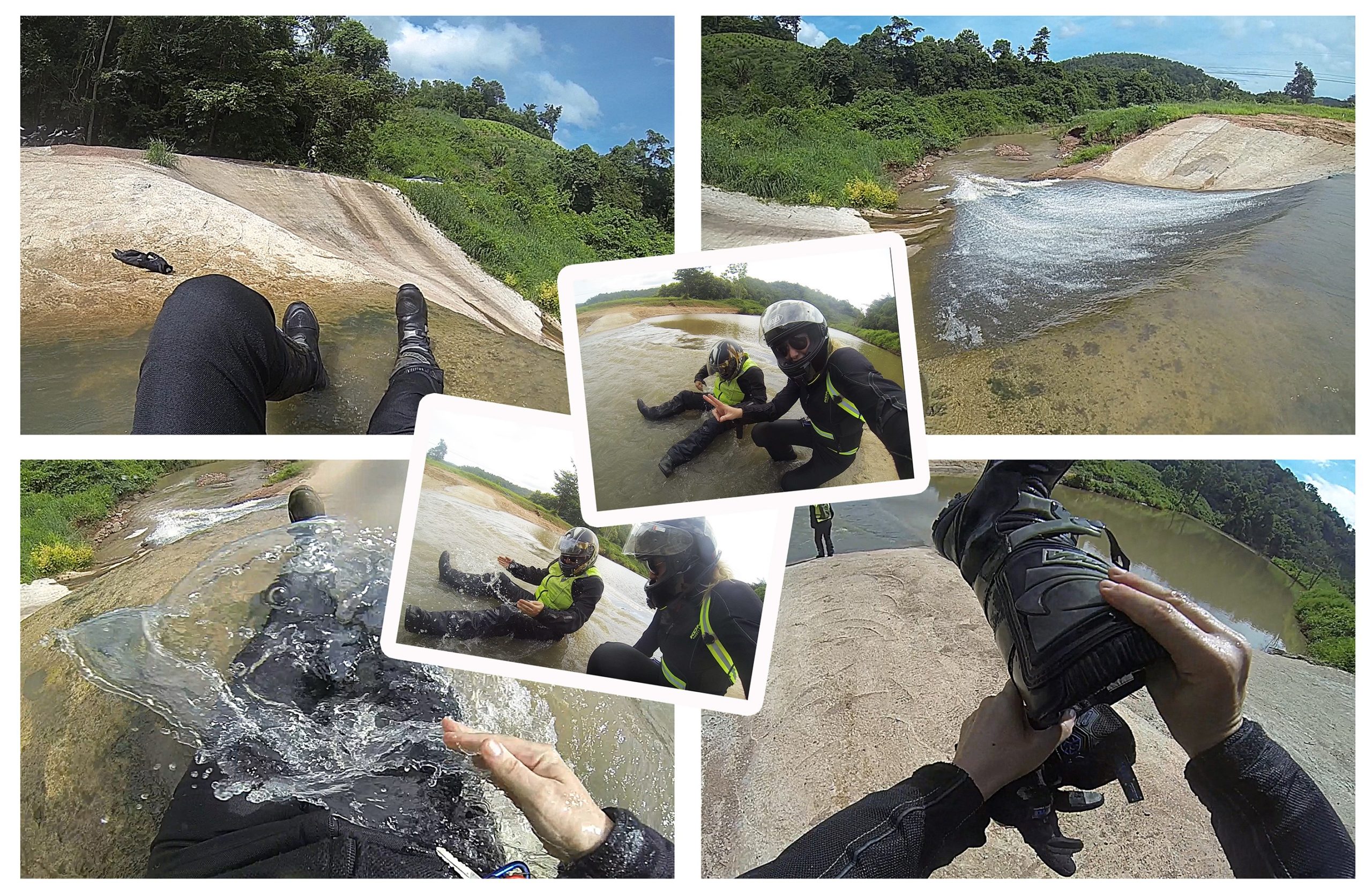 Something really fab about getting drenched on hot days then drying out whilst on the bike.
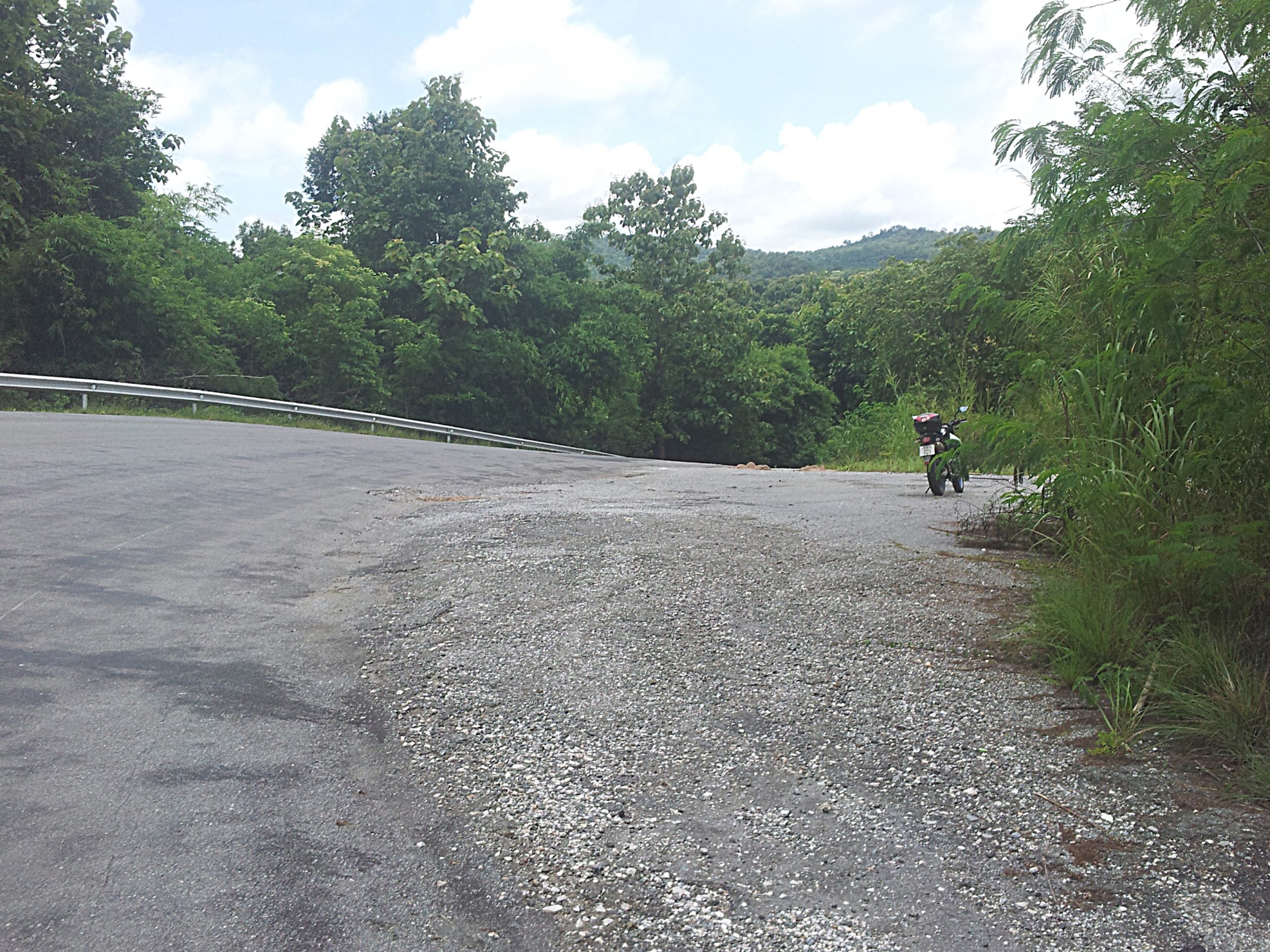
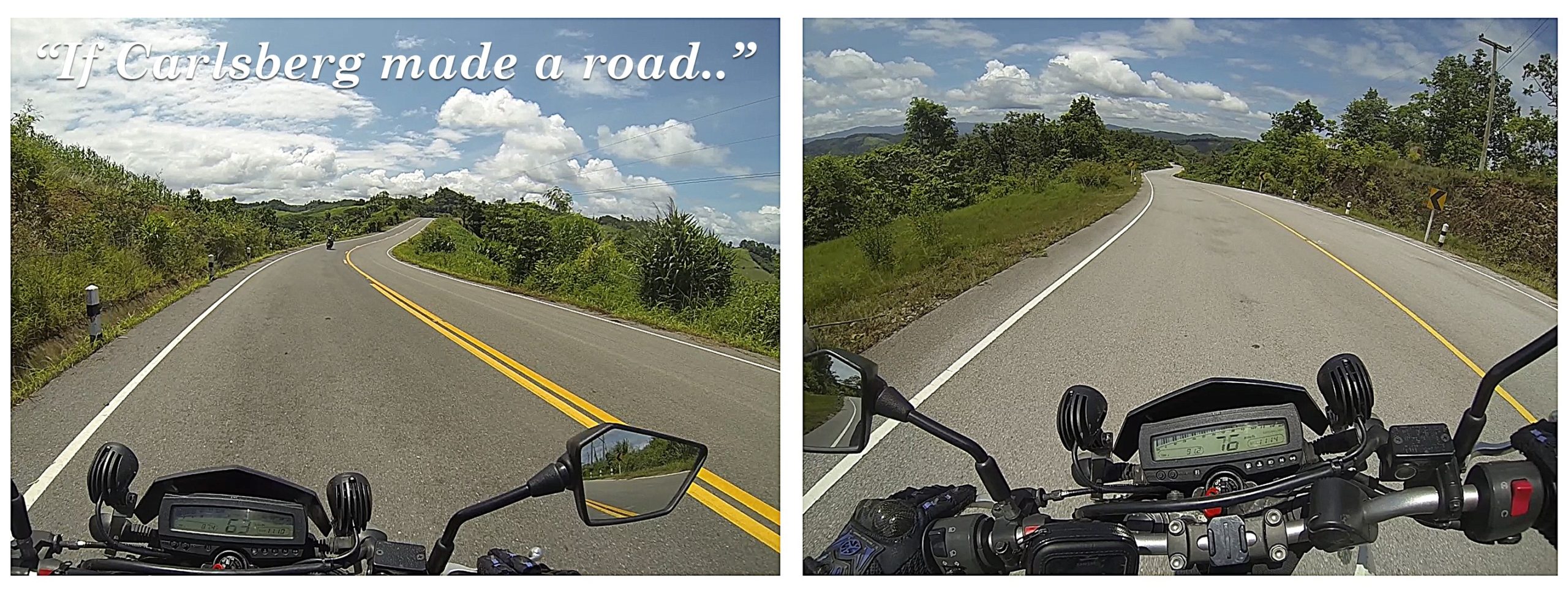
At one point on this road we were the only riders. It looked to be recently resurfaced and was pristine. I pulled over at one point and when Sam pulled up along side the first words out of her mouth were, “If Carlsberg made a road!” (a bit of British humour relating to some old lager adverts. Meaning: it is just the most perfect thing EVER).
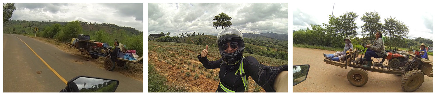
Later we crossed through small agricultural villages with workers on interesting vehicles. The area is known for pineapples, which are shipped to various provinces around Thailand, including Chiang Mai. In some areas you could really smell the scent of pineapple.
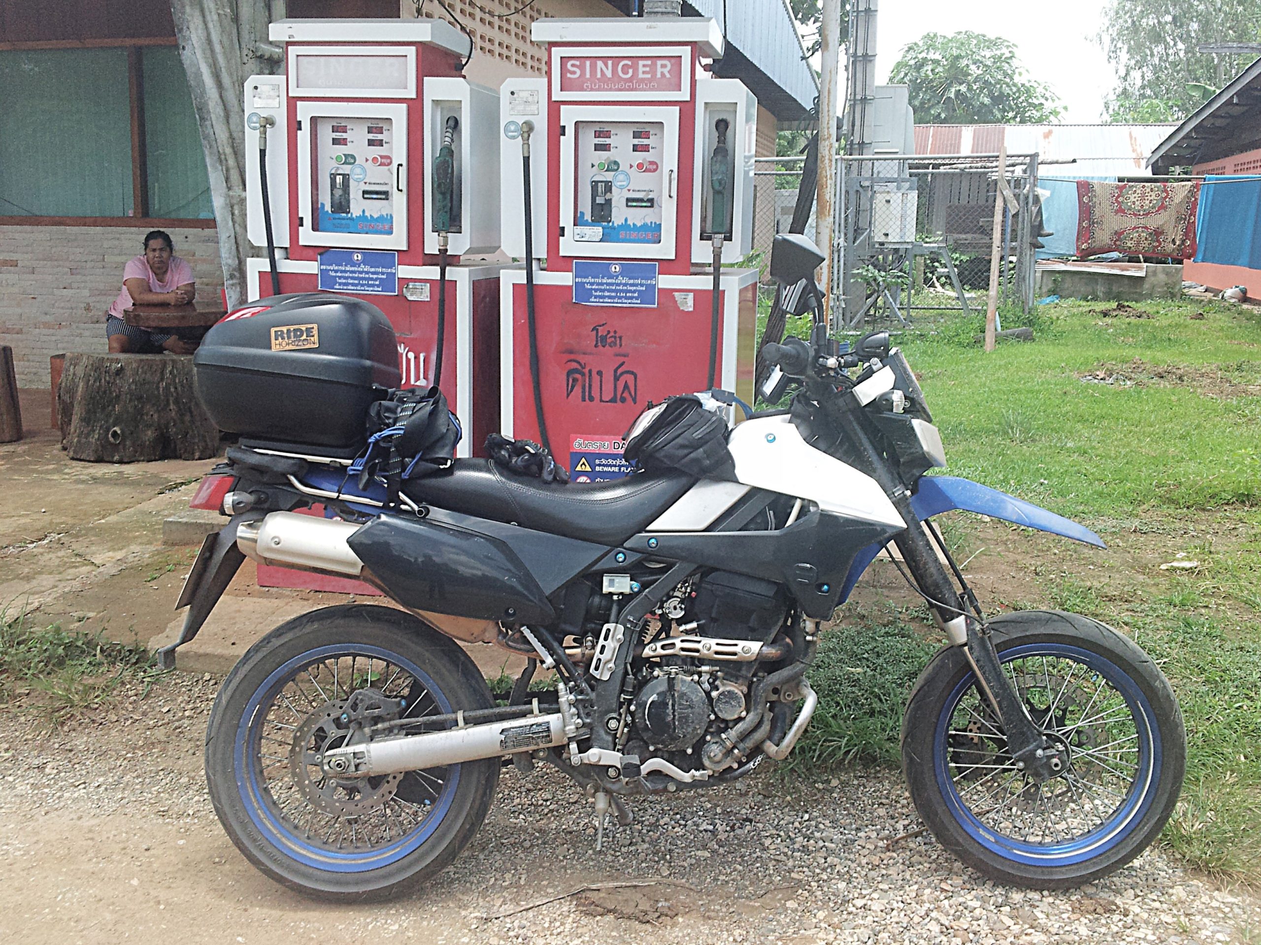
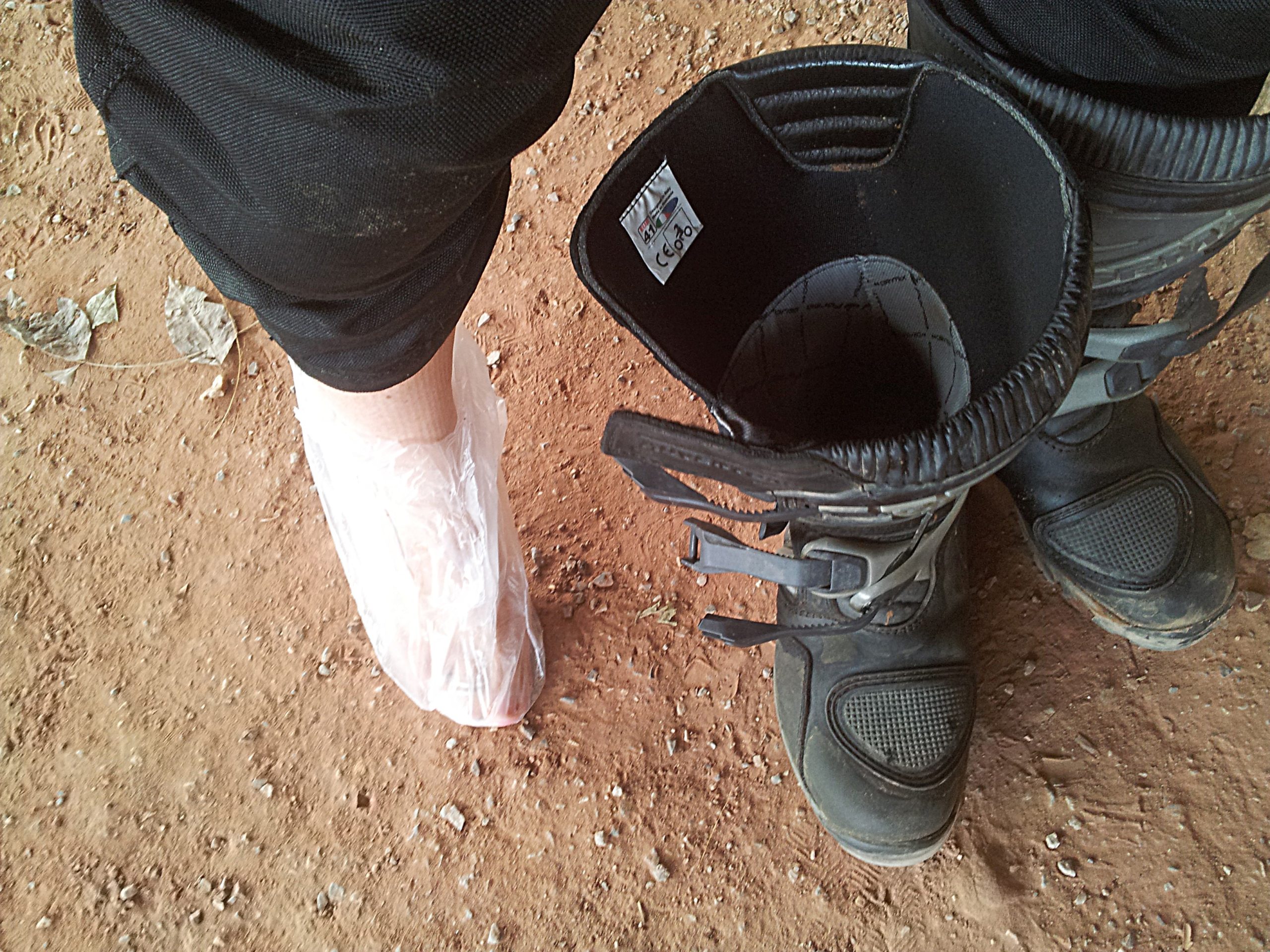
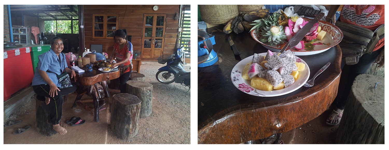
With my petrol tank being much smaller than Sam’s, we had to make more petrol stops for me. One stop off was at a small local village. Was good timing because my feet had been sloshing about inside wet boots, and i wanted to get some plastic bags on them as a temporary measure.
The ladies at the fuel stop were lovely to us. We chatted for a bit and then they cut up some fruit to offer us! This included the sweetest pineapple I have ever tasted in my life!
Heading off we went past Phu Soi Dao national park.
We didn’t plan on stopping in, but wanted a quick photo of the waterfall, which was visible from the road. I decided to ask at the counter if we could just go a little further in to take a photo of the waterfall only, but they refused saying we would need to pay the entry fee. Felt a bit annoyed to be honest, because all I wanted was a quick photo. Given that there is also dual pricing, them wanting to charge us for just getting a little closer for a photo, ticked me off. I walked away in disgust.
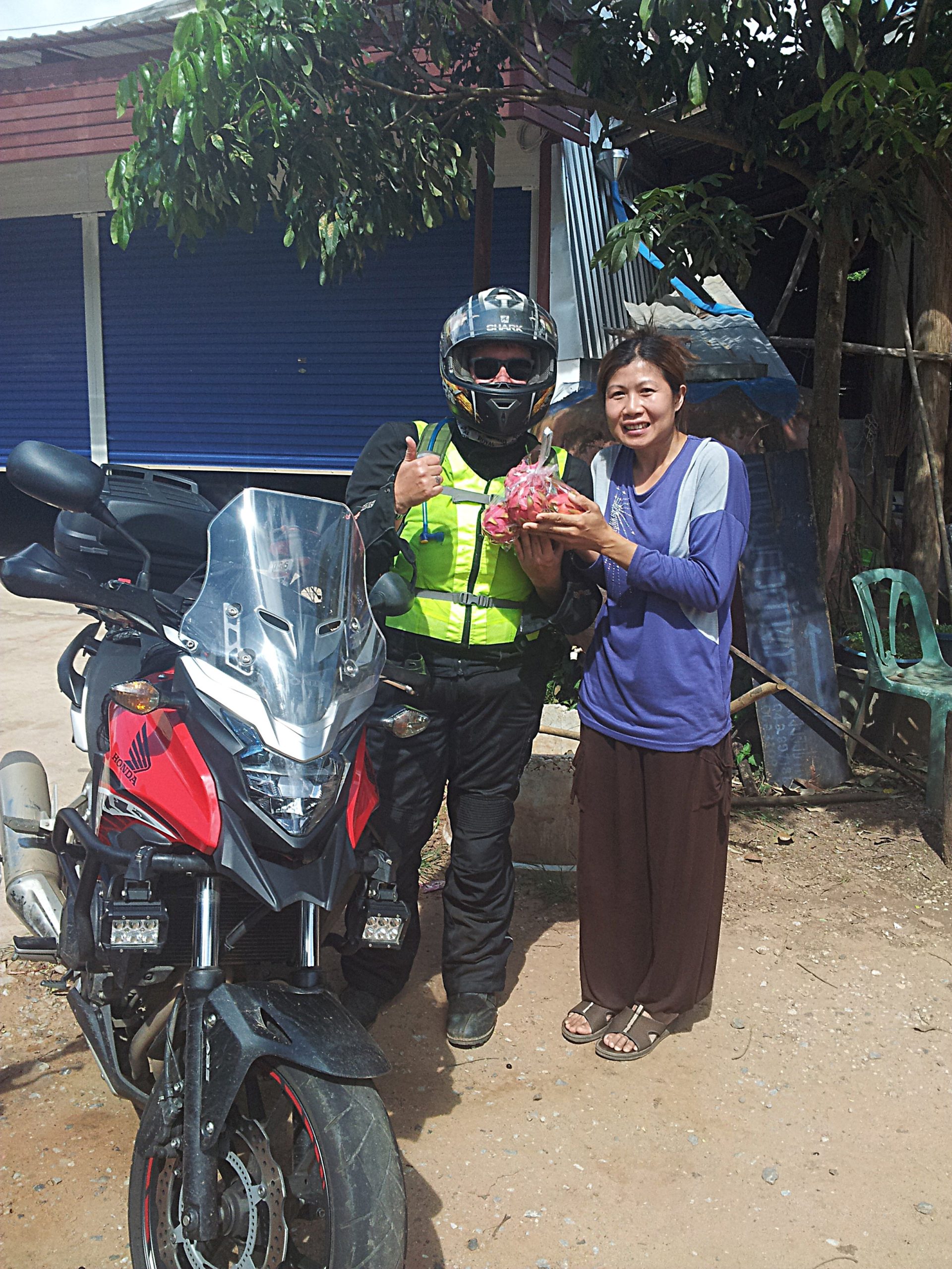
Later, at a small local lunch stop off, we ordered some simple food and worked out how far we are from our destination (Khao Koh). As we were leaving a local lady came running over with a bag of dragon fruit as a gift. We tried to pay her, but she wouldn’t let us. Just wanted us to have a nice gift for our journey. So kind!
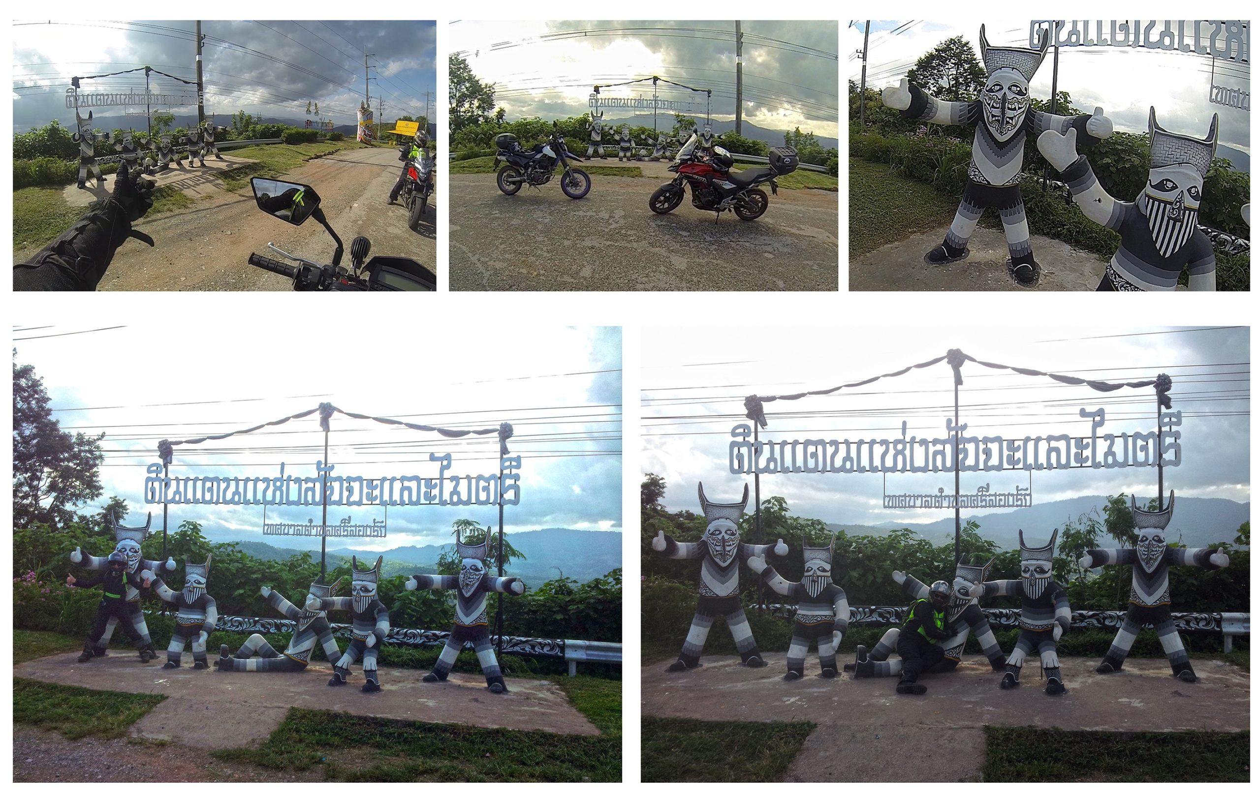
On the way to Khao Koh we passed through Dan Sai, which hosts the famous Phi Ta Khon Ghost Festival. They had some brilliant statues outside of the town which beckoned for a photo op (I didn’t get the gps location for these images, but next time I will).
We pulled in and got a few funny shots before heading off towards Khao Koh.
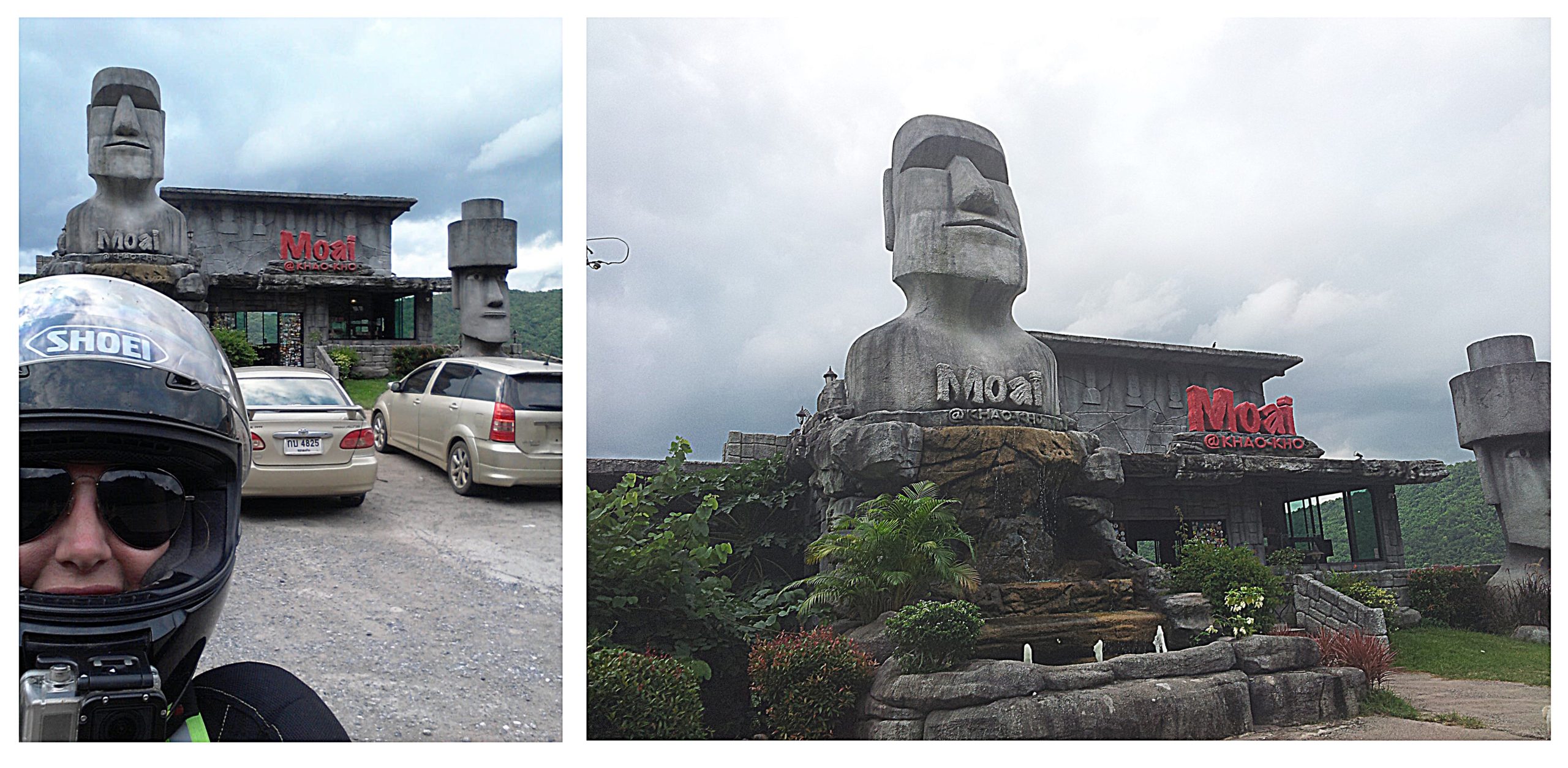
On route 12, close to Maoi@Khao Koh Coffee Shop, my mind was officially blown. Given that I usually don’t like main highways, this route was an unexpected joy. Beautifully scenic. Breathtaking in fact. This area is known as “The Thai Switzerland”. Having spent some time in Switzerland in the past, I could see why it might be called that.
As we were riding along we spotted the famous Khao Koh coffee shop, so stopped there for a quick photo.
 Serendipity would have it that the owner was there so we had a chat. Turns out he also has this other fab coffee shop with a dragon theme (and when i find the details on it I will update). We inquired about where would be a good place to stay with a beautiful view, and he recommended a resort close by. We set off to find it and said we would be back in the morning for coffee.
Turned out to be a heavenly resort with a view to die for. The most expensive of all the places we stayed at, but worth it (actually, he had suggested Phu Fa Sai Resort, but on the same complex there was a resort called Best Views, which we chose to stay at instead).
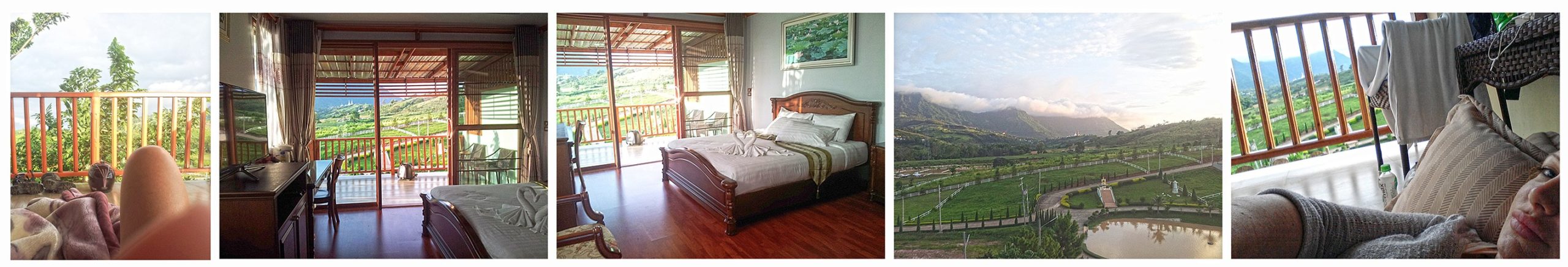
In contrast dinner was at a poor choice of a restaurant serving really quite awful kiddy-type food, but we were too tired to consider other options. That night the air was so nice that i slept out on the balcony.
Day 4: Khao Koh to Chat Trakan (Route taken)
(For Tom’s route see Day 3 as his suggested route was for over a 2 day period)
 For me this was the most adventurous day of all. The previous day was the most pleasant and pretty part of the trip. But this day was the adventure one.
We set off along the main highway 12 to find what Tom (who devised the original route guide) dubbed as “Jurassic Park”. He emphasized that it was a truly stunning area and worth spending time in.
However, Sam and I got our wires crossed regarding the route we were taking and there was a bit of confusion, as we ended up elsewhere, but actually, it was wonderful none-the-less.
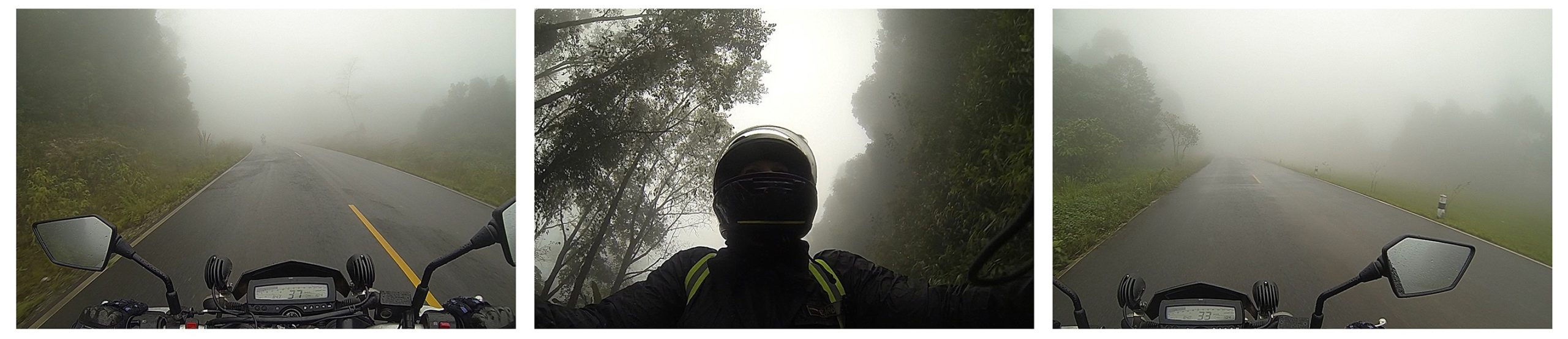
We were riding along the 2331 and a national park entrance came into view (Phu Hin Rong Kla National Park). I assumed that we had to go through this way to reach “Jurassic Park”, so we went up to the entrance booth and sorted out the fee (no discount for Thai license anymore and no amount of chit-chat in Thai helped. *cry*). It had started to rain previously and the national park route would take is into wetter areas, but we gambled going in anyway.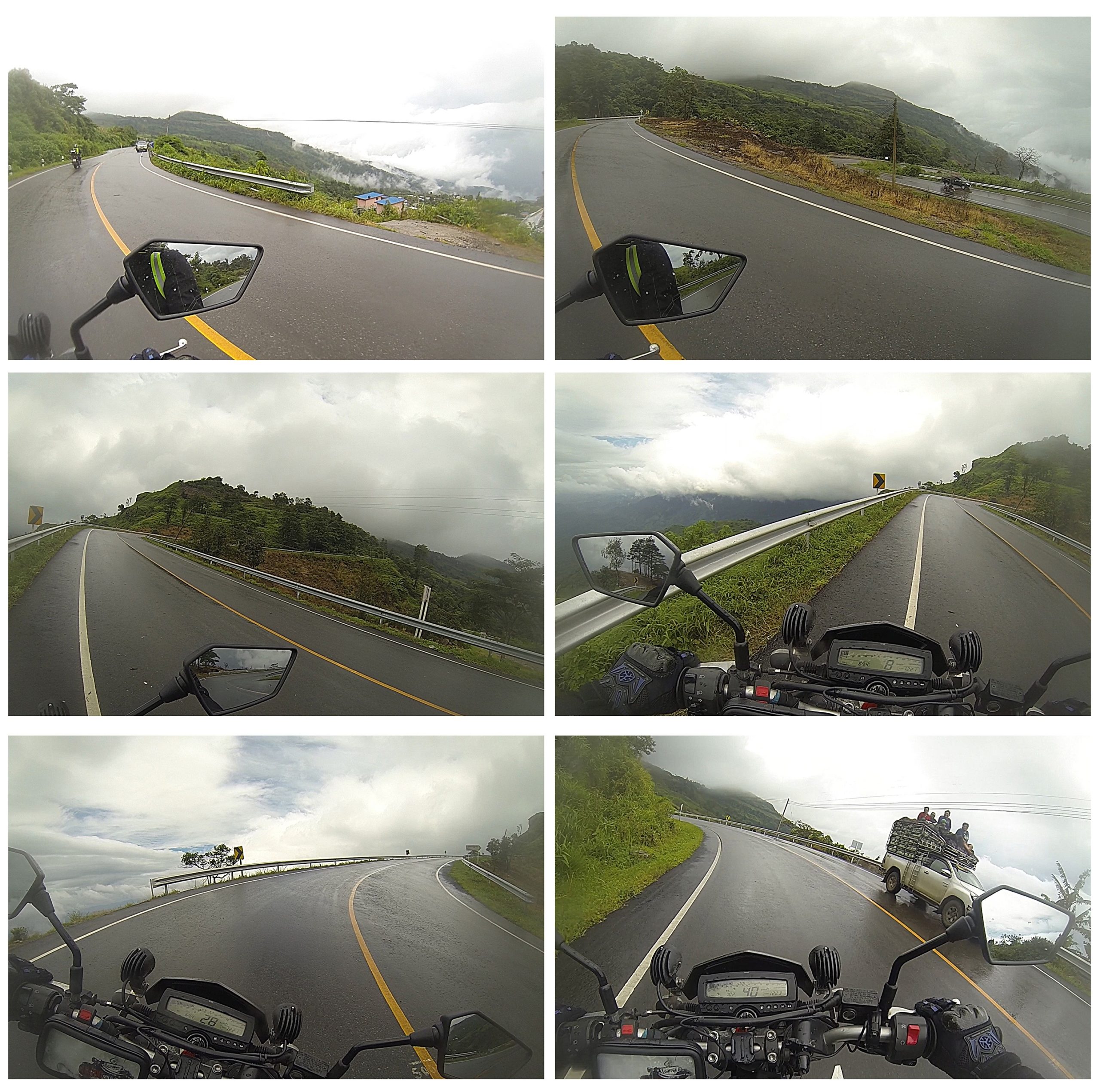
It did in fact get wetter … and WINDIER…. and, as we climbed higher, it became foggy and foggier.
A short video clip of how misty it started to become…
Scary moment:
Before we hit the foggy spot, I pulled over to look at the view and to get my rain jacket on. Quite a stupid moment really, because I didn’t factor in the strength of the wind versus the weight of my bike. I was off my bike and attempting to get on my rain jacket when a massive gust of wind nearly knocked me off my feet and nearly launched my bike off the side of the mountain! Thankfully I was able to catch my bike and hold onto it at an angle for what seemed like an extremely long time while the wind blew hard. I got it at a better angle, then had to wait for some time before i could mount it, due to the strength of the wind. As soon as there was a lull period I pushed my bike (with some difficulty due to the incline and weather conditions) to a safer spot with more of a wind barrier, and then was able to get back on it. Was a real “OMFG” moment and im grateful for consequences not being dire, when I have these stupid moments…
I have to say, the road going up this mountain gave a view over the edge that was so amazing i was experiencing a bit of vertigo when I looked over the edge. I had to keep a check on myself as my legs were going to jelly. It was exciting though and I loved it. This for me was the highlight of the trip, because it was so beautiful and brought out some fears. I enjoy feeling challenged and conquering fears (within certain perimeters). Makes me feel stronger when I come out the other side.
As we hit the main peak and into the national park zone the area was filled with so much dense fog that we could not see ANY of the national park attractions. It was seriously THICK fog for most of the route.
(Phu Hin Rong Kla National Park (Wikipedia info) is situated within the so-called “Guerilla Triangle” and was a former base of the Communist Party of Thailand (CPT). The park has some significant historical attractions (including the site of a bloody battle where hundreds of soldiers attempted in vain to conquer the communist stronghold on the mountain) as well as natural ones. Will certainly need to return again in the cool season to experience the sights this national park has to offer).
When we came down and out of it, we were faced with a junction. I decided to take a right turn, which turned out to be the wrong turn (haha), but for adventure-sake it was actually the correct turn..! (If that makes any sense..) This turning took us over a bridge onto a dirt road and into a small mountain village. I asked if there was a place to eat and we were directed to a very local Thai style place. We parked up the bikes not expecting any kind of culinary extravaganza. Sam, who had been craving spicy food, ordered ผัดกระเพราไก่/Pad Kapow Gai/Basil Chicken, which she said was her favorite Thai dish. Not only did she end up with her favorite dish, but it was SUPER SPICY and apparently the best she had EVER eaten. I ordered a simple dish of fresh vegetables which had a minor kick and was very tasty. Absolutely fab authentic local food.
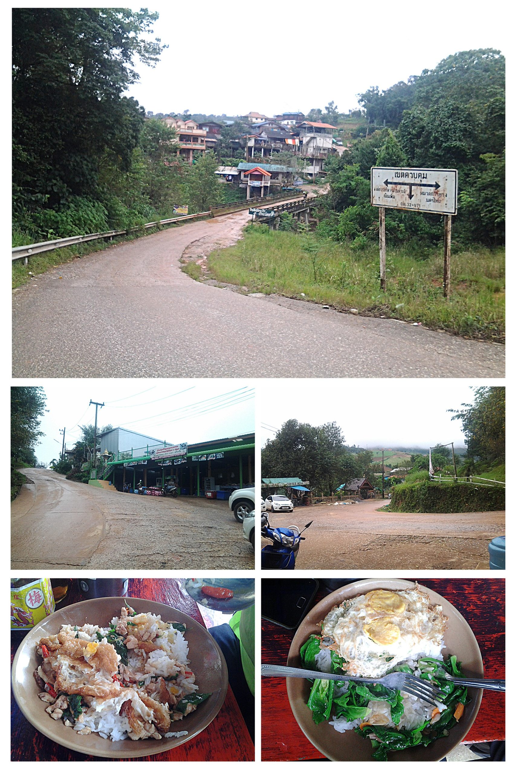
Later, when we headed to the National Park information booth we found out that our wrong turn had led us to an authentic Hmong village with a great deal of history attached to it. BONUS! Sometimes the wrong turn, turns out to be the right turn..haha!
When we came out of the national park and looked at where we were, I realised that we were not where I thought we were supposed to be or where we were supposed to be going. Sam had given herself around 8 days to do this trip and suggested we head back on ourselves and explore the “Jurrasic Park” area the next day.
In truth though this five day trip had stretched my social elastic band. I have an introverted personality and enjoy a lot of solo time and solo riding, so I had to make the unfortunate call of saying I need to call it a day on the trip. Sam was great company, but I had reached my social battery capacity. I suggested that she carry on this part of the ride herself and that I had back on my own.
She decided instead to head in the same direction as me but then do her own thing in the morning. She wanted to get in other areas that I had already been to before (such as Mae Sot). So this worked out well.
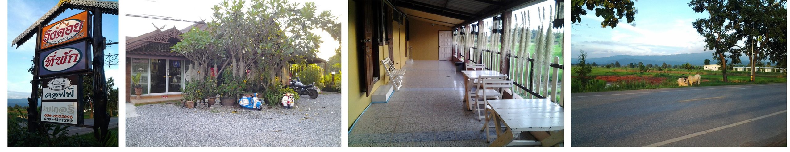
We headed up the 1143 to Chat Trakan where we stopped for the night at small roadside accommodation. It was a pleasant quiet evening with lovely weather and a pretty sunset. We enjoyed a few drinks and a chat and wind down after the exciting day. I slept well that night.
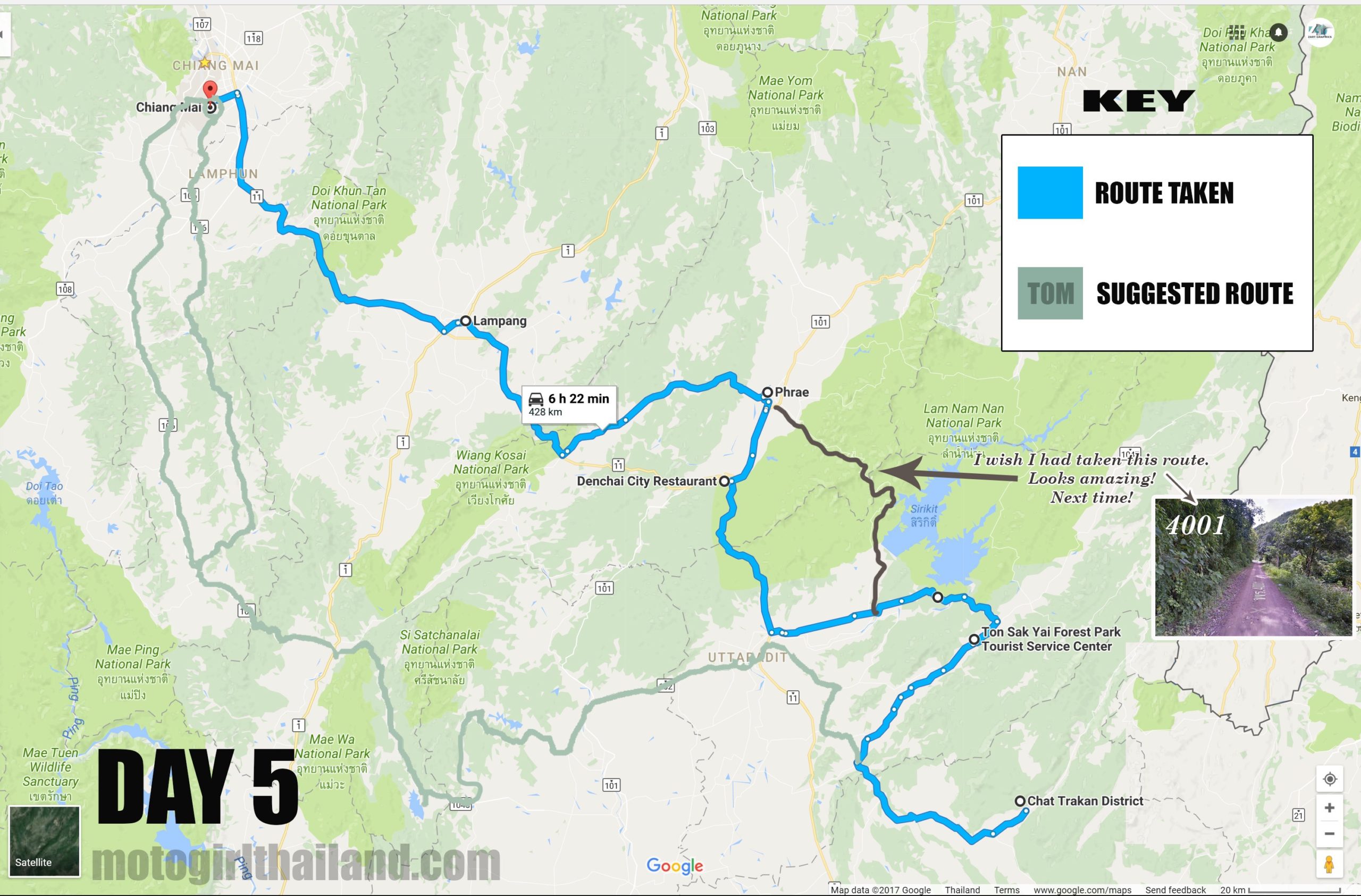
Day 5: Chat Trakan to Chiang Mai (via Prae) (Route taken)
(Tom’s suggested route)
Sam and I met up for breakfast and wished safe travels. She headed off before me.
I took a meandering ride back to Chiang Mai via Prae, while exploring some nooks and crannies on the way. Most of the nooks and crannies didn’t take me any place of much interest in truth, but it was nice to not worry about where i was going for a bit. On the 1047 I spotted a sign for Ton Sak Yai (meaning Big Teak Tree), so stopped in to see.
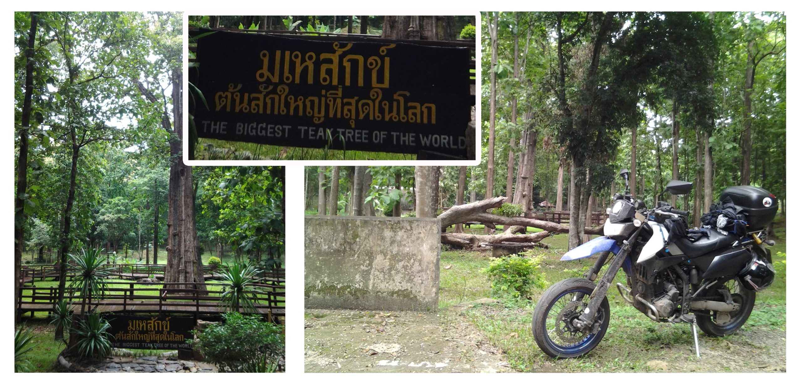
The sign claimed the stunning teak tree was the biggest in the world. However, a quick search on google would debate otherwise. None-the-less, was still a lovely sight to see. Plus I seemed to be the only person visiting at that time. Heaven!
After Ton Sak Yai I headed left towards Uttaradit towards the main highway (unfortunately). Reviewing my route later I wish I had taken Sirikit dam route instead (which I thought I was on initially – bloody GPS dot!), because this would have taken me through some glorious twisties and some dirt tracks. Maybe it was a good thing though, as with it being rainy season there could have been some issues riding solo on this particular route. The route I would have liked to have taken is here: (google map link)
But anyway, I ended up on the main highway 11 and found an interesting place to stop to eat (Denchai City Resort):
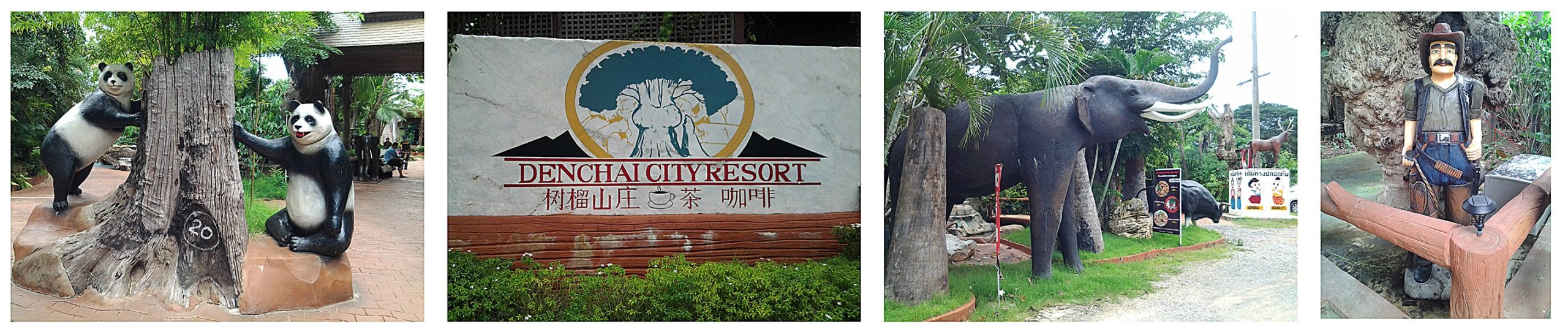 …as well as a funny motorbike statue, which of course required sitting upon ^^.
I decided then to try to get my speed up (as much as a 250 dtracker can speed up that is), and try get to Wat Chalermprakiat, a stunning mountain temple, which is outside of Lampang. However, by the time I arrived in Lampang, having doddle on the ride back, it was already around 4pm. I checked google maps for the location and was informed that i was around 60 – 70 km away. Given that I wasn’t sure where the temple was and that I would need an hour or so to enjoy the ride up and the view, I decided instead to turn that one into a day trip for another day. Pity really, as would have been a nice ending to the trip, but never mind.
 So, I headed back through horrendous traffic light stops and rush hour traffic down the main highway 11 to Chiang Mai. Really brought home the contrast of city traffic and main highway traffic and the gloriously quiet and scenic routes of the trip.
Video highlights of our full trip. Its longer than most of my videos, but hard to cram 5 days worth of amazing sites into a 14 minute video. I think it becomes progressively more interesting as it goes along though, so hopefully not boring 😉
A few other random images…
I hope you enjoyed this trip report! 😀