![]()
*Note*: Op Luang is also sometimes spelled as Ob Luang, this is due to Thai-English transliteration.
*Note 2* The initial stretch of road along the 108 to Op Luang from Chiang Mai is basically highway and not too pretty, however it is worth it once you reach the National Park it becomes very scenic.
***EDIT: I AM CURRENTLY UPDATING SOME SECTIONS IN THIS POST***

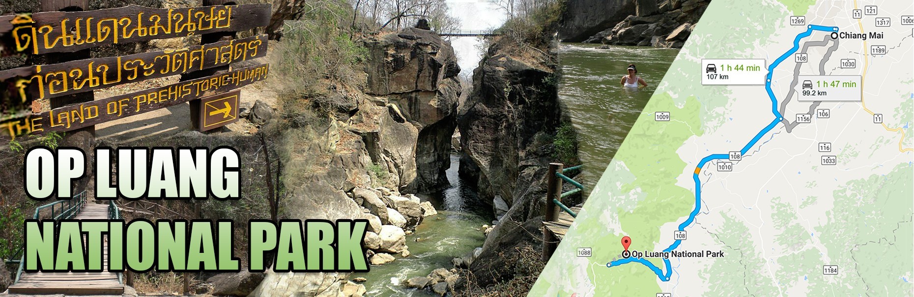
Op Luang National Park is situated approximately 100km South West of Chiang Mai and is part of the Thanon Thong Chai mountain range (which extends to Doi Inthanon, it’s highest peak.)
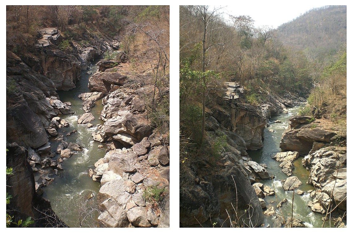
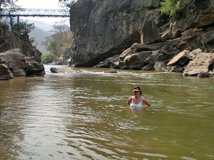
This National Park is famous for limestone mountain ranges and it’s carved out gorge formed by strong currents during the rainy season.
A river flows through the gorge and offers suitable sections for swimming (which are clearly marked) and the gorge itself has a man-made bridge which connects the river banks and provide an interesting hike area.
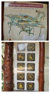
The main entrance is clearly marked, and you will need to purchase a ticket to enter at the ticket booth.
The current (2017) prices for admission are:
200 baht for adults, 100 baht for children.
The pricing stinger
As with all National Parks (and many places of interest), Thailand exercises a two tier pricing; one price for locals, one for tourists.
The thing about this is that it ends up being those who look Thai don’t get questioned (even if not Thai) but those who look foreign will always be expected to pay the higher price, even when clearly not a tourist (ie: speaking Thai).
It used to be that showing a Thai drivers license would get you the local rate, but now every man and his dog is getting a local license so that no longer is accepted usually.
You may be able to charm your way with a license plus speaking Thai, but that is hit and miss. Or, you can show official documents if you have them (IE: Thai ID for foreigners, Tabian Baan (House book), and/or work permit). It is becoming increasingly difficult to enter in at a local rate for expats and long-stayers.
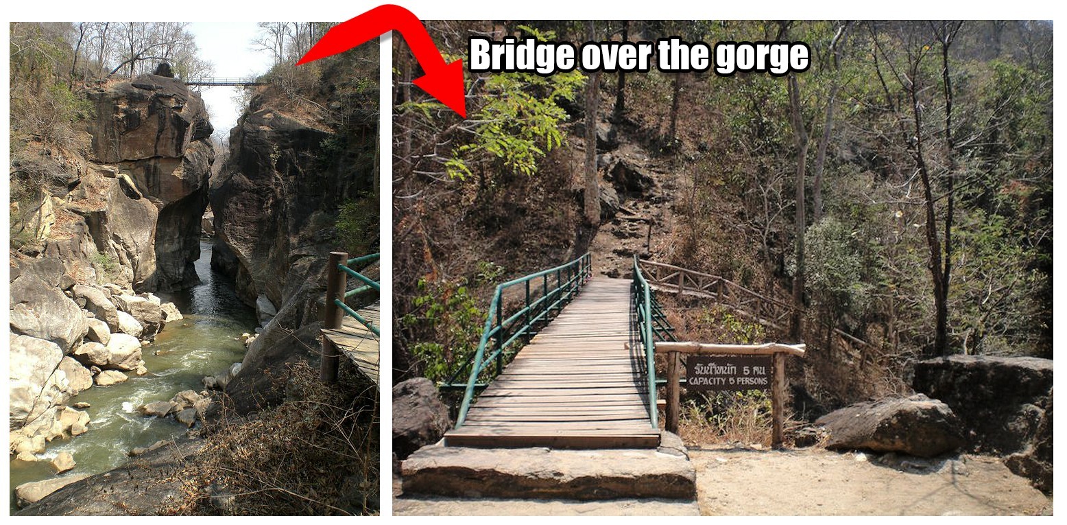 The bridge over the gorge takes you to a crossroads area with interesting nature trails (approximately 2km of trails). The bridge itself offers a wonderful view of the gorge.
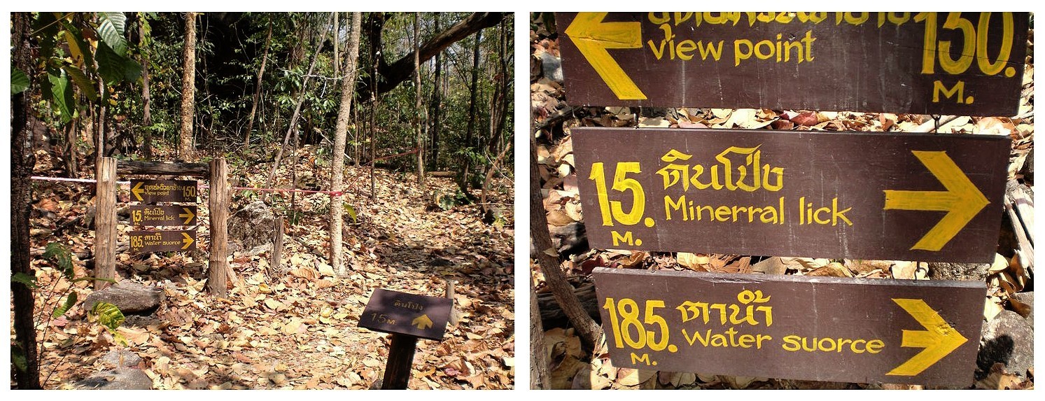
Here you can choose to take various routes:
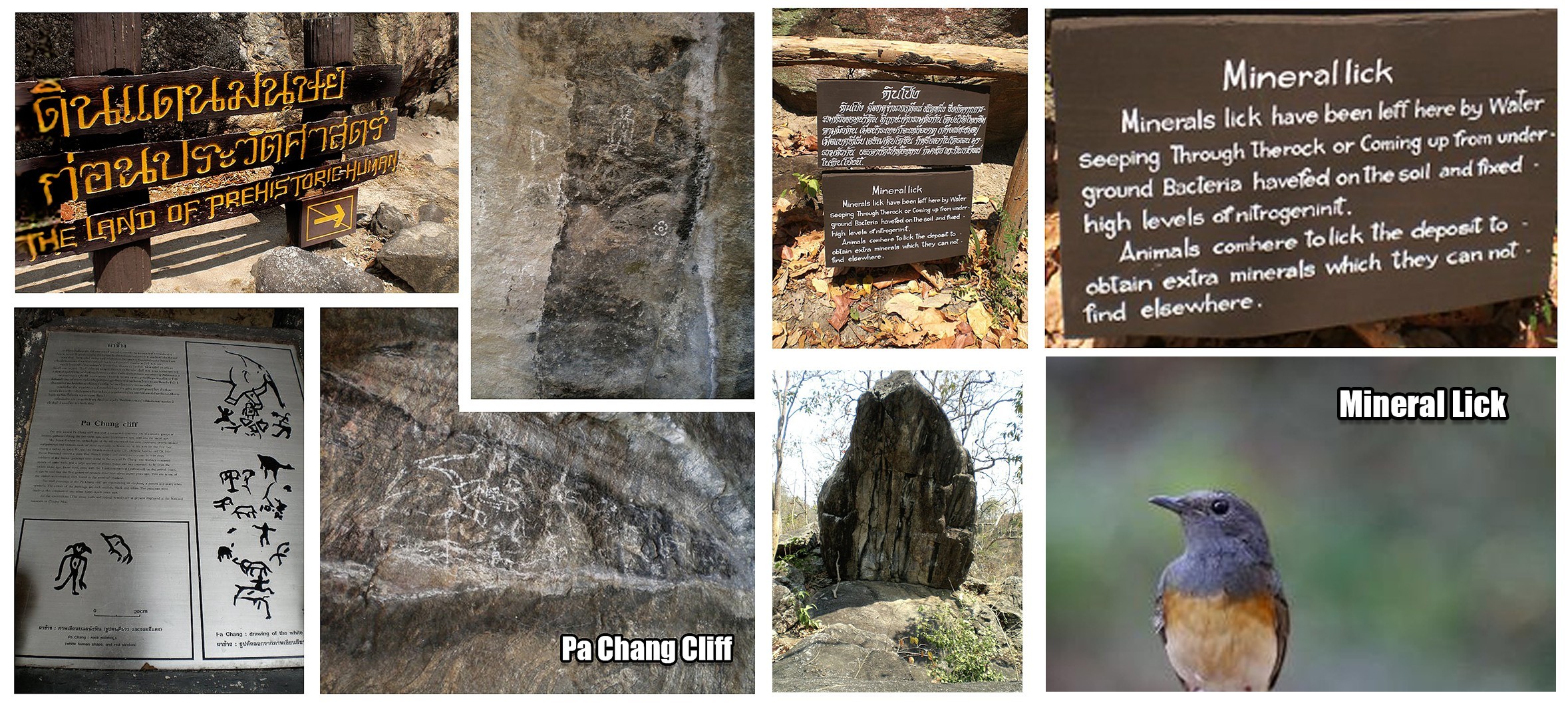
You can visit the view point which is a short steep climb (but worth it), view Stone Age depictions at Pa Chang cliff (and read about the uses of Northern Thailand’s forestry from Stone Age to present day), visit “Mineral lick” (or salt lick), which is an attraction for local fauna due to the mineral nutrient deposits, and/or head to the “water source” spring.
This area is great for nature photographers hoping to capture bugs, butterflies and birdlife (the park boasts around 200 species of birds).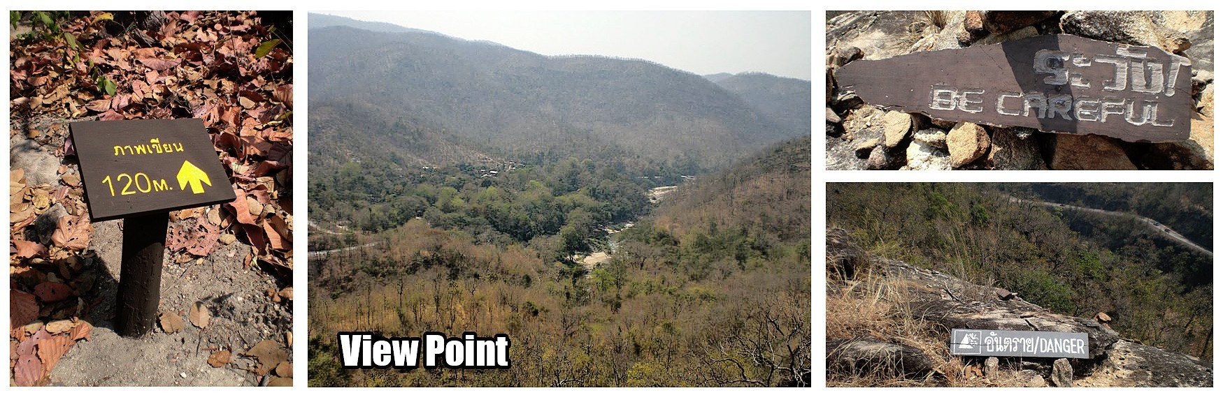
 Other attractions:
Ob Luang has three waterfalls; Mae Bau Kham waterfall, Mae Chon waterfall and Mae Teeya waterfall. (I currently do not have GPS for these waterfalls and not on google map, but next time I visit Ob Luang, I will record GPS locations, take photos, and update this guide.)
Mae Bau Kham waterfall is located 2 km south of Ob Luang Canyon. Here the water cascades down the rock wall for 50 meters.
Mae Chon waterfall. This waterfall originates from Mae Chon stream. An 80 meters wide drop on rocks composed of granite and grey-white colored metamorphic rock. It is a popular spot for picnics.
Mae Teeya waterfall (google map link). This waterfall originates from the Mae Teeya stream. Walk approximately 8 km to reach it, but in the end you will be met by a stunning 80 meters high waterfall.
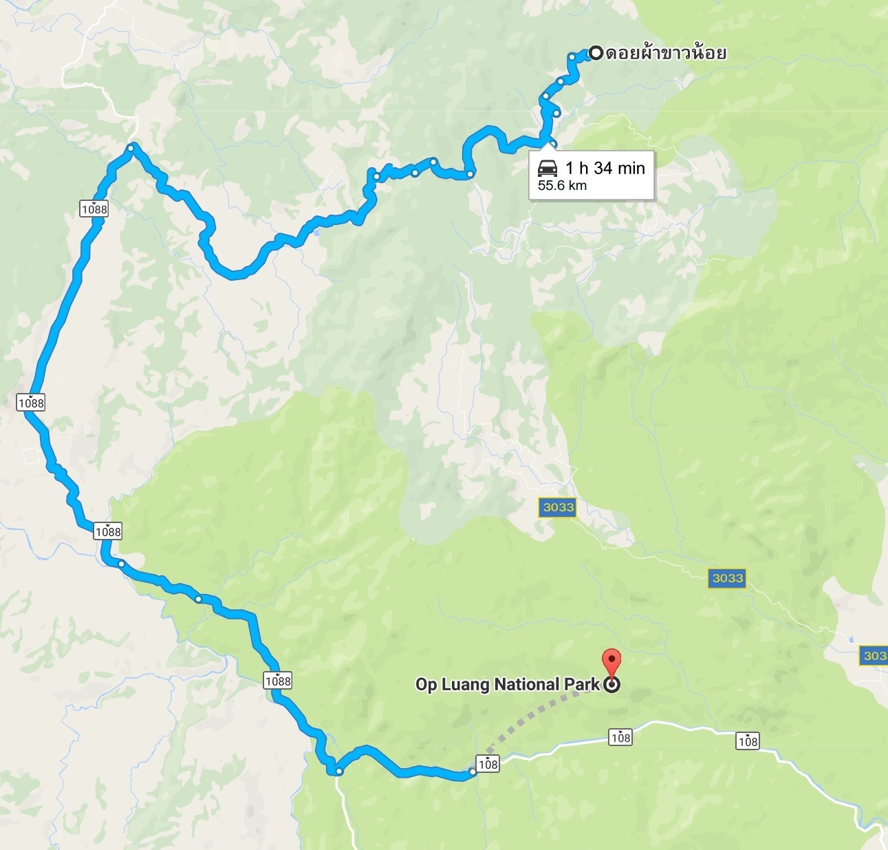
Doi Pha Chang Viewpoint (google map link). A fair distance from Ob Luang at 55km but worth mentioning as the viewpoint gives a dramatic view of Mae Bua Kham waterfall below. The area is said to resemble an elephant lying down, which gives it it’s name. On the cliff you will find a rock painting representing an elephant in multiple colors.
Thep Phanom hot spring (google map link): Located 14 km from the park entrance this hotspring reaches temperatures of 99ºC. There is one large pool at Thep Phanom where you can swim, but is best enjoyed late at night or in the very early morning. You can spend the night at Thep Phanom, but with only one cabin available you are best to book ahead. The cabin has three double rooms and two bathrooms. You can rent the rooms individually or rent the whole cabin for 1800 baht. The grounds of the hot springs also offer Thai massage for around 150 baht. There is no restaurant in the grounds but a few km down the road you will find a few open air food stalls in the town of Om Khut.
Tong cave. Two long tunnels set within Doi Pha Liab’s granite and limestone mountain. It is said that these tunnels will lead out to Doi Chiang Dao mountain in the north (hard to believe that is possible, so maybe just an old wives tale? ^^). The tunnel entrance is small but entering it is possible. I need to return to Ob Luang and visit this area to update GPS links. Apologies, as I have found it impossible to find via google. I will update at a later date.
 Accommodation
Ob Luang park offers two bungalow rooms at the headquarters area, and one at the ranger station. There is also a camping area with some tents available for rent.
Prices vary depending on season. For inquiries call: +66 (0) 5322 9272
Getting to Ob Luang
Personally I recommend Scooter/Motorbike, but of course there are other options.
The route is an easy one for cars and bikes. You could hire a taxi to take you there and back, or you can go via bus on the Chiang Mai-Hot-Omkoi bus, which you take from Chiang Mai Gate. Take the bus to Hot then from the Hot roundabout catch one of any of these 3 bus routes: Hot-Mae Sariang, Hot-Mae Chaem, Hot-Omkoi.
All of these buses stop at Ob Luang National Park.
Hope this was helpful.
If so, let me know – below!
Related Posts


2 Comments
Leave a Reply
You must be logged in to post a comment.
Excellent travel blog. The bus information is most helpful to poor travel like me. It would be great if the bus stop location is also marked on map because sometimes this is hard to find.
Glad it was helpful Alex 🙂